|
|
|
0 members (),
1,375
guests, and
22
robots. |
|
Key:
Admin,
Global Mod,
Mod
|
|
S |
M |
T |
W |
T |
F |
S |
|
|
|
|
|
1
|
2
|
3
|
|
4
|
5
|
6
|
7
|
8
|
9
|
10
|
|
11
|
12
|
13
|
14
|
15
|
16
|
17
|
|
18
|
19
|
20
|
21
|
22
|
23
|
24
|
|
25
|
26
|
27
|
28
|
29
|
30
|
31
|
|
There are no members with birthdays on this day. |
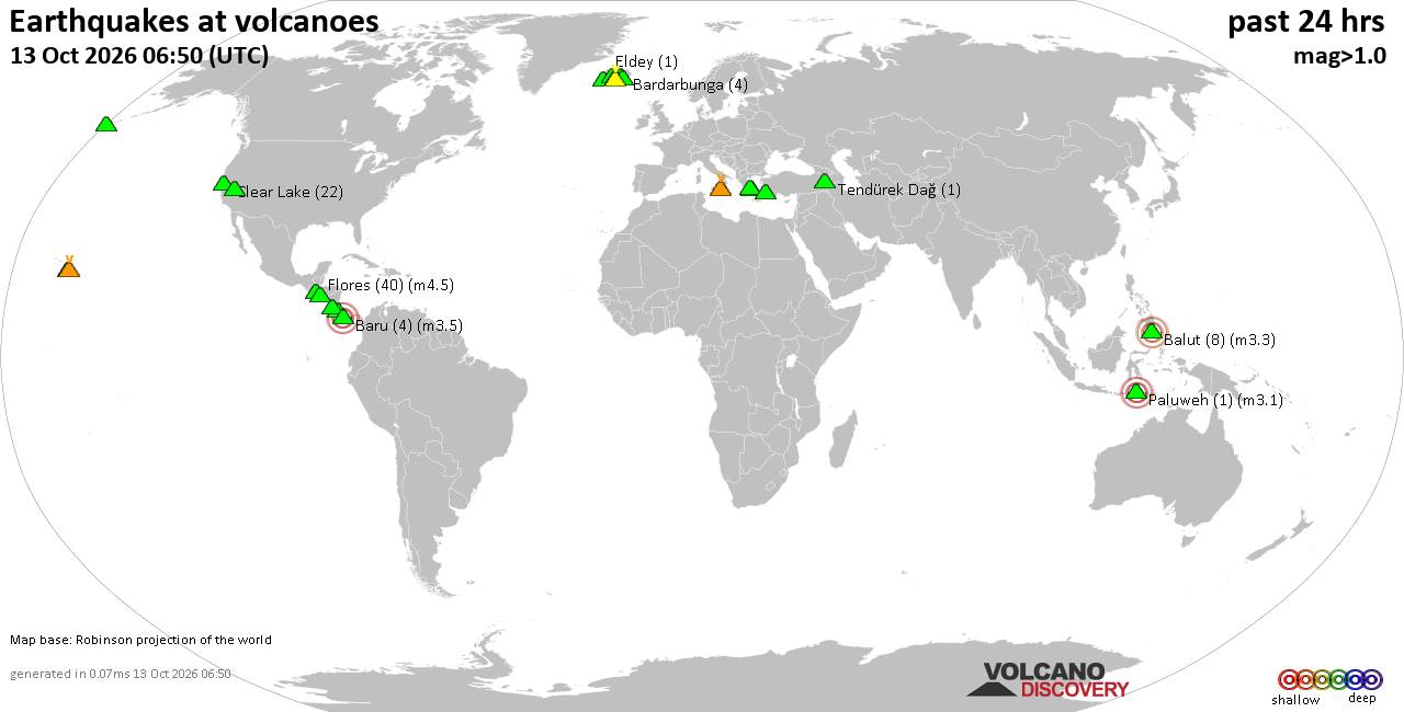
Volcano earthquake report for Tuesday, 13 October 2026
• M 1.4 - 26 km S of Cantwell, Alaska
• M 2.0 - 111 km N of Yakutat, Alaska
• M 1.7 - 4 km N of Kalifornsky, Alaska
• M 1.0 - 7 km SW of Salton City, CA
• M 1.3 - 15 km NE of Milford, Utah
|

#899989
Thu 08 Oct 2026 07:31:AM
|
Joined: Feb 2001
Posts: 678,977
Launch Director
|
|
Launch Director
Joined: Feb 2001
Posts: 678,977 |
SPC Oct 8, 2026 0730 UTC Day 3 Severe Thunderstorm OutlookSPC 0730Z Day 3 Outlook 
Day 3 Convective Outlook
NWS Storm Prediction Center Norman OK
0230 AM CDT Thu Oct 08 2026

Valid 101200Z - 111200Z

...THERE IS A SLIGHT RISK OF SEVERE THUNDERSTORMS FROM THE FLORIDA
PANHANDLE ACROSS MUCH OF WESTERN GEORGIA AND EASTERN ALABAMA...

...SUMMARY...
A corridor of tornado risk may develop out of the Florida Panhandle
and into parts of Georgia and eastern Alabama on Saturday.

...Southeastern States...
As Isaias merges with the developing shortwave trough over the Lower
MS Valley on Saturday, moderate to strong wind fields will develop
over much of the Southeast. East of the surface low track, strong
southerly low-level winds will aid northward movement of moisture
and instability from the FL Panhandle northward across eastern AL
and across much of GA and the eastern Carolinas.

It is anticipated that severe storms may be ongoing within a
north-south oriented band east of the low, roughly from the FL
Panhandle into far eastern AL and southwest GA. Some of the early
day cells near or south of the effective warm front may produce
tornadoes as low-level shear will be very strong. This threat area
should lift north during the day across AL and GA. It should be
noted that depending on the exact surface low track and warm front
position, the Slight Risk area may be adjusted in later outlooks.

Overnight, the warm front will continue to lift north, with
additional destabilization possible toward the southern
Appalachians, and Carolinas. A low severe probability has been added
for the night time scenario, which should see generally lesser (but
still favorable) shear values and boundary layer instability.

...AZ...
The remnants of Rachel are forecast to spread across the region late
Saturday into Sunday. As this occurs, moisture and instability will
increase, as well as deep layer shear as a shortwave trough moves
toward the region. Given the nocturnal timing of destabilization,
and substantial model differences, will defer possible severe
probabilities to later outlooks. At this time, it appears isolated
cells cannot be ruled out into Sunday morning, but severe potential
will depend heavily on proper destabilization.

..Jewell.. 10/08/2026
Read morehttps://www.spc.noaa.gov/products/outlook/day3otlk_0730.html
|
|



CMS The Best Conveyancing solicitors conveyancing quotes throughout the UK
For any webhosting enquiries please email webmaster@aus-city.com
|
|
Forums60
Topics872,992
Posts907,788
Members2,960
| |
Most Online102,106
Jul 10th, 2026
|
|
|
|
|

|









































