|
|
|
0 members (),
2,316
guests, and
27
robots. |
|
Key:
Admin,
Global Mod,
Mod
|
|
S |
M |
T |
W |
T |
F |
S |
|
|
|
1
|
2
|
3
|
4
|
5
|
|
6
|
7
|
8
|
9
|
10
|
11
|
12
|
|
13
|
14
|
15
|
16
|
17
|
18
|
19
|
|
20
|
21
|
22
|
23
|
24
|
25
|
26
|
|
27
|
28
|
29
|
30
|
|
|
|
|
There are no members with birthdays on this day. |
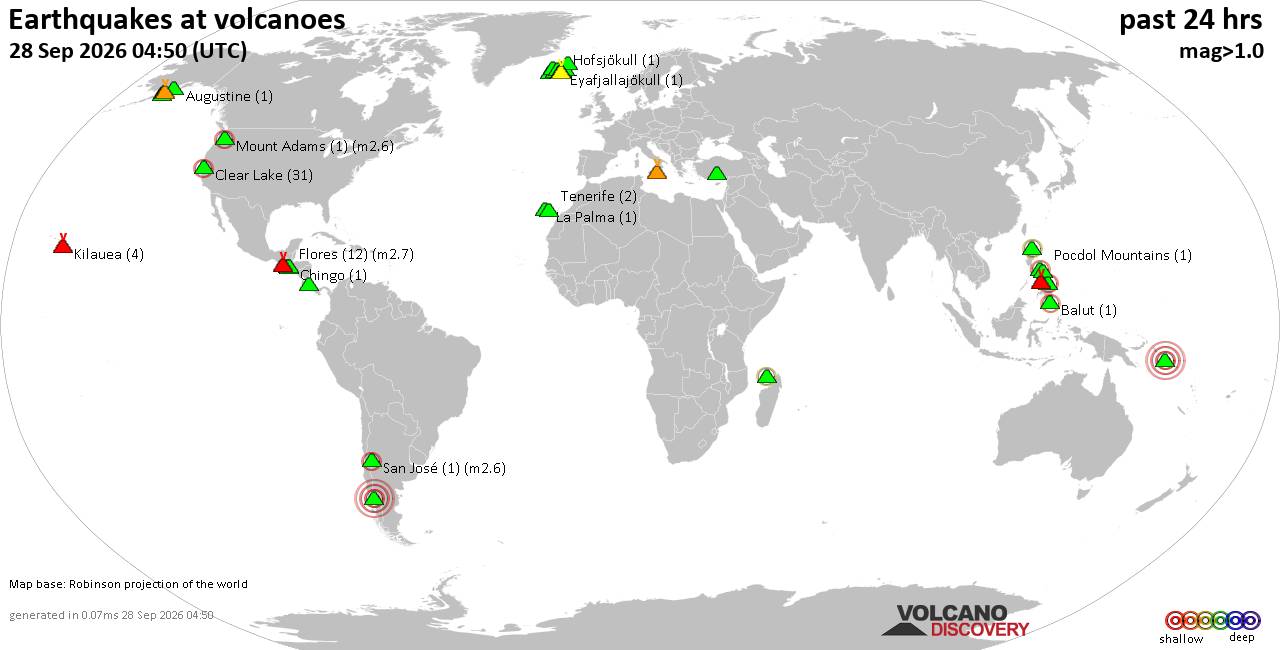
Volcano earthquake report for Monday, 28 September 2026
• M 4.9 - 124 km SE of Pondaguitan, Philippines
• M 4.9 - 124 km SE of Pondaguitan, Philippines
• M 4.2 - 7 km SE of Denali National Park, Alaska
• M 5.4 - north of Svalbard
• M 2.4 - 70 km SSW of Nikolski, Alaska
|

#648675
Fri 25 Feb 2022 07:21:PM
|
Joined: Feb 2001
Posts: 678,977
Launch Director
|
|
Launch Director
Joined: Feb 2001
Posts: 678,977 |
Using the Santa Cruz Mountains as a natural laboratory, researchers have built a 3D tectonic model that clarifies the link between earthquakes and mountain building along the San Andreas fault for the first time. The findings may be used to improve seismic hazard maps of the Bay Area. Source: New model may improve San Francisco Bay Area, U.S., seismic hazard maps
|
|



CMS The Best Conveyancing solicitors conveyancing quotes throughout the UK
For any webhosting enquiries please email webmaster@aus-city.com
|
|
Entire Thread
|
 New model may improve San Francisco Bay Area, U.S., seismic hazard maps
|
Webmaster
|
Fri 25 Feb 2022 07:21:PM
|
|
Forums60
Topics844,707
Posts879,502
Members2,960
| |
Most Online102,106
Jul 10th, 2026
|
|
|
|
|

|





































