|
|
|
0 members (),
2,931
guests, and
23
robots. |
|
Key:
Admin,
Global Mod,
Mod
|
|
S |
M |
T |
W |
T |
F |
S |
|
|
|
1
|
2
|
3
|
4
|
5
|
|
6
|
7
|
8
|
9
|
10
|
11
|
12
|
|
13
|
14
|
15
|
16
|
17
|
18
|
19
|
|
20
|
21
|
22
|
23
|
24
|
25
|
26
|
|
27
|
28
|
29
|
30
|
|
|
|
|
There are no members with birthdays on this day. |
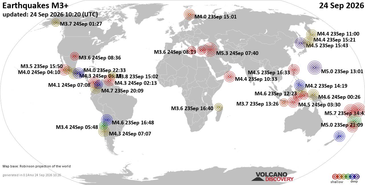
World Earthquake Report for Thursday, 24 September 2026
• Moderate mag. 4.3 earthquake - Madagascar: Mozambique Channel on Thursday, ...
• Small magnitude 3.9 earthquake hits near Hastings, Hastings District, Hawke...
• Volcano earthquake report for Thursday, 24 September 2026
• Light mag. 3.9 earthquake - South Pacific Ocean, 10.2 km south of Hastings,...
• Moderate magnitude 4.1 quake hits 31 miles southeast of Midland, Texas, Uni...
|

#696138
Thu 10 Aug 2023 06:00:AM
|
Joined: Feb 2001
Posts: 678,977
Launch Director
|
|
Launch Director
Joined: Feb 2001
Posts: 678,977 |
SPC MD 1930MD 1930 CONCERNING SEVERE POTENTIAL...WATCH POSSIBLE FOR SOUTHERN MIDDLE TN INTO NORTH AL 
Mesoscale Discussion 1930
NWS Storm Prediction Center Norman OK
1259 AM CDT Thu Aug 10 2023

Areas affected...Southern middle TN into north AL

Concerning...Severe potential...Watch possible

Valid 100559Z - 100730Z

Probability of Watch Issuance...40 percent

SUMMARY...Some damaging-wind threat will persist overnight as storms
spread eastward. Downstream watch issuance is possible if there is
any uptick in storm intensity/organization.

DISCUSSION...A small bowing segment has evolved within a larger
thunderstorm cluster across western TN. The downstream environment
remains favorable for organized convection, with rather strong
low/midlevel flow and favorable deep-layer shear noted on regional
VWPs, along with moderate buoyancy. A low-level temperature
inversion and a related tendency for convection to be somewhat
elevated has limited the damaging-wind threat thus far, and may
continue to do so as storms generally stay north of an outflow
boundary across central AL. However, any uptick in intensity with
the bowing segment and/or the trailing convection to the southwest
may be accompanied by an increasing risk for damaging gusts
overnight. Short-term trends will continue to be monitored for
possible watch issuance.

..Dean/Grams.. 08/10/2023

...Please see www.spc.noaa.gov for graphic product...

ATTN...WFO...MRX...OHX...BMX...HUN...MEG...

LAT...LON   35768805 35838693 35768576 34858569 34188581 33968628
            33878668 33888721 33988785 34378809 34758801 35768805
Read morehttps://www.spc.noaa.gov/products/md/md1930.html
|
|



CMS The Best Conveyancing solicitors conveyancing quotes throughout the UK
For any webhosting enquiries please email webmaster@aus-city.com
|
|
Entire Thread
|
 SPC MD 1930
|
Webmaster
|
Thu 10 Aug 2023 06:00:AM
|
|
Forums60
Topics840,728
Posts875,523
Members2,960
| |
Most Online102,106
Jul 10th, 2026
|
|
|
|
|

|





































