|
|
|
1 members (Alisa),
1,374
guests, and
23
robots. |
|
Key:
Admin,
Global Mod,
Mod
|
|
S |
M |
T |
W |
T |
F |
S |
|
|
|
|
|
1
|
2
|
3
|
|
4
|
5
|
6
|
7
|
8
|
9
|
10
|
|
11
|
12
|
13
|
14
|
15
|
16
|
17
|
|
18
|
19
|
20
|
21
|
22
|
23
|
24
|
|
25
|
26
|
27
|
28
|
29
|
30
|
31
|
|
There are no members with birthdays on this day. |
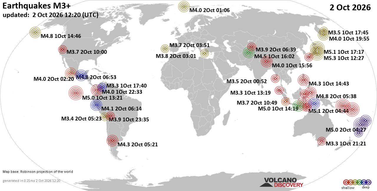
World Earthquake Report for Friday, 2 October 2026
• M 0.5 - 10 km SE of Winchester, CA
• M 1.8 - 65 km SE of Chalkyitsik, Alaska
• M 3.0 - 71 km NE of Punta Cana, Dominican Republic
• M 1.3 - 5 km NNE of Progreso, B.C., MX
• M 0.9 - 22 km ESE of Anza, CA
|

#706387
Wed 13 Dec 2023 07:39:PM
|
Joined: Feb 2001
Posts: 678,977
Launch Director
|
|
Launch Director
Joined: Feb 2001
Posts: 678,977 |
SPC Dec 13, 2023 2000 UTC Day 1 Convective OutlookSPC 2000Z Day 1 Outlook 
Day 1 Convective Outlook
NWS Storm Prediction Center Norman OK
0135 PM CST Wed Dec 13 2023

Valid 132000Z - 141200Z

...NO SEVERE THUNDERSTORM AREAS FORECAST...

...SUMMARY...
Scattered, generally weak, thunderstorm activity remains possible
late this afternoon through tonight across parts of the Four Corners
and southern Rockies into the Texas South Plains and Panhandle
vicinity.

...20Z Update...

...Florida...
Cloud cover and rain across much of the southeastern Florida
Peninsula and Keys have contributed to the maintenance of a
generally stable boundary layer, with little forcing in lower-levels
to support an appreciable risk for thunderstorms.  Some risk for
convection capable of producing lightning may linger offshore of
coastal areas, mainly along the surface front, to the east of the
Greater Miami vicinity.

..Kerr.. 12/13/2023

.PREV DISCUSSION... /ISSUED 1017 AM CST Wed Dec 13 2023/

...Synopsis/Discussion...
A closed mid/upper-level low will continue eastward over the Four
Corners area and southern Rockies through tonight, removed from a
more progressive belt of westerlies over the northern tier of the
CONUS and Canada. Steepening lapse rates and ascent ahead of the
aforementioned upper low will support isolated thunderstorm
potential from northeast Arizona/southeast Utah into New Mexico
especially tonight, while other thunderstorms will be possible today
and tonight farther east across eastern New Mexico and western Texas
within a persistent warm advection regime.

Additionally, a few thunderstorms will be possible across/near south
Florida near a convergence zone where a moist air mass persists.
Read morehttps://www.spc.noaa.gov/products/outlook/day1otlk_2000.html
|
|



CMS The Best Conveyancing solicitors conveyancing quotes throughout the UK
For any webhosting enquiries please email webmaster@aus-city.com
|
|
Entire Thread
|
 SPC Dec 13, 2023 2000 UTC Day 1 Convective Outlook
|
Webmaster
|
Wed 13 Dec 2023 07:39:PM
|
|
Forums60
Topics853,224
Posts888,019
Members2,960
| |
Most Online102,106
Jul 10th, 2026
|
|
|
|
|

|









































