|
1 members (Alisa),
2,213
guests, and
27
robots. |
|
Key:
Admin,
Global Mod,
Mod
|
|
S |
M |
T |
W |
T |
F |
S |
|
|
|
1
|
2
|
3
|
4
|
5
|
|
6
|
7
|
8
|
9
|
10
|
11
|
12
|
|
13
|
14
|
15
|
16
|
17
|
18
|
19
|
|
20
|
21
|
22
|
23
|
24
|
25
|
26
|
|
27
|
28
|
29
|
30
|
|
|
|
|
There are no members with birthdays on this day. |
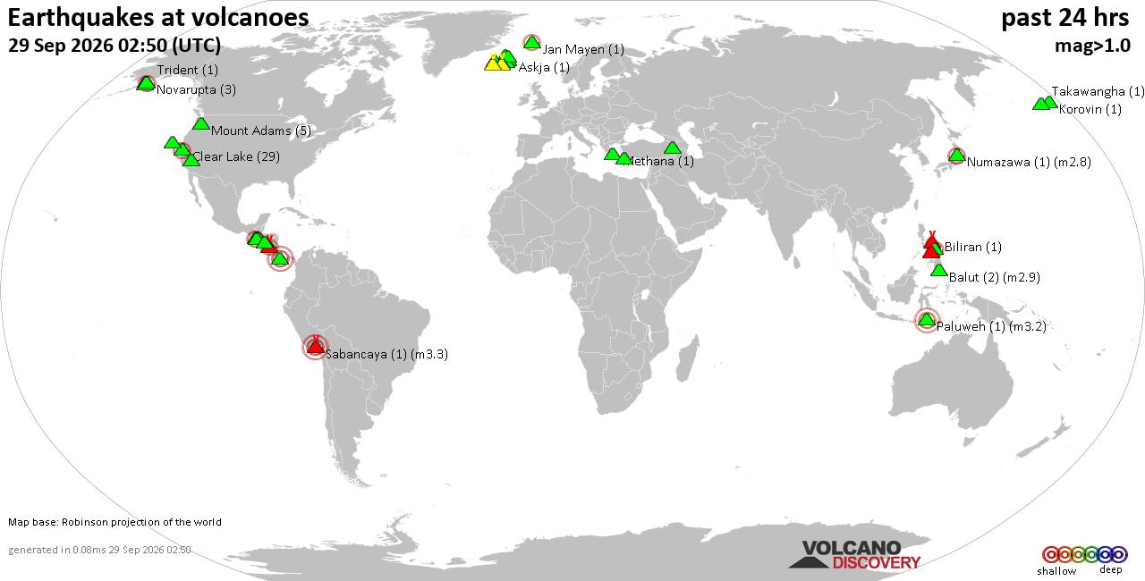
Volcano earthquake report for Tuesday, 29 September 2026
• M 2.5 - 13 km S of Fern Forest, Hawaii
• M 2.0 - 12 km SSE of Stonewall Gap, Colorado
• M 2.2 - 42 km NNE of Covelo, CA
• M 1.2 - 3 km W of Dublin, CA
• M 1.7 - 2 km NW of Hollister, CA
|

#714922
Thu 07 Mar 2024 08:07:PM
|
Joined: Feb 2001
Posts: 678,977
Launch Director
|
|
Launch Director
Joined: Feb 2001
Posts: 678,977 |
SPC MD 199MD 0199 CONCERNING SEVERE POTENTIAL...WATCH POSSIBLE FOR PARTS OF THE TX BIG COUNTRY/CONCHO VALLEY 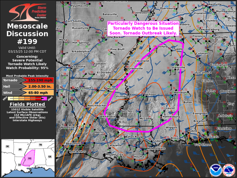
Mesoscale Discussion 0199
NWS Storm Prediction Center Norman OK
0206 PM CST Thu Mar 07 2024

Areas affected...Parts of the TX Big Country/Concho Valley

Concerning...Severe potential...Watch possible

Valid 072006Z - 072200Z

Probability of Watch Issuance...60 percent

SUMMARY...The severe-thunderstorm threat is expected to increase
later this afternoon. A couple of supercells will be possible, with
a threat of large hail, isolated severe gusts, and possibly a
tornado or two.

DISCUSSION...Diurnal heating of an increasingly moist airmass is
ongoing this afternoon, mainly to the south and west of a band of
elevated convection extending from west-central to north-central TX.
Steep midlevel lapse rates atop the increasing moisture are
supporting MLCAPE approaching 1000 J/kg, though poor upper-level
lapse rates within a cirrus plume are likely limiting the depth of
stronger buoyancy.

Strong mid/upper-level flow is supporting effective shear of 60+ kt
across the region, more than sufficient for organized storms. The
details of storm initiation and coverage remain somewhat uncertain,
though continued heating and diminishing MLCINH will likely support
isolated to widely scattered storm development along a diffuse
dryline later this afternoon. Some increasing cumulus has also been
noted near San Angelo, in the vicinity of an apparent outflow
boundary, where surface winds are backed to more of an easterly
direction. This boundary could serve as a focus for storm initiation
as well, or else provide a favored corridor for storms that move in
from the west late this afternoon or early this evening.

With favorable shear in place, at least a couple supercells could
develop by late afternoon, posing a threat of hail (potentially in
the 1.5 to 2 inch diameter range) and localized severe gusts. Some
tornado threat could also evolve, especially where surface winds are
backed near the remnant outflow boundary. Watch issuance is possible
by 4 PM CST if convective initiation appears imminent.

..Dean/Hart.. 03/07/2024

...Please see www.spc.noaa.gov for graphic product...

ATTN...WFO...FWD...SJT...LUB...MAF...

LAT...LON   30830180 31650207 32160196 32640146 33250079 33279938
            33209863 32619856 31709881 31159915 30829937 30639963
            30510042 30520102 30720161 30830180
Read morehttps://www.spc.noaa.gov/products/md/md0199.html
|
|



CMS The Best Conveyancing solicitors conveyancing quotes throughout the UK
For any webhosting enquiries please email webmaster@aus-city.com
|
|
Entire Thread
|
 SPC MD 199
|
Webmaster
|
Thu 07 Mar 2024 08:07:PM
|
|
Forums60
Topics846,630
Posts881,425
Members2,960
| |
Most Online102,106
Jul 10th, 2026
|
|
|









































