|
0 members (),
1,471
guests, and
52
robots. |
|
Key:
Admin,
Global Mod,
Mod
|
|
S |
M |
T |
W |
T |
F |
S |
|
|
|
|
|
|
|
1
|
|
2
|
3
|
4
|
5
|
6
|
7
|
8
|
|
9
|
10
|
11
|
12
|
13
|
14
|
15
|
|
16
|
17
|
18
|
19
|
20
|
21
|
22
|
|
23
|
24
|
25
|
26
|
27
|
28
|
29
|
|
30
|
31
|
|
|
|
|
|
|
There are no members with birthdays on this day. |
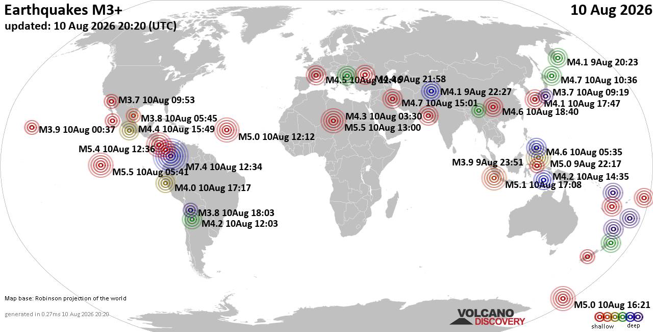
World Earthquake Report for Monday, 10 August 2026
• Volcano earthquake report for Monday, 10 Aug 2026
• Moderate mag. 4.0 earthquake - Zangilan Rayon, 58 km southwest of Ganja, Ga...
• Moderate mag. 4.6 earthquake - 31 km northeast of Xunchang, Sichuan, China,...
• Moderate mag. 4.2 earthquake - New Zealand on Tuesday, Aug 11, 2026, at 06:...
• World Earthquake Report for August 2026
|

#725048
Tue 04 Jun 2024 09:57:PM
|
Joined: Feb 2001
Posts: 678,976
Launch Director
|
OP

Launch Director
Joined: Feb 2001
Posts: 678,976 |
SPC MD 1165MD 1165 CONCERNING SEVERE THUNDERSTORM WATCH 391... FOR SOUTHERN LOUISIANA AND SOUTHERN MISSISSIPPI 
Mesoscale Discussion 1165
NWS Storm Prediction Center Norman OK
0455 PM CDT Tue Jun 04 2024

Areas affected...Southern Louisiana and southern Mississippi

Concerning...Severe Thunderstorm Watch 391...

Valid 042155Z - 042330Z

The severe weather threat for Severe Thunderstorm Watch 391
continues.

SUMMARY...A few damaging wind gusts up to 60-65 mph and localized
instances of marginally severe hail near 0.75-1.25" in diameter may
continue to accompany a linear complex of thunderstorms through this
evening.

DISCUSSION...Latest radar and satellite imagery show an MCS
progressing east-southeastward across portions of southern LA and
southern MS. A moderately unstable air mass remains in place ahead
of this system, where diurnal heating has resulted in surface
temperatures climbing into the upper 80s and 90s, with dewpoints
generally in the mid 70s. Recent trends from the POE VAD profiler
indicate westerly 0-3 km shear has increased to around 50 kt over
the past 30 minutes behind the system. This may support an
increasing opportunity for bowing segments, and damaging wind gusts,
oriented north-south on the eastern flank of the complex, and a
general eastward progression into south-central/southeastern MS over
the next 1-2 hours. In addition, brief instances of marginally
severe hail will be possible within any of the more robust updrafts.

..Barnes.. 06/04/2024

...Please see www.spc.noaa.gov for graphic product...

ATTN...WFO...JAN...LIX...LCH...

LAT...LON   33039059 32149090 31169135 31079175 30849310 30589338
            29999303 29869260 29989164 30309029 31098976 31708971
            32448956 33068991 33129021 33039059
Read morehttps://www.spc.noaa.gov/products/md/md1165.html
|
|



CMS The Best Conveyancing solicitors conveyancing quotes throughout the UK
For any webhosting enquiries please email webmaster@aus-city.com
|
|
Entire Thread
|
 SPC MD 1165
|
Webmaster
|
Tue 04 Jun 2024 09:57:PM
|
|
Forums60
Topics795,967
Posts830,757
Members2,960
| |
Most Online102,106
Jul 10th, 2026
|
|
|





































