|
0 members (),
1,300
guests, and
91
robots. |
|
Key:
Admin,
Global Mod,
Mod
|
|
S |
M |
T |
W |
T |
F |
S |
|
|
|
|
|
|
|
1
|
|
2
|
3
|
4
|
5
|
6
|
7
|
8
|
|
9
|
10
|
11
|
12
|
13
|
14
|
15
|
|
16
|
17
|
18
|
19
|
20
|
21
|
22
|
|
23
|
24
|
25
|
26
|
27
|
28
|
29
|
|
30
|
31
|
|
|
|
|
|
|
There are no members with birthdays on this day. |
|
|
|
|
|
|
by Webmaster - Wed 05 Aug 2026 03:55:PM
|
by Webmaster - Wed 05 Aug 2026 03:55:PM
|
by Webmaster - Wed 05 Aug 2026 03:55:PM
|
|
|
|
|
|
|
|
|
|
|
|
|
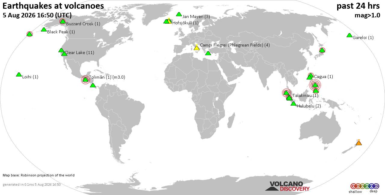
Volcano earthquake report for Wednesday, 5 Aug 2026
• World Earthquake Report for Wednesday, 5 August 2026
• Significant 5.3 quake hits near Tasikmalaya, Kota Tasikmalaya, Jawa Barat, ...
• Moderate mag. 4.1 earthquake - Near North Coast of West Papua on Wednesday,...
• Strong mag. 5.0 earthquake - Java, Indonesia, on Wednesday, Aug 5, 2026, at...
• Moderate mag. 4.0 earthquake - Banda Sea on Wednesday, Aug 5, 2026, at 10:3...
|

#729484
Tue 16 Jul 2024 10:33:PM
|
Joined: Feb 2001
Posts: 678,976
Launch Director
|
OP

Launch Director
Joined: Feb 2001
Posts: 678,976 |
SPC MD 1658MD 1658 CONCERNING SEVERE POTENTIAL...WATCH LIKELY FOR PORTIONS OF SOUTHERN NEW ENGLAND 
Mesoscale Discussion 1658
NWS Storm Prediction Center Norman OK
0434 PM CDT Tue Jul 16 2024

Areas affected...Portions of southern New England

Concerning...Severe potential...Watch likely

Valid 162134Z - 162300Z

Probability of Watch Issuance...80 percent

SUMMARY...A broken line of severe storms currently over eastern New
York will continue eastward across southern New England into
tonight. The primary concern is damaging straight-line winds, though
a tornado or two cannot be ruled out.

DISCUSSION...Latest radar data from KENX depicts an MCS with
embedded/deep rotating updrafts tracking eastward across the Hudson
Valley at around 40-50 kt. This line has been producing severe gusts
(generally associated with embedded mesovorticies), and a couple
tornadoes have also been noted.

Over the next few hours, this line will continue eastward across
southern New England. Ahead of the line, earlier diurnal heating
(lower 90s temperatures) of a moist boundary layer (upper 60s/lower
70s dewpoints) should support its maintenance -- despite slightly
weaker buoyancy with eastward extent. Additionally, around 40-50 kt
of westerly deep-layer shear (per regional VWP) oriented
perpendicular to the well-established gust front, and a developing
low-level jet, should favor continued convective organization. The
strong deep-layer shear (and favorable/increasing low-level
hodograph curvature) should yield embedded supercells/mesovorticies
capable of severe gusts (generally 65-75 mph) and perhaps a
localized tornado threat. A watch will likely be issued in the next
hour or so.

..Weinman/Bunting.. 07/16/2024

...Please see www.spc.noaa.gov for graphic product...

ATTN...WFO...GYX...BOX...BTV...OKX...ALY...

LAT...LON   41507263 41807305 42967285 43727254 44197232 44407163
            44297088 44097026 43816986 42467002 41757013 41537053
            41427200 41507263
Read morehttps://www.spc.noaa.gov/products/md/md1658.html
|
|



CMS The Best Conveyancing solicitors conveyancing quotes throughout the UK
For any webhosting enquiries please email webmaster@aus-city.com
|
|
Entire Thread
|
 SPC MD 1658
|
Webmaster
|
Tue 16 Jul 2024 10:33:PM
|
|
Forums60
Topics794,206
Posts828,994
Members2,960
| |
Most Online102,106
Jul 10th, 2026
|
|
|