|
|
|
0 members (),
1,447
guests, and
24
robots. |
|
Key:
Admin,
Global Mod,
Mod
|
|
S |
M |
T |
W |
T |
F |
S |
|
|
|
|
|
|
1
|
2
|
|
3
|
4
|
5
|
6
|
7
|
8
|
9
|
|
10
|
11
|
12
|
13
|
14
|
15
|
16
|
|
17
|
18
|
19
|
20
|
21
|
22
|
23
|
|
24
|
25
|
26
|
27
|
28
|
29
|
30
|
|
31
|
|
|
|
|
|
|
|
There are no members with birthdays on this day. |
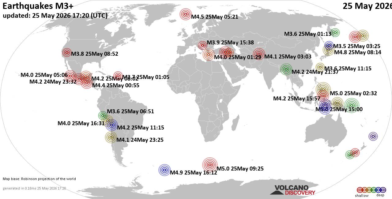
World Earthquake Report for Monday, 25 May 2026
• Moderate mag. 4.1 earthquake - 80 km northwest of Galela, Kabupaten Halmahe...
• Moderate magnitude 4.5 quake hits 102 km northeast of Manokwari, Indonesia ...
• Volcano earthquake report for Monday, 25 May 2026
• Moderate mag. 4.8 earthquake - South Pacific Ocean, 89 km northeast of Mano...
• Moderate mag. 4.0 earthquake - South Pacific Ocean, 81 km southwest of Moll...
|

#734070
Thu 05 Sep 2024 01:13:AM
|
Joined: Feb 2001
Posts: 381,904
Launch Director
|
OP

Launch Director
Joined: Feb 2001
Posts: 381,904 |
Significant earthquake of magnitude 6.1 just reported 76 km northeast of Wewak, Papua New Guinea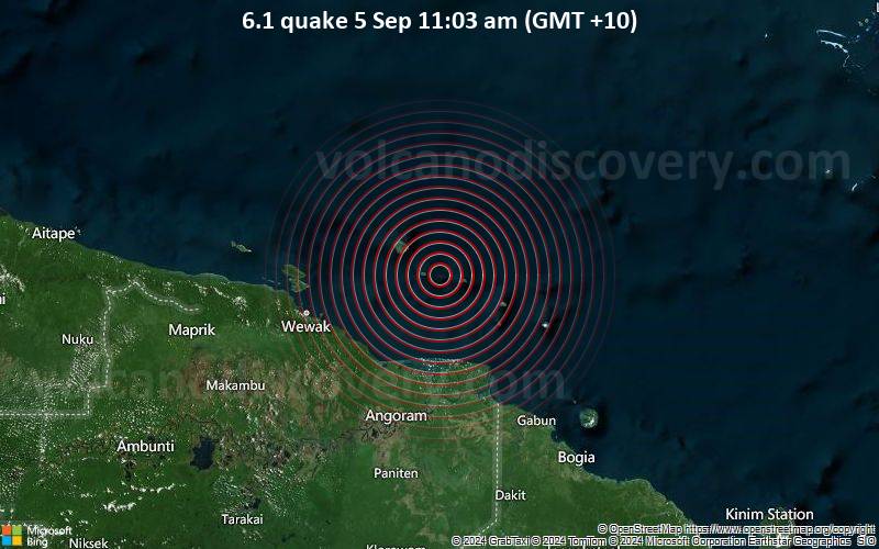 6.1 quake 5 Sep 11:03 am (GMT +10) An earthquake of magnitude 6.1 occurred only 9 minutes ago 76 km northeast of Wewak, Papua New Guinea, the European-Mediterranean Seismological Centre (EMSC) reported.
The quake hit at a shallow depth of 10 km beneath the epicenter near Wewak, East Sepik, Papua New Guinea, in the morning on Thursday, September 5th, 2024, at 11:03 am local time. The exact magnitude, epicenter, and depth of the quake might be revised within the next few hours or minutes as seismologists review data and refine their calculations, or as other agencies issue their report.
Our monitoring service identified a second report from the German Research Centre for Geosciences (GFZ) which listed the quake at magnitude 6.1 as well.
Based on the preliminary seismic data, the quake was probably felt by many people in the area of the epicenter. It should not have caused significant damage, other than objects falling from shelves, broken windows, etc.
In Wewak (pop. 18,200) located 76 km from the epicenter, and Angoram (pop. 1,600) 82 km away, the quake should have been felt as light shaking.
VolcanoDiscovery will automatically update magnitude and depth if these change and follow up if other significant news about the quake become available. If you’re in the area, please send us your experience through our reporting mechanism, either online or via our mobile app. This will help us provide more first-hand updates to anyone around the globe who wants to know more about this quake.
Earthquake data: Date & time: Sep 5, 2024 11:03 am (Port Moresby time) local time (5 Sep 2024 01:03 GMT)Magnitude: 6.0 Depth: 27.0 km Epicenter latitude / longitude: 3.6°S / 144.3°E  ( Papua New Guinea) Primary data source: EMSChttps://www.volcanodiscovery.com/earthquake/news/251581/Significant-earthquake-of-magnitude-61-just-reported-76-km-northeast-of-Wewak-Papua-New-Guinea.html
|
|



CMS The Best Conveyancing solicitors conveyancing quotes throughout the UK
For any webhosting enquiries please email webmaster@aus-city.com
|
|
Entire Thread
|
 Significant earthquake of magnitude 6.1 just reported 76 km northeast of Wewak, Papua New Guinea
|
Webmaster
|
Thu 05 Sep 2024 01:13:AM
|
|
Forums60
Topics776,784
Posts811,581
Members2,960
| |
Most Online22,463
May 9th, 2026
|
|
|
|
|
Copyright 1996 - 2026 by David Cottle. Designed by David Bate Jr. All Rights Reserved.
By using this forum, the user agrees not to transfer any data or technical information received under this agreement to any other entity without the express approval of the AUS-CITY Forum Admins and/or authors of individual posts (Forum Admins and DoD/USSPACECOM for the analysis of satellite tracking data).
Two-line elements (TLE) and all other satellite data presented and distributed via this forum and AUS-CITY mailing lists are distributed with permission from DoD/USSTRATCOM.

|

|