|
|
|
0 members (),
1,213
guests, and
16
robots. |
|
Key:
Admin,
Global Mod,
Mod
|
|
S |
M |
T |
W |
T |
F |
S |
|
|
|
|
|
|
1
|
2
|
|
3
|
4
|
5
|
6
|
7
|
8
|
9
|
|
10
|
11
|
12
|
13
|
14
|
15
|
16
|
|
17
|
18
|
19
|
20
|
21
|
22
|
23
|
|
24
|
25
|
26
|
27
|
28
|
29
|
30
|
|
31
|
|
|
|
|
|
|
|
There are no members with birthdays on this day. |
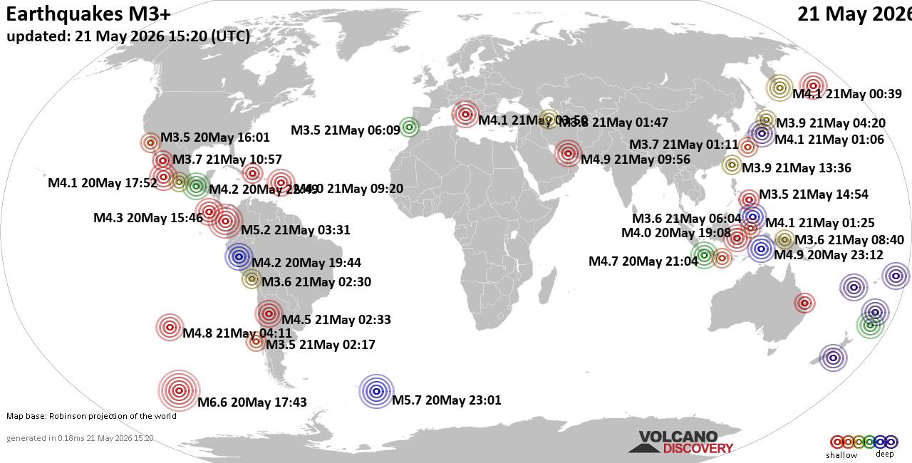
World Earthquake Report for Thursday, 21 May 2026
• Volcano earthquake report for Thursday, 21 May 2026
• Light mag. 3.9 earthquake - 48 km southwest of Coatepeque, Departamento de ...
• Moderate mag. 4.4 earthquake - New Zealand on Friday, May 22, 2026, at 02:1...
• Moderate mag. 4.4 earthquake - Gisborne, New Zealand, on Friday, May 22, 20...
• Moderate mag. 4.0 earthquake - Bay of Plenty, New Zealand, on Friday, May 2...
|

#787953
Sun 07 Dec 2025 05:45:AM
|
Joined: Feb 2001
Posts: 381,904
Launch Director
|
OP

Launch Director
Joined: Feb 2001
Posts: 381,904 |
SPC Dec 7, 2025 0600 UTC Day 1 Convective OutlookSPC 1200Z Day 1 Outlook 
Day 1 Convective Outlook
NWS Storm Prediction Center Norman OK
1141 PM CST Sat Dec 06 2025

Valid 071200Z - 081200Z

...THERE IS A MARGINAL RISK OF SEVERE THUNDERSTORMS IN THE FL
PENINSULA...

...SUMMARY...
Isolated damaging winds and a brief tornado or two are possible,
mainly across central Florida during the late afternoon and evening.

...FL Peninsula...
Abundant convective development is expected later this morning
across the north-central to northeast Gulf along a largely
west/east-oriented quasi-stationary front. Downstream
cloudiness/rain along/north of the front will support pronounced
differential boundary-layer heating across it, from central to north
FL. With most guidance indicating potential for an MCV to evolve
from the morning convection, within the broadly cyclonic mid-level
flow regime across the Southeast, it is plausible that convection
may strengthen along the baroclinic zone towards peak heating. Weak
mid-level lapse rates will remain a key limiting factor to
convective intensity. But adequate deep-layer shear will exist for
transient mid-level rotation. With a warm boundary layer anticipated
across central to south FL, a few strong gusts capable of localized
damaging winds are possible. While the 00Z NAM appears to be an
aggressive outlier with stronger low-level mass response, expected
modest low-level SRH may be sufficient for a brief tornado or two.

..Grams/Thornton.. 12/07/2025
Read morehttps://www.spc.noaa.gov/products/outlook/day1otlk_1200.html
|
|



CMS The Best Conveyancing solicitors conveyancing quotes throughout the UK
For any webhosting enquiries please email webmaster@aus-city.com
|
|
Entire Thread
|
 SPC Dec 7, 2025 0600 UTC Day 1 Convective Outlook
|
Webmaster
|
Sun 07 Dec 2025 05:45:AM
|
|
Forums60
Topics776,490
Posts811,285
Members2,960
| |
Most Online22,463
May 9th, 2026
|
|
|
|
|
Copyright 1996 - 2026 by David Cottle. Designed by David Bate Jr. All Rights Reserved.
By using this forum, the user agrees not to transfer any data or technical information received under this agreement to any other entity without the express approval of the AUS-CITY Forum Admins and/or authors of individual posts (Forum Admins and DoD/USSPACECOM for the analysis of satellite tracking data).
Two-line elements (TLE) and all other satellite data presented and distributed via this forum and AUS-CITY mailing lists are distributed with permission from DoD/USSTRATCOM.

|

|