|
0 members (),
1,301
guests, and
25
robots. |
|
Key:
Admin,
Global Mod,
Mod
|
|
S |
M |
T |
W |
T |
F |
S |
|
|
|
|
|
1
|
2
|
3
|
|
4
|
5
|
6
|
7
|
8
|
9
|
10
|
|
11
|
12
|
13
|
14
|
15
|
16
|
17
|
|
18
|
19
|
20
|
21
|
22
|
23
|
24
|
|
25
|
26
|
27
|
28
|
29
|
30
|
31
|
|
There are no members with birthdays on this day. |
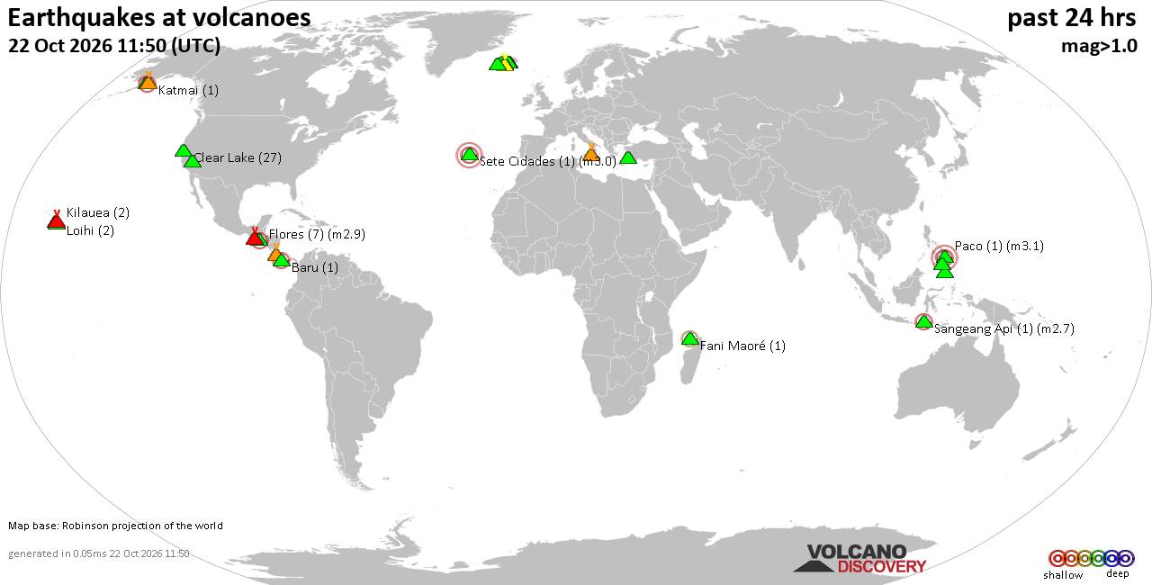
Volcano earthquake report for Thursday, 22 October 2026
• Magnitude 3.2 earthquake strikes near Pilsen, Okres Plzeň-město, Plzeňsk...
• M 2.4 - 17 km ESE of Pearsall, Texas
• M 2.2 - 15 km ESE of Pearsall, Texas
• M 1.0 - 12 km SE of Livermore, CA
• M 1.2 - 36 km ENE of McKinney Acres, Texas
|

#793114
Thu 15 Jan 2026 02:33:AM
|
Joined: Feb 2001
Posts: 678,977
Launch Director
|
|
Launch Director
Joined: Feb 2001
Posts: 678,977 |
SPC MD 22MD 0022 CONCERNING HEAVY SNOW FOR NORTHERN INDIANA AND FAR SOUTHWEST LOWER MICHIGAN 
Mesoscale Discussion 0022
NWS Storm Prediction Center Norman OK
0501 PM CST Wed Jan 14 2026

Areas affected...Northern Indiana and far southwest Lower Michigan

Concerning...Heavy snow

Valid 142301Z - 150500Z

SUMMARY...A lake effect snow band will likely support heavy snowfall
rates in excess of 2 inches/hour across portions of northern Indiana
through the evening and into the overnight hours.

DISCUSSION...A lake effect snow band has been steadily organizing
over the past couple of hours across far southwest lower MI and
northern/northwest IN amid strengthening cold advection on the
backside of a passing upper disturbance. Surface observations under
the band report quarter-mile visibility with heavy snowfall, and
these observations are supported by live web cams in the South Bend,
IN area that show significant visibility reductions indicative of
heavy snowfall rates.

Recent surface observations and 925 mb analyses show a subtle
confluence axis established across southeastern Lake Michigan that
is forecast to persist and shift to the southwest over the next
several hours. Latest forecast soundings depict 6.5 C/km lapse rates
and saturated profiles from the surface through roughly 3 km.
Additional deepening/saturation of this layer possible as ascent
within the left-exit region of an approaching upper jet (currently
noted upstream across portions of MN/WI in water-vapor imagery)
overspreads the region heading into the evening/overnight hours.

Maintenance of a favorable low to mid-level thermodynamic profile,
steady low-level confluence, and relatively warm water temperatures
(approximately 35-40 F per recent analyses) along the southeastern
shore of Lake MI should all contribute to robust lake effect snow
band capable of heavy snowfall rates potentially exceeding 2
inch/hour. Strong winds within the lowest few kilometers, gusting to
30-40 mph at times, may support periods of blizzard conditions under
the band.

..Moore.. 01/14/2026

...Please see www.spc.noaa.gov for graphic product...

ATTN...WFO...IWX...LOT...

LAT...LON   41638720 41698702 41828675 42008656 42218640 42118627
            41518579 41338576 41208584 41038613 40978632 40908658
            40908680 40918701 40988722 41098723 41638720
Read morehttps://www.spc.noaa.gov/products/md/md0022.html
|
|



CMS The Best Conveyancing solicitors conveyancing quotes throughout the UK
For any webhosting enquiries please email webmaster@aus-city.com
|
|
Entire Thread
|
 SPC MD 22
|
Webmaster
|
Thu 15 Jan 2026 02:33:AM
|
|
Forums60
Topics889,402
Posts924,199
Members2,960
| |
Most Online102,106
Jul 10th, 2026
|
|
|









































