|
|
|
0 members (),
926
guests, and
25
robots. |
|
Key:
Admin,
Global Mod,
Mod
|
|
S |
M |
T |
W |
T |
F |
S |
|
1
|
2
|
3
|
4
|
5
|
6
|
7
|
|
8
|
9
|
10
|
11
|
12
|
13
|
14
|
|
15
|
16
|
17
|
18
|
19
|
20
|
21
|
|
22
|
23
|
24
|
25
|
26
|
27
|
28
|
|
There are no members with birthdays on this day. |

#795003
Fri 23 Jan 2026 05:37:PM
|
Joined: Feb 2001
Posts: 381,904
Launch Director
|
OP

Launch Director
Joined: Feb 2001
Posts: 381,904 |
Moderate magnitude 4.0 quake hits 60 miles southeast of Grande Prairie, Alberta, Canada in the morning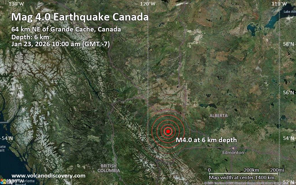 An earthquake of magnitude 4.0 occurred in the morning on Friday, January 23rd, 2026, at 10:00 am local time near Grande Prairie, Alberta, Canada, as reported by the United States Geological Survey.
According to preliminary data, the quake was located at a very shallow depth of 3.8 miles. Shallow earthquakes are felt more strongly than deeper ones as they are closer to the surface. Magnitude and other quake parameters can still change in the coming hours as the agency continues to process seismic data.
A second report was later issued by The Incorporated Research Institutions for Seismology (IRIS), which listed it as a magnitude 4.0 earthquake as well. A third agency, the European-Mediterranean Seismological Centre (EMSC), reported the same quake at magnitude 4.0.
Towns or cities near the epicenter where the quake might have been felt as very weak shaking include Grande Cache (pop. 3,300) located 40 miles from the epicenter, and Grande Prairie (pop. 70,400) 60 miles away.
Earthquake data: Date & time: Jan 23, 2026 10:00 am (GMT -7) local time (23 Jan 2026 17:00 GMT)Magnitude: 4.0 Depth: 6.15 km Epicenter latitude / longitude: 54.31°N / 118.47°W  ( Valleyview, Alberta, Canada) Primary data source: USGShttps://www.volcanodiscovery.com/earthquake/news/292761/Moderate-magnitude-40-quake-hits-60-miles-southeast-of-Grande-Prairie-Alberta-Canada-in-the-morning-.html
|
|


CMS The Best Conveyancing solicitors conveyancing quotes throughout the UK
For any webhosting enquiries please email webmaster@aus-city.com
|
|
Entire Thread
|
 Moderate magnitude 4.0 quake hits 60 miles southeast of Grande Prairie, Alberta, Canada in the morning
|
Webmaster
|
Fri 23 Jan 2026 05:37:PM
|
|
Forums60
Topics760,905
Posts795,629
Members2,957
| |
Most Online17,963
Jan 15th, 2026
|
|
|
|
|
Copyright 1996 - 2026 by David Cottle. Designed by David Bate Jr. All Rights Reserved.
By using this forum, the user agrees not to transfer any data or technical information received under the agreement, to any other entity without the express approval of the AUS-CITY Forum Admins and/or authors of individual posts (Forum Admins and DoD/USSPACECOM for the analysis of satellite tracking data).
Two-line elements (TLE) and all other satellite data presented and distributed via this forum and e-mail lists of AUS-CITY are distributed with permission from DoD/USSTRATCOM.

Reprise Hosting

|

|


 - Click image for larger picture.")


