|
0 members (),
1,178
guests, and
24
robots. |
|
Key:
Admin,
Global Mod,
Mod
|
|
S |
M |
T |
W |
T |
F |
S |
|
|
|
|
|
|
|
1
|
|
2
|
3
|
4
|
5
|
6
|
7
|
8
|
|
9
|
10
|
11
|
12
|
13
|
14
|
15
|
|
16
|
17
|
18
|
19
|
20
|
21
|
22
|
|
23
|
24
|
25
|
26
|
27
|
28
|
29
|
|
30
|
31
|
|
|
|
|
|
|
There are no members with birthdays on this day. |
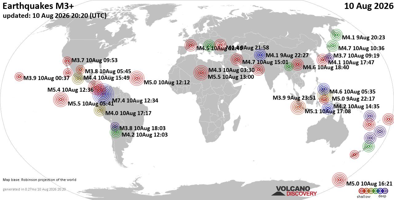
World Earthquake Report for Monday, 10 August 2026
• Volcano earthquake report for Monday, 10 Aug 2026
• Moderate mag. 4.0 earthquake - Zangilan Rayon, 58 km southwest of Ganja, Ga...
• Moderate mag. 4.6 earthquake - 31 km northeast of Xunchang, Sichuan, China,...
• Moderate mag. 4.2 earthquake - New Zealand on Tuesday, Aug 11, 2026, at 06:...
• World Earthquake Report for August 2026
|

#795493
Mon 26 Jan 2026 08:58:PM
|
Joined: Feb 2001
Posts: 678,976
Launch Director
|
OP

Launch Director
Joined: Feb 2001
Posts: 678,976 |
SPC Day 3-8 Fire Weather OutlookSPC Day 3-8 Fire Weather Outlook 
Day 3-8 Fire Weather Outlook
NWS Storm Prediction Center Norman OK
0253 PM CST Mon Jan 26 2026

Valid 281200Z - 031200Z

...Synopsis...
Longer term ensemble cluster analysis depicts ongoing broad scale
mid-level troughing east of the Continental Divide through at least
through the weekend, with potentially a more progressive wave
pattern emerging by Day 7 or 8 (Sunday-Monday). Colder temperatures,
antecedent moisture and lingering snow cover should largely mitigate
fire weather concerns east of the High Plains. The persistent
northwest flow aloft could bring occasional downslope warming and
drying events to the central and southern High Plains, but stronger
winds should be localized and limited to adjacent lee slopes of the
southern/central Rockies. Ridging across the West will promote dry
and seasonably warm conditions across much of the Southwest through
early next week.

...Florida...
Surface high pressure settling into the Southern Plains and lower MS
River Valley should keep deeper boundary layer moisture shunted
offshore across the Southeast and Florida. Persistent northerly to
northwesterly flow across FL will likely lead to critically low
relative humidity each day through Friday, but subdued lower-level
wind profiles and diffuse surface pressure gradients should limit
breezier winds from developing. Extended model guidance suggests a
stronger surface cyclone developing near FL by Day 6/Saturday,
traversing the East Coast into early next week. Stronger north winds
behind a cold front trailing the low is expected Saturday, but
preceding rainfall should mitigate fire weather concerns prior to
this potentially stronger offshore wind event.

..Williams.. 01/26/2026

...Please see www.spc.noaa.gov/fire for graphic product...
Read morehttps://www.spc.noaa.gov/products/exper/fire_wx/
|
|



CMS The Best Conveyancing solicitors conveyancing quotes throughout the UK
For any webhosting enquiries please email webmaster@aus-city.com
|
|
Entire Thread
|
 SPC Day 3-8 Fire Weather Outlook
|
Webmaster
|
Mon 26 Jan 2026 08:58:PM
|
|
Forums60
Topics796,363
Posts831,153
Members2,960
| |
Most Online102,106
Jul 10th, 2026
|
|
|





































