|
0 members (),
1,878
guests, and
22
robots. |
|
Key:
Admin,
Global Mod,
Mod
|
|
S |
M |
T |
W |
T |
F |
S |
|
|
|
|
|
1
|
2
|
3
|
|
4
|
5
|
6
|
7
|
8
|
9
|
10
|
|
11
|
12
|
13
|
14
|
15
|
16
|
17
|
|
18
|
19
|
20
|
21
|
22
|
23
|
24
|
|
25
|
26
|
27
|
28
|
29
|
30
|
31
|
|
There are no members with birthdays on this day. |
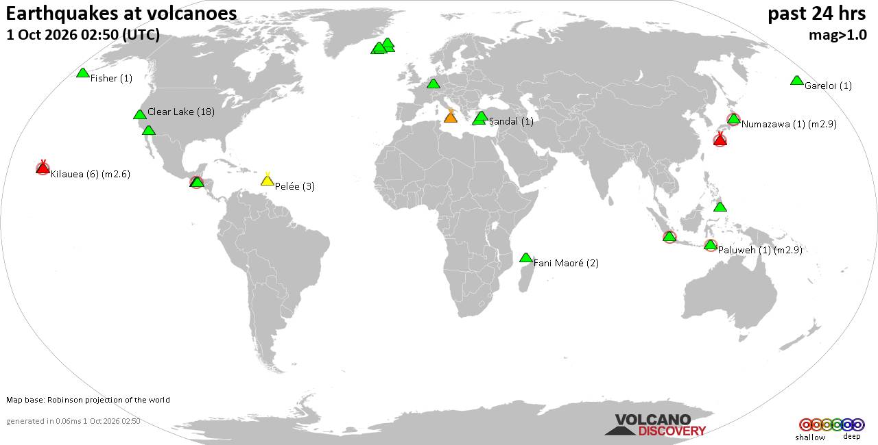
Volcano earthquake report for Thursday, 1 October 2026
• M 3.3 - 82 km SSW of Nikolski, Alaska
• M 1.8 - 68 km WSW of Karluk, Alaska
• M 0.5 - 7 km WNW of Cobb, CA
• M 3.2 - 82 km SSW of Nikolski, Alaska
• M 1.4 - 47 km WNW of Happy Valley, Alaska
• M 1.0 Explosion - 7 km NNE of Airway Heights, Washington
|

#809723
Mon 11 May 2026 05:31:PM
|
Joined: Feb 2001
Posts: 678,977
Launch Director
|
|
Launch Director
Joined: Feb 2001
Posts: 678,977 |
SPC MD 704MD 0704 CONCERNING SEVERE POTENTIAL...WATCH UNLIKELY FOR PORTIONS OF THE COASTAL CAROLINAS 
Mesoscale Discussion 0704
NWS Storm Prediction Center Norman OK
1143 AM CDT Mon May 11 2026

Areas affected...portions of the coastal Carolinas

Concerning...Severe potential...Watch unlikely

Valid 111643Z - 111845Z

Probability of Watch Issuance...5 percent

SUMMARY...Isolated to widely scattered thunderstorms may pose a risk
for isolated damaging wind gusts and marginally severe hail this
afternoon across the coastal Carolinas.

DISCUSSION...Isolated convection is ongoing ahead of a weak surface
low analyzed east of Florence, SC, with additional agitated cumulus
noted on the seaward side of the coastal sea breeze across portions
of the Crystal Coast southward to near Charleston, SC. While
mid-level lapse rates remain poor (as sampled by the 12z MHX/CHS
observed soundings), continued diurnal heating amid ample low-level
moisture (dewpoints in the mid-60s to near 70 F) is aiding in weak
destabilization, with latest mesoanalysis and forecast soundings
depicting 500-1000 J/kg MLCAPE. Expectation is for convection to
gradually increase in coverage along the sea breeze and ahead of the
approaching front as lingering inhibition continues to erode.

Strong westerly flow aloft downstream of an approaching upper-level
trough is supporting 35-45+ kts of effective bulk shear, which is
sufficient to promote updraft organization into multicells and
perhaps marginal supercell structures. Some potential for locally
damaging wind gusts and marginally severe hail will accompany more
robust updrafts, with the greatest potential expected on the coastal
side of the sea breeze where greater low-level moisture may favor
locally stronger buoyancy. The given the expectation for the severe
risk to remain limited in magnitude and coverage, watch issuance is
not expected at this time.

..Chalmers/Mosier.. 05/11/2026

...Please see www.spc.noaa.gov for graphic product...

ATTN...WFO...MHX...ILM...CHS...

LAT...LON   32547991 32628014 32998026 33567976 34247880 34837748
            35207647 35357567 35297544 35137541 35007568 34797613
            34497645 34537687 34357737 34007770 33757783 33677849
            33477885 33147908 32807938 32677963 32547991

MOST PROBABLE PEAK TORNADO INTENSITY...UP TO 90 MPH
MOST PROBABLE PEAK WIND GUST...UP TO 60 MPH
MOST PROBABLE PEAK HAIL SIZE...UP TO 1.25 IN
Read morehttps://www.spc.noaa.gov/products/md/md0704.html
|
|



CMS The Best Conveyancing solicitors conveyancing quotes throughout the UK
For any webhosting enquiries please email webmaster@aus-city.com
|
|
Entire Thread
|
 SPC MD 704
|
Webmaster
|
Mon 11 May 2026 05:31:PM
|
|
Forums60
Topics851,758
Posts886,553
Members2,960
| |
Most Online102,106
Jul 10th, 2026
|
|
|









































