|
0 members (),
1,269
guests, and
41
robots. |
|
Key:
Admin,
Global Mod,
Mod
|
|
S |
M |
T |
W |
T |
F |
S |
|
|
|
|
|
|
1
|
2
|
|
3
|
4
|
5
|
6
|
7
|
8
|
9
|
|
10
|
11
|
12
|
13
|
14
|
15
|
16
|
|
17
|
18
|
19
|
20
|
21
|
22
|
23
|
|
24
|
25
|
26
|
27
|
28
|
29
|
30
|
|
31
|
|
|
|
|
|
|
|
There are no members with birthdays on this day. |
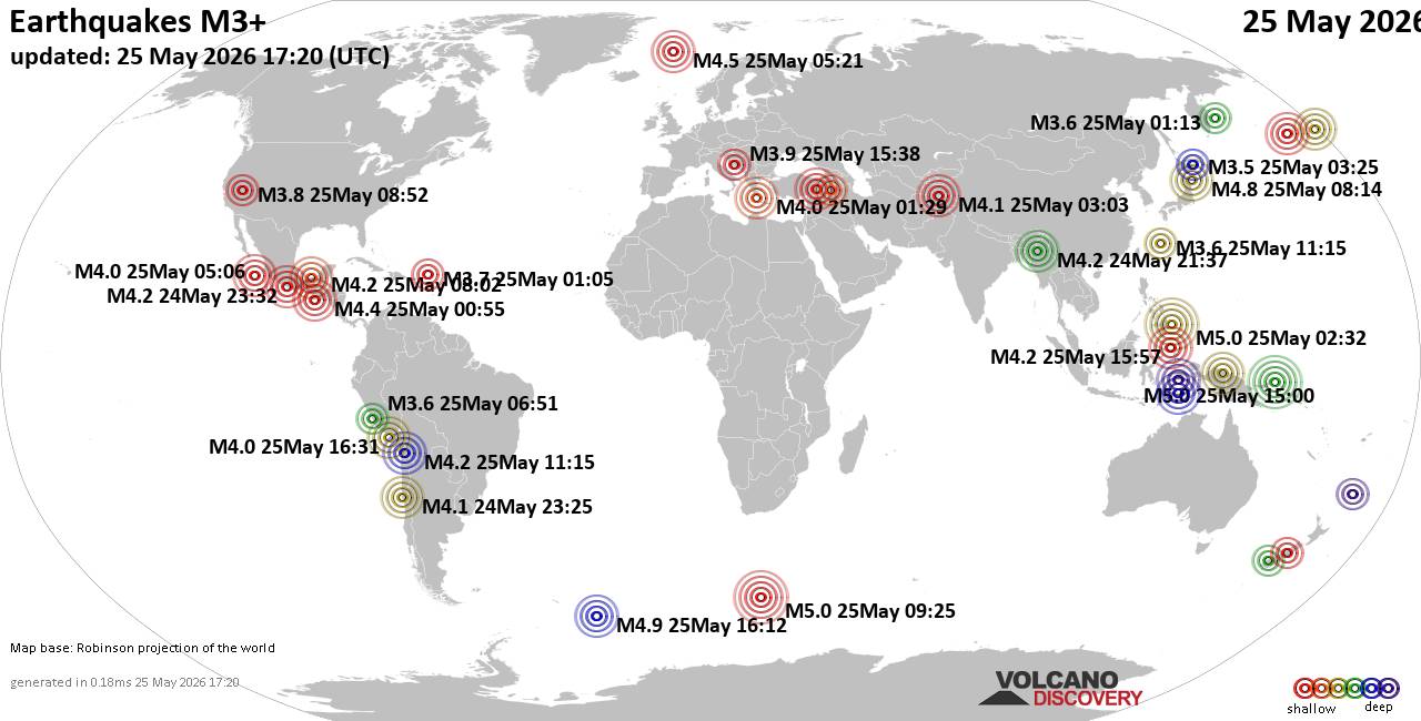
World Earthquake Report for Monday, 25 May 2026
• Moderate mag. 4.1 earthquake - 80 km northwest of Galela, Kabupaten Halmahe...
• Moderate magnitude 4.5 quake hits 102 km northeast of Manokwari, Indonesia ...
• Volcano earthquake report for Monday, 25 May 2026
• Moderate mag. 4.8 earthquake - South Pacific Ocean, 89 km northeast of Mano...
• Moderate mag. 4.0 earthquake - South Pacific Ocean, 81 km southwest of Moll...
|

#810280
Wed 13 May 2026 03:58:PM
|
Joined: Feb 2001
Posts: 381,904
Launch Director
|
OP

Launch Director
Joined: Feb 2001
Posts: 381,904 |
SPC MD 710MD 0710 CONCERNING SEVERE POTENTIAL...WATCH UNLIKELY FOR PORTIONS OF WESTERN/CENTRAL NY INTO NORTHERN/WESTERN PA 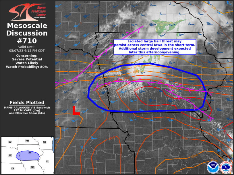
Mesoscale Discussion 0710
NWS Storm Prediction Center Norman OK
1056 AM CDT Wed May 13 2026

Areas affected...portions of western/central NY into
northern/western PA

Concerning...Severe potential...Watch unlikely

Valid 131556Z - 131830Z

Probability of Watch Issuance...5 percent

SUMMARY...A band of thunderstorms may bring locally gusty winds and
small hail to portions of western/central New York into western and
northern Pennsylvania this afternoon. A severe thunderstorm watch is
not expected.

DISCUSSION...Thunderstorms are beginning to develop just ahead of a
surface cold front from far western NY into northeast OH. While 12z
regional RAOBs and current regional VWPs indicate 30-40 kt
west/southwesterly flow in the 1-3 km range, instability remains
scant. Lingering cloudiness will limit stronger heating and
boundary-layer moisture is expected to remain modest this afternoon.
However, cold temperatures aloft will support modestly steep
midlevel lapse rates. As a result, a narrow band of weak MLCAPE
(less than 500 J/kg) is forecast just ahead of the cold front. This,
along with sufficient deep layer flow, should allow for an organized
band of thunderstorms developing eastward across the region this
afternoon. Given cool surface temperatures, poor low-level lapse
rates, and limited instability, overall severe potential appears
low. However, given the strength of deep layer flow and cold
temperatures aloft, the strongest cells could produce locally gusty
winds and perhaps small hail through the afternoon.

..Leitman/Mosier.. 05/13/2026

...Please see www.spc.noaa.gov for graphic product...

ATTN...WFO...BGM...BUF...CTP...PBZ...CLE...

LAT...LON   43007727 43367625 43357573 43227550 42347587 41557688
            41277735 40927833 40907971 41048023 41178028 41288029
            41418016 43007727

MOST PROBABLE PEAK WIND GUST...UP TO 60 MPH
MOST PROBABLE PEAK HAIL SIZE...UP TO 1.25 IN
Read morehttps://www.spc.noaa.gov/products/md/md0710.html
|
|



CMS The Best Conveyancing solicitors conveyancing quotes throughout the UK
For any webhosting enquiries please email webmaster@aus-city.com
|
|
Entire Thread
|
 SPC MD 710
|
Webmaster
|
Wed 13 May 2026 03:58:PM
|
|
Forums60
Topics776,742
Posts811,539
Members2,960
| |
Most Online22,463
May 9th, 2026
|
|
|