|
0 members (),
1,475
guests, and
27
robots. |
|
Key:
Admin,
Global Mod,
Mod
|
|
S |
M |
T |
W |
T |
F |
S |
|
|
|
|
|
1
|
2
|
3
|
|
4
|
5
|
6
|
7
|
8
|
9
|
10
|
|
11
|
12
|
13
|
14
|
15
|
16
|
17
|
|
18
|
19
|
20
|
21
|
22
|
23
|
24
|
|
25
|
26
|
27
|
28
|
29
|
30
|
31
|
|
There are no members with birthdays on this day. |
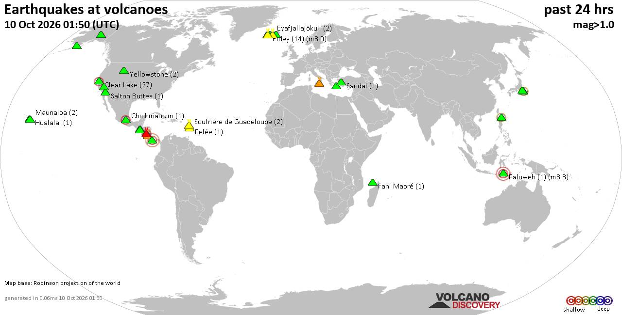
Volcano earthquake report for Saturday, 10 October 2026
• M 3.4 - 31 km NE of Punta Cana, Dominican Republic
• M 4.7 - 2 km WNW of El Cacao, Panama
• M 4.7 - 2 km WNW of El Cacao, Panama
• M 4.7 - 2 km WNW of El Cacao, Panama
• M 4.5 - 103 km SW of Puerto Madero, Mexico
|

#811241
Sat 16 May 2026 07:37:PM
|
Joined: Feb 2001
Posts: 678,977
Launch Director
|
|
Launch Director
Joined: Feb 2001
Posts: 678,977 |
SPC MD 736MD 0736 CONCERNING SEVERE POTENTIAL...WATCH LIKELY FOR NORTHEAST COLORADO...NORTHWEST KANSAS AND SOUTHWEST NEBRASKA 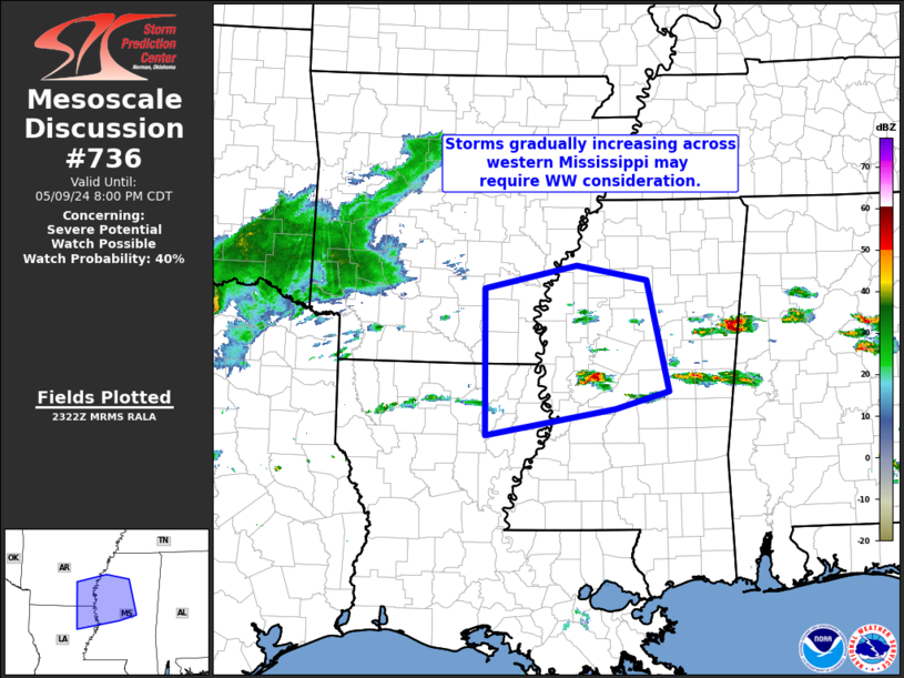
Mesoscale Discussion 0736
NWS Storm Prediction Center Norman OK
0236 PM CDT Sat May 16 2026

Areas affected...Northeast Colorado...northwest Kansas and southwest
Nebraska

Concerning...Severe potential...Watch likely

Valid 161936Z - 162100Z

Probability of Watch Issuance...80 percent

SUMMARY...The early stages of thunderstorm development are underway,
with an increasing threat for large hail and severe outflow gusts
into this evening.  A severe thunderstorm watch is likely by about
21z.

DISCUSSION...Convection is deepening over the Palmer Divide per 1-km
visible satellite imagery as of 20z.  Downstream from this
convection, persistent upslope flow (north of the lee cyclone in
southeast CO) is advecting low-level moisture westward as surface
temperatures warm into the low-mid 80s.  The storm environment will
favor initial/high-based supercells capable of producing large hail
and severe outflow gusts, and the supercell threat is most likely to
persist along the southern flank of the convection.  An eventual
increase in storm coverage/intensity is expected as the storms
encounter increasing buoyancy with eastward extent, and as
hodographs lengthen with increasing low-level curvature (which could
become sufficient for an isolated tornado or two).  Thus, a severe
thunderstorm watch will be likely by about 21z.

..Thompson/Mosier.. 05/16/2026

...Please see www.spc.noaa.gov for graphic product...

ATTN...WFO...LBF...GLD...BOU...

LAT...LON   39250079 39070133 38930220 38920293 39100361 39430371
            40330309 40870222 40980159 40960101 40510071 39830059
            39250079

MOST PROBABLE PEAK TORNADO INTENSITY...85-110 MPH
MOST PROBABLE PEAK WIND GUST...65-80 MPH
MOST PROBABLE PEAK HAIL SIZE...1.50-2.50 IN
Read morehttps://www.spc.noaa.gov/products/md/md0736.html
|
|



CMS The Best Conveyancing solicitors conveyancing quotes throughout the UK
For any webhosting enquiries please email webmaster@aus-city.com
|
|
Entire Thread
|
 SPC MD 736
|
Webmaster
|
Sat 16 May 2026 07:37:PM
|
|
Forums60
Topics867,917
Posts902,713
Members2,960
| |
Most Online102,106
Jul 10th, 2026
|
|
|









































