|
0 members (),
1,894
guests, and
23
robots. |
|
Key:
Admin,
Global Mod,
Mod
|
|
S |
M |
T |
W |
T |
F |
S |
|
|
|
|
|
|
|
1
|
|
2
|
3
|
4
|
5
|
6
|
7
|
8
|
|
9
|
10
|
11
|
12
|
13
|
14
|
15
|
|
16
|
17
|
18
|
19
|
20
|
21
|
22
|
|
23
|
24
|
25
|
26
|
27
|
28
|
29
|
|
30
|
31
|
|
|
|
|
|
|
There are no members with birthdays on this day. |
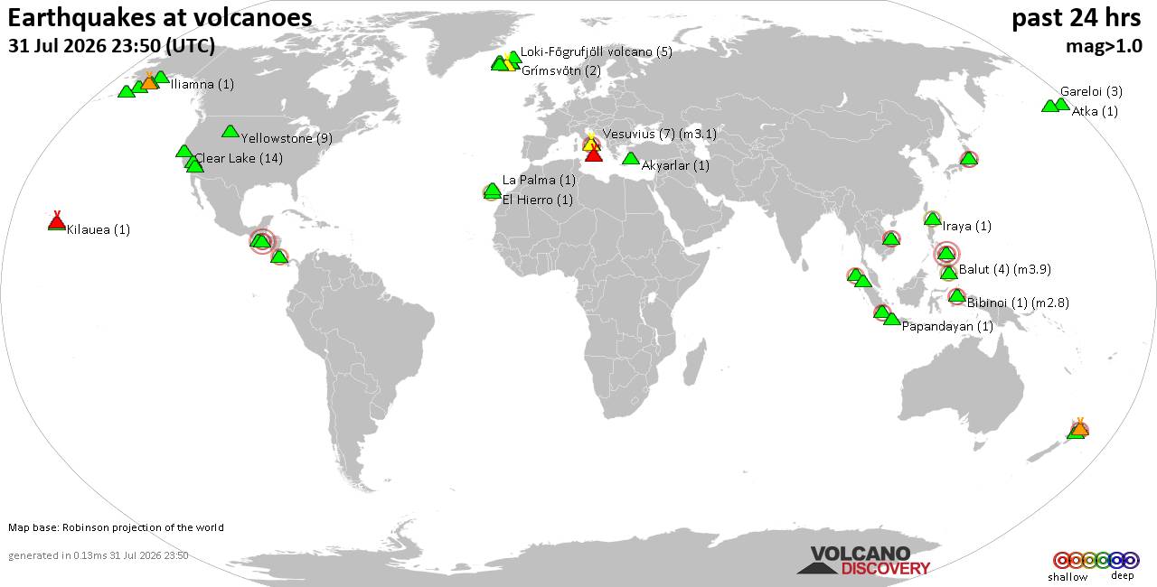
Volcano earthquake report for Friday, 31 Jul 2026
• World Earthquake Report for Friday, 31 July 2026
• Light mag. 3.9 earthquake - Philippine Sea, 57 km east of Sulangan, Philipp...
• Small tremor of magnitude 3.1 just reported 10 km southwest of Naples, Ital...
• Seismic-like event, possible earthquake, reported few minutes ago near Napl...
• Strong mag. 5.0 earthquake - 65 km northeast of Pu'er, Yunnan Sheng, China,...
|

#814113
Sat 30 May 2026 04:45:AM
|
Joined: Feb 2001
Posts: 678,976
Launch Director
|
OP

Launch Director
Joined: Feb 2001
Posts: 678,976 |
SPC MD 902MD 0902 CONCERNING SEVERE POTENTIAL...WATCH UNLIKELY FOR SOUTH-CENTRAL NEBRASKA 
Mesoscale Discussion 0902
NWS Storm Prediction Center Norman OK
1143 PM CDT Fri May 29 2026

Areas affected...south-central Nebraska

Concerning...Severe potential...Watch unlikely

Valid 300443Z - 300615Z

Probability of Watch Issuance...20 percent

SUMMARY...The potential for locally severe wind gusts may persist
for the next hour or two. A watch is currently not anticipated.

DISCUSSION...As of 04:35 UTC, KUEX radar indicated the apex of a
bowing line segment near Holdrege, with that feature indicating some
forward-propagational characteristics. A wind gust of 67 mph was
recently reported near Oxford. The downstream air mass across
south-central NE is relatively moist with dewpoints in the mid 60s,
which are contributing to MLCAPE of 1000-1500 J/kg. However,
RAP-based forecast soundings and plan-view objective fields indicate
poor low-level lapse rates, which are expected to temper the
intensity of and areal extent of any severe wind gust threat.
Nonetheless, the presence of an organized cold pool, and relatively
strong storm-relative inflow into the convective system (ref.
current KUEX VWP) may continue to support isolated occurrences of
severe wind gusts for the next hour or two.

Given the expected areal coverage of the severe-weather threat, a
watch is not anticipated.

..Mead/Guyer.. 05/30/2026

...Please see www.spc.noaa.gov for graphic product...

ATTN...WFO...GID...LBF...

LAT...LON   40009975 40150012 40690016 41009991 41309909 41419861
            41239829 40869819 40579822 40329849 40099883 40019929
            40009975

MOST PROBABLE PEAK WIND GUST...55-70 MPH
Read morehttps://www.spc.noaa.gov/products/md/md0902.html
|
|



CMS The Best Conveyancing solicitors conveyancing quotes throughout the UK
For any webhosting enquiries please email webmaster@aus-city.com
|
|
Entire Thread
|
 SPC MD 902
|
Webmaster
|
Sat 30 May 2026 04:45:AM
|
|
Forums60
Topics794,183
Posts828,971
Members2,960
| |
Most Online102,106
Jul 10th, 2026
|
|
|