|
|
|
1 members (Alisa),
2,530
guests, and
26
robots. |
|
Key:
Admin,
Global Mod,
Mod
|
|
S |
M |
T |
W |
T |
F |
S |
|
|
|
1
|
2
|
3
|
4
|
5
|
|
6
|
7
|
8
|
9
|
10
|
11
|
12
|
|
13
|
14
|
15
|
16
|
17
|
18
|
19
|
|
20
|
21
|
22
|
23
|
24
|
25
|
26
|
|
27
|
28
|
29
|
30
|
|
|
|
|
There are no members with birthdays on this day. |
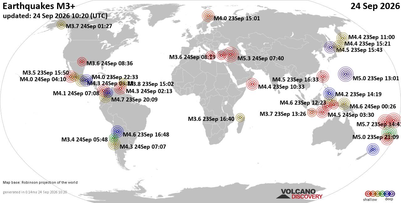
World Earthquake Report for Thursday, 24 September 2026
• Moderate mag. 4.3 earthquake - Madagascar: Mozambique Channel on Thursday, ...
• Small magnitude 3.9 earthquake hits near Hastings, Hastings District, Hawke...
• Volcano earthquake report for Thursday, 24 September 2026
• Light mag. 3.9 earthquake - South Pacific Ocean, 10.2 km south of Hastings,...
• Moderate magnitude 4.1 quake hits 31 miles southeast of Midland, Texas, Uni...
|

#830240
Fri 31 Jul 2026 02:48:AM
|
Joined: Feb 2001
Posts: 678,977
Launch Director
|
|
Launch Director
Joined: Feb 2001
Posts: 678,977 |
Issued at 500 PM HST Thu Jul 30 2026 000
WTPZ42 KNHC 310248
TCDEP2
Tropical Storm Genevieve Discussion Number 28
NWS National Hurricane Center Miami FL EP072026
500 PM HST Thu Jul 30 2026
Genevieve is now a tropical storm, and the cyclone remains on a
weakening trend. Visible and infrared satellite imagery shows
that the convection in the inner core continues to degrade. Water
vapor imagery also shows that some dry air has made progress into
the inner core of the storm as well. In addition, the objective
intensity estimates continue to trend downward, in the range of
50-65 kt. The most recent current intensity estimate from TAFB is
4.0/65 kt but the T-number has decreased to 3.5/55 kt. Based on the
downward trend presented by both the satellite imagery and the
various subjective and objective estimates, the advisory intensity
is reduced to 60 kt.
Genevieve continues to move along a west-northwestward heading
today, guided by a strengthening ridge to the north. This general
motion will prevail over the next 72 h or so. By early next week, a
strong upper-level trough will advance toward the western U.S. and
evolve into a cutoff low, steering Genevieve toward the northwest
then north-northwest. Only slight adjustments have been made to the
track based on the latest guidance and the position of the storm at
this time. The track forecast continues to be in good agreement with
the consensus of the guidance.
The tropical storm has moved into cooler waters and is experiencing
dry mid-level air and less favorable upper-level winds. These
factors will lead to further steady weakening over the next several
days. Global model guidance suggests that Genevieve may struggle to
produce organized deep convection this weekend, and the forecast
calls for the system to become post-tropical by 72 h, and a remnant
low early next week. The new forecast intensity remains very similar
to the previous advisory, and is near the middle of the consensus
guidance.
FORECAST POSITIONS AND MAX WINDS
INIT 31/0300Z 21.3N 126.0W 60 KT 70 MPH
12H 31/1200Z 21.8N 128.0W 55 KT 65 MPH
24H 01/0000Z 22.5N 130.7W 50 KT 60 MPH
36H 01/1200Z 23.3N 133.5W 50 KT 60 MPH
48H 02/0000Z 24.1N 136.4W 45 KT 50 MPH
60H 02/1200Z 25.0N 139.2W 40 KT 45 MPH
72H 03/0000Z 26.1N 141.5W 35 KT 40 MPH...POST-TROPICAL
96H 04/0000Z 28.4N 144.9W 30 KT 35 MPH...POST-TROP/REMNT LOW
120H 05/0000Z 31.7N 146.8W 25 KT 30 MPH...POST-TROP/REMNT LOW
$$
Forecaster Katz/Pasch Source: Tropical Storm Genevieve Forecast Discussion Number 28
|
|



CMS The Best Conveyancing solicitors conveyancing quotes throughout the UK
For any webhosting enquiries please email webmaster@aus-city.com
|
|
Entire Thread
|
 Tropical Storm Genevieve Forecast Discussion Number 28
|
Webmaster
|
Fri 31 Jul 2026 02:48:AM
|
|
Forums60
Topics840,505
Posts875,300
Members2,960
| |
Most Online102,106
Jul 10th, 2026
|
|
|
|
|

|





































