|
|
|
0 members (),
964
guests, and
60
robots. |
|
Key:
Admin,
Global Mod,
Mod
|
|
S |
M |
T |
W |
T |
F |
S |
|
|
|
|
|
|
|
1
|
|
2
|
3
|
4
|
5
|
6
|
7
|
8
|
|
9
|
10
|
11
|
12
|
13
|
14
|
15
|
|
16
|
17
|
18
|
19
|
20
|
21
|
22
|
|
23
|
24
|
25
|
26
|
27
|
28
|
29
|
|
30
|
31
|
|
|
|
|
|
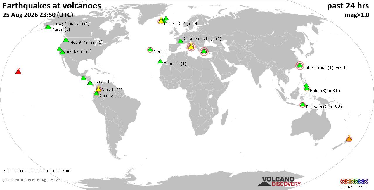
Volcano earthquake report for Tuesday, 25 Aug 2026
• M 2.1 - 61 km SW of Nanwalek, Alaska
• M 1.5 - 9 km WNW of The Geysers, CA
• M 0.3 - 4 km W of Cobb, CA
• M 4.8 - 76 km NNW of Ende, Indonesia
• M -0.2 - 10 km NW of The Geysers, CA
• M 0.3 - 7 km W of Cobb, CA
|

#830283
Sat 01 Aug 2026 08:21:AM
|
Joined: Feb 2001
Posts: 678,977
Launch Director
|
|
Launch Director
Joined: Feb 2001
Posts: 678,977 |
SPC Aug 1, 2026 Day 4-8 Severe Weather OutlookDay 4-8 Outlook 
Day 4-8 Convective Outlook
NWS Storm Prediction Center Norman OK
0317 AM CDT Sat Aug 01 2026

Valid 041200Z - 091200Z

...DISCUSSION...
...Day 4/Tuesday...

A broader-scale trough is forecast over central Canada into the
north-central U.S. with a series of subtle disturbances moving
through the base of that feature. At the surface, a front is
expected to move through the upper Great Lakes with the western
extension of the boundary settling slowly south through the central
High Plains. A severe weather threat may materialize from the mid MO
Valley into the central High Plains along the front and in the
post-frontal upslope, where an overlap of moderate instability and
stronger vertical shear is expected to reside.

Elsewhere, a more widespread area of moderate instability developing
across southern AZ could support a locally greater risk of severe
storms.

The extent of the severe weather threat in both areas is currently
too uncertain to delineate an area.


...Day 5/Wednesday...

The broad, cyclonic flow regime will continue over the north-central
CONUS with a belt of slightly enhanced mid-level winds extending
from the northern Rockies through the northern and central Plains
into the Great Lakes. At the surface, the previously mentioned front
will continue through the Great Lakes with the boundary extending
southwest through the mid MS Valley into the central or southern
High Plains. Similar to Day 4/Tuesday, some severe weather appears
possible along the boundary over the lower MO into mid MS Valleys,
as well as within the post-frontal upslope across the central High
Plains.

The subtle nature of the forcing for ascent leads to uncertainty in
severe storm coverage, so no area will be included.


...Days 6-8/Thursday through Saturday...

The 00Z ensemble means are in reasonably good agreement in depicting
the continuation of an upper high over the southwestern U.S. with
lower-amplitude troughing over the Great Lakes into the Northeast.
At the surface, there is considerable model spread in the location
of relevant boundaries that might focus severe storms. That being
said, much of the available AI guidance suggests an increasing
severe weather threat in the Mid-Atlantic during this time frame.

Model trends will continue to be monitored for the possible
inclusion of an area in subsequent outlooks.
Read morehttps://www.spc.noaa.gov/products/exper/day4-8/
|
|



CMS The Best Conveyancing solicitors conveyancing quotes throughout the UK
For any webhosting enquiries please email webmaster@aus-city.com
|
|
Entire Thread
|
 SPC Aug 1, 2026 Day 4-8 Severe Weather Outlook
|
Webmaster
|
Sat 01 Aug 2026 08:21:AM
|
|
Forums60
Topics813,259
Posts848,052
Members2,960
| |
Most Online102,106
Jul 10th, 2026
|
|
|
|
|

|





































