|
|
|
0 members (),
940
guests, and
23
robots. |
|
Key:
Admin,
Global Mod,
Mod
|
|
S |
M |
T |
W |
T |
F |
S |
|
|
|
1
|
2
|
3
|
4
|
5
|
|
6
|
7
|
8
|
9
|
10
|
11
|
12
|
|
13
|
14
|
15
|
16
|
17
|
18
|
19
|
|
20
|
21
|
22
|
23
|
24
|
25
|
26
|
|
27
|
28
|
29
|
30
|
|
|
|
|
There are no members with birthdays on this day. |
|
|
|
|
|
|
|
|
|
|
the shoes
by Webmaster - Sun 06 Sep 2026 12:00:AM
|
|
|
|
|
|
|
|
|
|
|
|
|
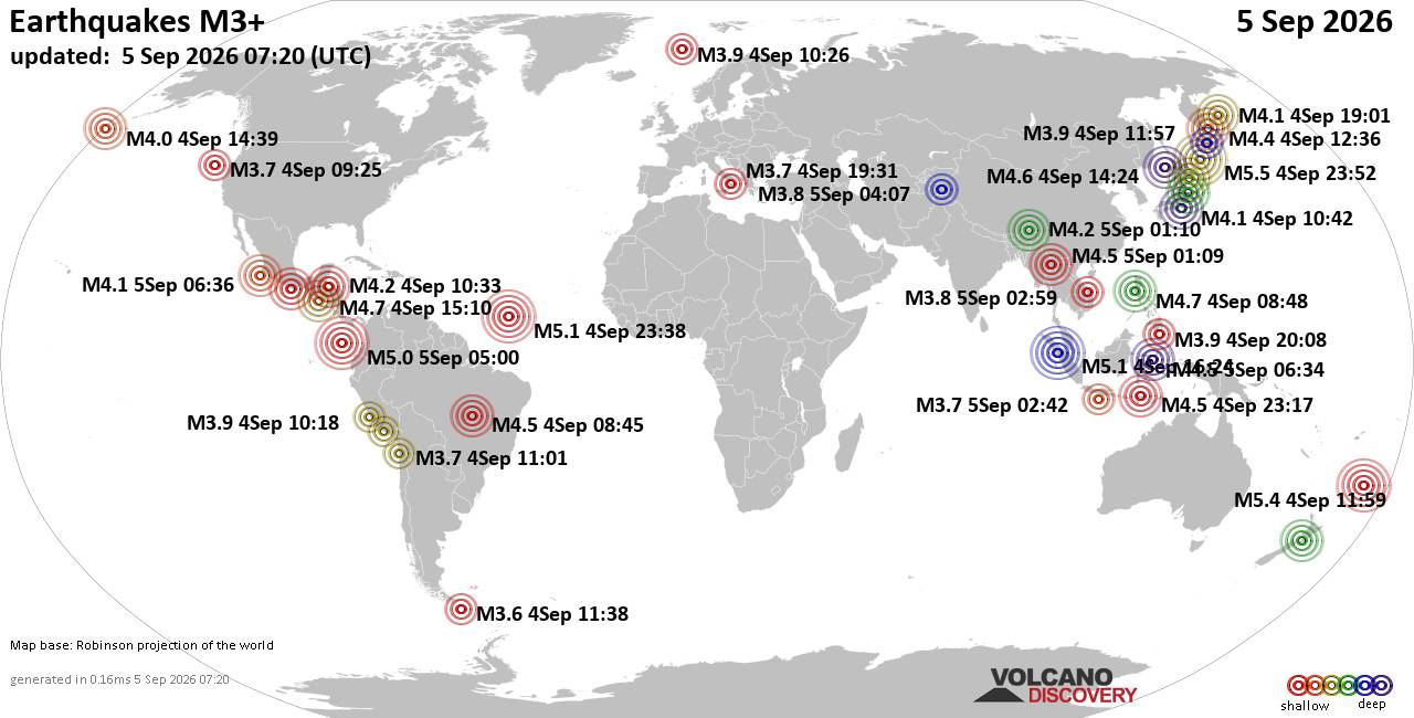
World Earthquake Report for Saturday, 5 September 2026
• Moderate mag. 4.0 earthquake - Provincia de Iquique, Tarapacá, Chile, on S...
• Volcano earthquake report for Saturday, 5 September 2026
• Moderate magnitude 4.6 earthquake 77 km southeast of Gorontalo, Indonesia
• Moderate mag. 4.1 earthquake - North Pacific Ocean, 152 km west of Manzanil...
• Moderate mag. 4.5 earthquake - Sulawesi Tengah, 77 km south of Gorontalo, K...
|

#837040
Fri 21 Aug 2026 03:31:AM
|
Joined: Feb 2001
Posts: 678,977
Launch Director
|
|
Launch Director
Joined: Feb 2001
Posts: 678,977 |
Moderate magnitude 4.2 earthquake 63 miles south of False Pass, Alaska, United StatesA magnitude 4.2 earthquake near False Pass, Aleutians East, Alaska, USA, was reported only 16 minutes ago by the United States Geological Survey, considered the key international and national agency that monitors seismic activity in the US. The earthquake occurred at a moderately shallow depth of 19 miles beneath the epicenter in the afternoon on Thursday, August 20th, 2026, at 4:14 pm local time. The exact magnitude, epicenter, and depth of the quake might be revised within the next few hours or minutes as seismologists review data and refine their calculations, or as other agencies issue their report.
A second report was later issued by the European-Mediterranean Seismological Centre (EMSC), which listed it as a magnitude 4.2 earthquake as well.
Towns or cities near the epicenter where the quake might have been felt as very weak shaking include False Pass (pop. 40) located 63 miles from the epicenter.
Earthquake data: Date & time: Aug 20, 2026 04:14 pm (GMT -11) local time (21 Aug 2026 03:14 GMT)Magnitude: 4.2 Depth: 30.86 km Epicenter latitude / longitude: 53.95°N / 163.34°W  ( Alaska, United States) Primary data source: USGShttps://www.volcanodiscovery.com/earthquake/news/327505/Moderate-magnitude-42-earthquake-63-miles-south-of-False-Pass-Alaska-United-States.html
|
|



CMS The Best Conveyancing solicitors conveyancing quotes throughout the UK
For any webhosting enquiries please email webmaster@aus-city.com
|
|
Entire Thread
|
 Moderate magnitude 4.2 earthquake 63 miles south of False Pass, Alaska, United States
|
Webmaster
|
Fri 21 Aug 2026 03:31:AM
|
|
Forums60
Topics820,319
Posts855,112
Members2,960
| |
Most Online102,106
Jul 10th, 2026
|
|
|
|
|

|





































