|
0 members (),
1,408
guests, and
24
robots. |
|
Key:
Admin,
Global Mod,
Mod
|
|
S |
M |
T |
W |
T |
F |
S |
|
|
|
|
|
1
|
2
|
3
|
|
4
|
5
|
6
|
7
|
8
|
9
|
10
|
|
11
|
12
|
13
|
14
|
15
|
16
|
17
|
|
18
|
19
|
20
|
21
|
22
|
23
|
24
|
|
25
|
26
|
27
|
28
|
29
|
30
|
31
|
|
There are no members with birthdays on this day. |
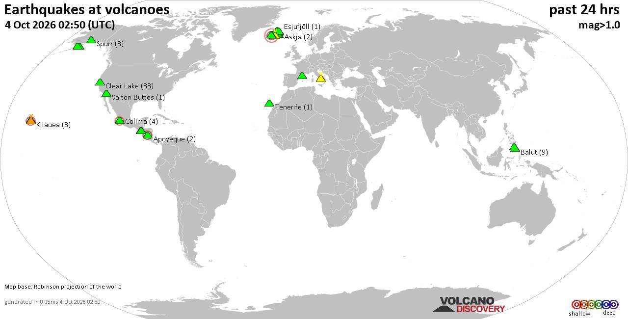
Volcano earthquake report for Sunday, 4 October 2026
• M 0.3 - 9 km SW of Beaumont, CA
• M 0.8 - 8 km NW of The Geysers, CA
• M 4.5 - 57 km S of Buala, Solomon Islands
• M 2.0 - 2 km NE of Almanor, CA
• M 0.9 - 15 km N of California City, CA
• M 1.9 - 22 km SSE of Pāhala, Hawaii
|

#837184
Fri 21 Aug 2026 06:49:AM
|
Joined: Feb 2001
Posts: 678,977
Launch Director
|
|
Launch Director
Joined: Feb 2001
Posts: 678,977 |
SPC Aug 21, 2026 0600 UTC Day 1 Convective OutlookSPC 1200Z Day 1 Outlook 
Day 1 Convective Outlook CORR 1
NWS Storm Prediction Center Norman OK
0146 AM CDT Fri Aug 21 2026

Valid 211200Z - 221200Z

...THERE IS A SLIGHT RISK OF SEVERE THUNDERSTORMS OVER PORTIONS OF
THE CENTRAL PLAINS...THE MIDWEST AND THE CAROLINAS...

CORRECTED FOR TEXT

...SUMMARY...
Scattered damaging hail (some greater than 2 inch diameter) and
severe wind gusts may occur over parts of the central Plains this
afternoon and evening. Scattered storms, some with severe wind gusts
and hail, also are possible across parts of the Midwest. Scattered
to numerous storms with damaging wind gusts are possible over the
Carolinas and Southeast.

...Central Plains...
Mid-level ridging over the western US is forecast to intensify,
strengthening northwesterly flow aloft over much of the central US.
Several embedded disturbances will pass overhead with the enhanced
northwesterlies through the day. A surface low will move
southeastward through the Great Lakes as a weak trailing cold front
moves southward through the central Plains and Midwest.

Ahead of the front, a plume of steep mid-level lapse rates will
shift eastward across the central Plains toward the Mid-MO Valley
atop a corridor of rich low-level moisture. Diurnal destabilization
should result in 3000-4000 J/kg of MLCAPE from SD to NE. Isolated to
widely scattered thunderstorm development is expected from the Black
Hills southeastward along the cold front. Elongated/straight
hodographs and 45+ kt effective shear will favor initial supercells.
Large to very large hail (some greater than 2 inches diameter) will
be possible. With time, a forward propagating cluster or two may
develop and move southeast across parts of NE and KS with the
potential for severe gusts (a few near 70-80 mph). It is unclear
exactly how far southeast any storms will persist overnight, but any
more substantial clustering could allow at least an isolated severe
threat to continue into early Saturday.

A much drier and hotter environment over the High Plains to the west
could also support isolated to widely scattered high-based storms
from eastern CO into western KS. Very steep lapse rates in the
lowest 2-3 km with modest buoyancy aloft could allow a few severe
gusts.

...Midwest...
Beneath the upper trough over the western Great Lakes, cool
mid-level temperatures and robust surface moisture should result in
moderate destabilization from WI into eastern IA and northwest IL.
Scattered thunderstorms by mid afternoon ahead of the cold front
spreading southeastward. Enhanced northwesterly flow with deep-layer
shear of 30-40 kt will promote a mix of organized clusters and
supercells. The large buoyancy will support a risk for damaging
gusts and some hail.

...Southeast and Gulf Coast...
A broad upper trough will move across the central US into parts of
the southern Appalachians while a weak cold front moves southward
from the mid Atlantic today and tonight. Weak ascent from the upper
trough and near the front should focus diurnal thunderstorm activity
across the Carolinas and southern Appalachians. Warm surface
temperatures and plentiful boundary-layer moisture will support
large buoyancy (3000+ J/kg MLCAPE) through the afternoon and evening
despite modest mid-level lapse rates. With scattered to numerous
storms expected, a few organized clusters may emerge with a risk
primarily for damaging wind gusts. Slight enhancement of the
westerly flow aloft could also support some isolated hail with the
stronger updrafts.

Farther south and west, a very humid and warm air mass is forecast
to become strongly unstable by early afternoon across the lower MS
Valley and Gulf Coast. Scattered to numerous thunderstorms are
expected along prior outflows and a weak, southward moving cold
front from East TX into LA/MS. The very strong buoyancy and high
PWAT content will support clustering and strong downdrafts with
sporadic damaging gust potential. Otherwise, weak vertical shear
will limit overall organization.

..Lyons/Weinman.. 08/21/2026
Read morehttps://www.spc.noaa.gov/products/outlook/day1otlk_1200.html
|
|



CMS The Best Conveyancing solicitors conveyancing quotes throughout the UK
For any webhosting enquiries please email webmaster@aus-city.com
|
|
Entire Thread
|
 SPC Aug 21, 2026 0600 UTC Day 1 Convective Outlook
|
Webmaster
|
Fri 21 Aug 2026 06:49:AM
|
|
Forums60
Topics856,655
Posts891,450
Members2,960
| |
Most Online102,106
Jul 10th, 2026
|
|
|









































