|
0 members (),
1,543
guests, and
23
robots. |
|
Key:
Admin,
Global Mod,
Mod
|
|
S |
M |
T |
W |
T |
F |
S |
|
|
|
|
|
1
|
2
|
3
|
|
4
|
5
|
6
|
7
|
8
|
9
|
10
|
|
11
|
12
|
13
|
14
|
15
|
16
|
17
|
|
18
|
19
|
20
|
21
|
22
|
23
|
24
|
|
25
|
26
|
27
|
28
|
29
|
30
|
31
|
|
There are no members with birthdays on this day. |
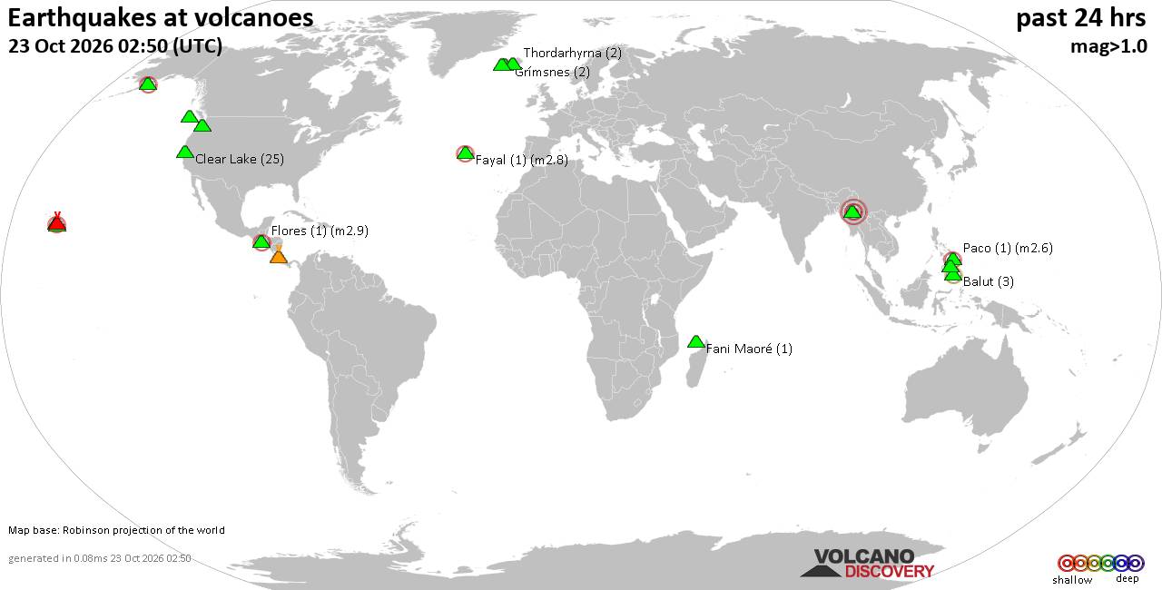
Volcano earthquake report for Friday, 23 October 2026
• M 0.6 - 85 km NNW of Karluk, Alaska
• M 2.0 - 27 km WNW of Willow, Alaska
• M 1.5 - 14 km S of Volcano, Hawaii
• M 2.3 - 17 km WNW of Point MacKenzie, Alaska
• M 4.7 - 4 km SE of Narutō, Japan
• M 1.6 - 14 km SW of Volcano, Hawaii
|

#837526
Sun 23 Aug 2026 08:42:AM
|
Joined: Feb 2001
Posts: 678,977
Launch Director
|
|
Launch Director
Joined: Feb 2001
Posts: 678,977 |
Issued at 1100 PM HST Sat Aug 22 2026 067
WTPA32 PHFO 230842
TCPCP2
BULLETIN
Tropical Storm Lala Advisory Number 44
NWS Central Pacific Hurricane Center Honolulu HI CP012026
Issued by NWS National Hurricane Center Miami FL
1100 PM HST Sat Aug 22 2026
...LALA MOVING NORTHWESTWARD OVER OPEN WATERS...
SUMMARY OF 1100 PM HST...0900 UTC...INFORMATION
-----------------------------------------------
LOCATION...32.0N 173.7W
ABOUT 335 MI...540 KM NNE OF PEARL AND HERMES ATOLL
ABOUT 370 MI...595 KM NE OF KURE ATOLL
MAXIMUM SUSTAINED WINDS...70 MPH...110 KM/H
PRESENT MOVEMENT...NW OR 325 DEGREES AT 7 MPH...11 KM/H
MINIMUM CENTRAL PRESSURE...984 MB...29.06 INCHES
WATCHES AND WARNINGS
--------------------
There are no coastal watches or warnings in effect.
DISCUSSION AND OUTLOOK
----------------------
At 1100 PM HST (0900 UTC), the center of Tropical Storm Lala was
located near latitude 32.0 North, longitude 173.7 West. Lala is
moving toward the northwest near 7 mph (11 km/h), and this general
motion is expected to continue for the next several days.
Maximum sustained winds are near 70 mph (110 km/h) with higher
gusts. Gradual weakening is forecast during the next several days.
Tropical-storm-force winds extend outward up to 185 miles (295 km)
from the center.
The estimated minimum central pressure is 984 mb (29.06 inches).
HAZARDS AFFECTING LAND
----------------------
SURF: Large surf associated with Lala will affect western sections
of the Papahanaumokuakea Marine National Monument for the next
couple of days. These large waves could inundate some low-lying
atolls, especially from Maro Reef to Kure Atoll.
NEXT ADVISORY
-------------
Next complete advisory at 500 AM HST.
$$
Forecaster Reinhart Source: Tropical Storm Lala Public Advisory Number 44
|
|



CMS The Best Conveyancing solicitors conveyancing quotes throughout the UK
For any webhosting enquiries please email webmaster@aus-city.com
|
|
Entire Thread
|
 Tropical Storm Lala Public Advisory Number 44
|
Webmaster
|
Sun 23 Aug 2026 08:42:AM
|
|
Forums60
Topics890,873
Posts925,670
Members2,960
| |
Most Online102,106
Jul 10th, 2026
|
|
|









































