|
1 members (Alisa),
2,521
guests, and
21
robots. |
|
Key:
Admin,
Global Mod,
Mod
|
|
S |
M |
T |
W |
T |
F |
S |
|
|
|
|
|
1
|
2
|
3
|
|
4
|
5
|
6
|
7
|
8
|
9
|
10
|
|
11
|
12
|
13
|
14
|
15
|
16
|
17
|
|
18
|
19
|
20
|
21
|
22
|
23
|
24
|
|
25
|
26
|
27
|
28
|
29
|
30
|
31
|
|
There are no members with birthdays on this day. |
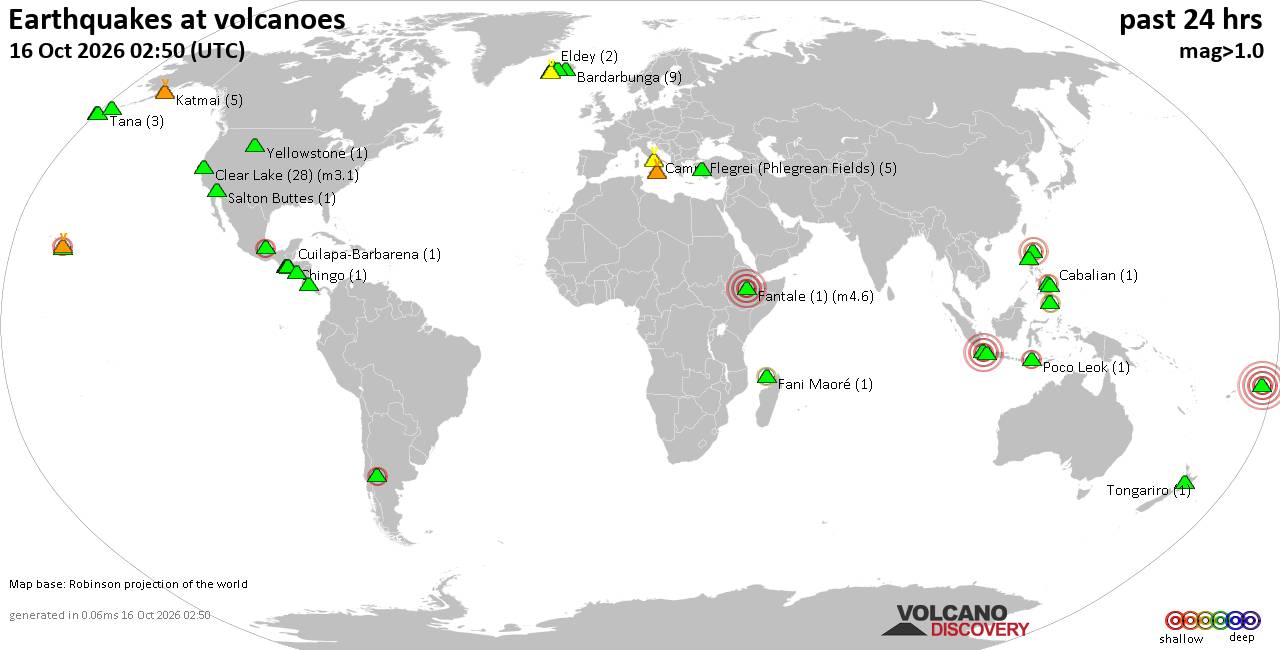
Volcano earthquake report for Friday, 16 October 2026
• M 3.1 - 202 km SE of Atka, Alaska
• M 2.3 - 40 km E of Chase, Alaska
• M 3.6 - 2 km NW of Knik, Alaska
• M 3.3 - 65 km NE of Punta Cana, Dominican Republic
• M 3.6 - 282 km ESE of Chiniak, Alaska
|

#837762
Mon 24 Aug 2026 08:51:AM
|
Joined: Feb 2001
Posts: 678,977
Launch Director
|
|
Launch Director
Joined: Feb 2001
Posts: 678,977 |
Issued at 200 AM PDT Mon Aug 24 2026 855
WTPZ44 KNHC 240851
TCDEP4
Tropical Storm Iselle Discussion Number 4
NWS National Hurricane Center Miami FL EP092026
200 AM PDT Mon Aug 24 2026
Iselle is being affected by northwesterly shear, with much of the
deep convection displaced to the south and east of the center. Over
the past several hours, the convective structure has evolved, with
curved banding becoming increasingly established around the center.
The latest Dvorak intensity estimate from TAFB at 0600 UTC was
3.0/45 kt; however, recent objective intensity estimates from
UW-CIMSS have increased and range from 43-59 kt. Given the improved
banding evident on satellite imagery and the upward trend in
objective intensity estimates, the initial intensity is set at 50 kt
for this advisory.
The tropical storm is moving northwestward around 10 kt, steered by
a mid-level ridge centered over the southwestern United States.
Iselle is forecast to turn toward the west-northwest as the ridge
expands westward into the eastern Pacific, and this general motion
is expected through much of this week. The latest NHC forecast is
very similar to the previous advisory and lies near the middle of
the track guidance envelope, closest to the HFIP Corrected Consensus
(HCCA) and the Google DeepMind (GDMI) model. There is considerable
spread among the guidance during the latter portion of the forecast
period, resulting in slightly below-average confidence in the track
forecast.
Iselle is moving over warm waters around 29-30 C and remains within
a fairly moist mid-level environment, which should support gradual
strengthening during the next 12-24 h. The latest NHC forecast
brings Iselle to hurricane strength during this period, near the
upper end of the intensity guidance, and is consistent with HCCA and
GDM. Beyond 24 h, increasing wind shear, cooler waters and
progressively drier mid-level air are expected to lead to gradual
weakening from Tuesday through the remainder of the week. The ECMWF
and GFS simulated satellite imagery suggest that Iselle may struggle
to maintain organized convection by late this week, raising the
possibility that the cyclone could become post-tropical earlier than
currently forecast.
FORECAST POSITIONS AND MAX WINDS
INIT 24/0900Z 17.8N 116.2W 50 KT 60 MPH
12H 24/1800Z 19.0N 117.4W 60 KT 70 MPH
24H 25/0600Z 20.1N 118.9W 65 KT 75 MPH
36H 25/1800Z 20.9N 120.7W 60 KT 70 MPH
48H 26/0600Z 21.5N 122.5W 55 KT 65 MPH
60H 26/1800Z 21.9N 124.4W 50 KT 60 MPH
72H 27/0600Z 22.4N 126.3W 45 KT 50 MPH
96H 28/0600Z 23.1N 130.1W 35 KT 40 MPH
120H 29/0600Z 23.9N 134.1W 30 KT 35 MPH...POST-TROP/REMNT LOW
$$
Forecaster Adams Source: Tropical Storm Iselle Forecast Discussion Number 4
|
|



CMS The Best Conveyancing solicitors conveyancing quotes throughout the UK
For any webhosting enquiries please email webmaster@aus-city.com
|
|
Entire Thread
|
 Tropical Storm Iselle Forecast Discussion Number 4
|
Webmaster
|
Mon 24 Aug 2026 08:51:AM
|
|
Forums60
Topics879,145
Posts913,942
Members2,960
| |
Most Online102,106
Jul 10th, 2026
|
|
|









































