|
0 members (),
764
guests, and
36
robots. |
|
Key:
Admin,
Global Mod,
Mod
|
|
S |
M |
T |
W |
T |
F |
S |
|
|
|
|
|
|
|
1
|
|
2
|
3
|
4
|
5
|
6
|
7
|
8
|
|
9
|
10
|
11
|
12
|
13
|
14
|
15
|
|
16
|
17
|
18
|
19
|
20
|
21
|
22
|
|
23
|
24
|
25
|
26
|
27
|
28
|
29
|
|
30
|
31
|
|
|
|
|
|
|
There are no members with birthdays on this day. |
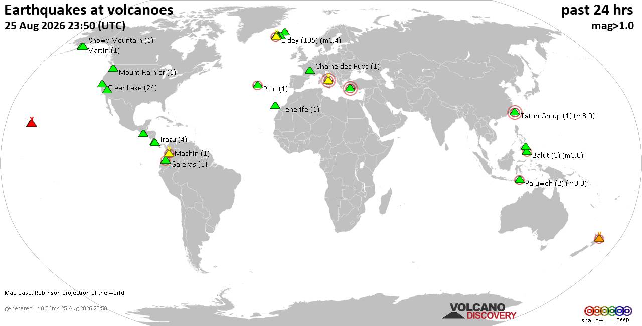
Volcano earthquake report for Tuesday, 25 Aug 2026
• Light mag. 3.9 earthquake - Myanmar (Burma): 85km NNW of Burma, Myanmar, on...
• World Earthquake Report for Tuesday, 25 August 2026
• Moderate mag. 4.0 earthquake - South OF Bali, Indonesia, on Wednesday, Aug ...
• Moderate mag. 4.7 earthquake - 77 km E of Tomioka, Japan, on Wednesday, Aug...
• Moderate mag. 4.2 earthquake - 192 km SSE of Sarangani, Philippines, on Wed...
|
|
|
Joined: Feb 2001
Posts: 678,977
Launch Director
|
|
Launch Director
Joined: Feb 2001
Posts: 678,977 |
Central Pacific Tropical Weather Outlook


000
ACPN50 PHFO 251754
TWOCP
Tropical Weather Outlook
NWS Central Pacific Hurricane Center Honolulu HI
Issued by NWS National Hurricane Center Miami FL
800 AM HST Tue Aug 25 2026
For the central North Pacific...between 140W and 180W:
Active Systems:
The National Hurricane Center is issuing advisories on Tropical
Storm Lala, located several hundred miles north of Pearl and Hermes
Atoll, on Tropical Storm Iselle, located several hundred miles
west of the southern tip of the Baja California Peninsula, and on
Tropical Storm Julio, located well west-southwest of the southern
tip of Baja California Peninsula.
Western East Pacific:
A trough of low pressure located well to the east-southeast of the
Hawaiian Islands is producing some disorganized showers and
thunderstorms. An area of low pressure is forecast to form along the
trough during the next couple of days, and environmental conditions
appear conducive for some gradual development thereafter. A tropical
depression is likely to form during the latter part of the week or
early this weekend while the system drifts northeastward, then
turns to the west-northwest.
* Formation chance through 48 hours...low...30 percent.
* Formation chance through 7 days...high...70 percent.
Central Pacific:
An area of low pressure could form well south of the Hawaiian
Islands late this week. Some gradual development is possible by
the weekend into early next week while the system moves slowly to
the west or west-northwest, well south-southwest of the Hawaiian
Islands.
* Formation chance through 48 hours...low...near 0 percent.
* Formation chance through 7 days...low...20 percent.
$$
Forecaster Blake
NNNN
|
|



CMS The Best Conveyancing solicitors conveyancing quotes throughout the UK
For any webhosting enquiries please email webmaster@aus-city.com
|
|
Entire Thread
|

 Central Pacific Tropical Weather Outlook
|
Webmaster
|
Yesterday at 05:54 PM
|
|
Forums60
Topics801,772
Posts836,565
Members2,960
| |
Most Online102,106
Jul 10th, 2026
|
|
|





































