|
|
|
1 members (Alisa),
1,393
guests, and
30
robots. |
|
Key:
Admin,
Global Mod,
Mod
|
|
S |
M |
T |
W |
T |
F |
S |
|
|
|
|
|
1
|
2
|
3
|
|
4
|
5
|
6
|
7
|
8
|
9
|
10
|
|
11
|
12
|
13
|
14
|
15
|
16
|
17
|
|
18
|
19
|
20
|
21
|
22
|
23
|
24
|
|
25
|
26
|
27
|
28
|
29
|
30
|
31
|
|
There are no members with birthdays on this day. |
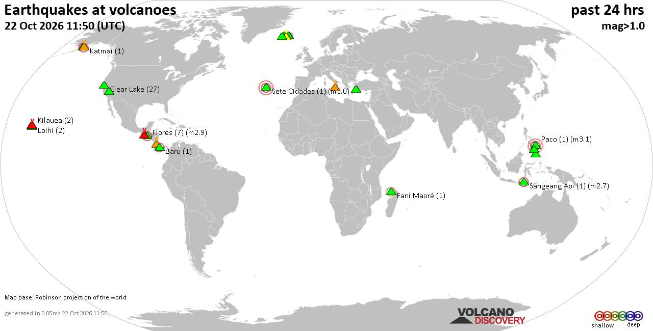
Volcano earthquake report for Thursday, 22 October 2026
• Magnitude 3.2 earthquake strikes near Pilsen, Okres Plzeň-město, Plzeňsk...
• M 2.4 - 17 km ESE of Pearsall, Texas
• M 2.2 - 15 km ESE of Pearsall, Texas
• M 1.0 - 12 km SE of Livermore, CA
• M 1.2 - 36 km ENE of McKinney Acres, Texas
|

#850069
Thu 27 Aug 2026 08:01:AM
|
Joined: Feb 2001
Posts: 678,977
Launch Director
|
|
Launch Director
Joined: Feb 2001
Posts: 678,977 |
SPC Aug 27, 2026 Day 4-8 Severe Weather OutlookDay 4-8 Outlook 
Day 4-8 Convective Outlook
NWS Storm Prediction Center Norman OK
0258 AM CDT Thu Aug 27 2026

Valid 301200Z - 041200Z

...DISCUSSION...
...D4/Sunday - Northern Plains...
Some severe weather is possible across the northern Plains on
Sunday, but details remain unclear. The primary mid-level shortwave
trough and associated large-scale ascent is expected to traverse
northern Montana and North Dakota. However, the greater instability
is focused farther southeast across eastern South Dakota and
southwest Montana. The ECMWF shows enough instability developing
farther north into south-central North Dakota to support some severe
weather threat. The uncertainties regarding destabilization and
storm coverage preclude severe weather probabilities at this time.

...D5 and Beyond...
The forecast next week features multiple mid-level shortwave troughs
and considerable uncertainty with the timing of these features.
However, there is a larger scale trend toward a ridge building
across the Plains with northwesterly flow from the Upper Midwest to
the Mid-Atlantic/New England. Moderate to strong instability along
this corridor will support some severe weather potential next week.
However, specific areas of greater severe weather potential will
depend on the timing and amplitude of embedded mid-level shortwave
troughs. Therefore, no probabilities can be added at this time.
Read morehttps://www.spc.noaa.gov/products/exper/day4-8/
|
|



CMS The Best Conveyancing solicitors conveyancing quotes throughout the UK
For any webhosting enquiries please email webmaster@aus-city.com
|
|
Entire Thread
|
 SPC Aug 27, 2026 Day 4-8 Severe Weather Outlook
|
Webmaster
|
Thu 27 Aug 2026 08:01:AM
|
|
Forums60
Topics889,433
Posts924,230
Members2,960
| |
Most Online102,106
Jul 10th, 2026
|
|
|
|
|

|









































