|
|
|
0 members (),
1,091
guests, and
25
robots. |
|
Key:
Admin,
Global Mod,
Mod
|
|
S |
M |
T |
W |
T |
F |
S |
|
|
|
1
|
2
|
3
|
4
|
5
|
|
6
|
7
|
8
|
9
|
10
|
11
|
12
|
|
13
|
14
|
15
|
16
|
17
|
18
|
19
|
|
20
|
21
|
22
|
23
|
24
|
25
|
26
|
|
27
|
28
|
29
|
30
|
|
|
|
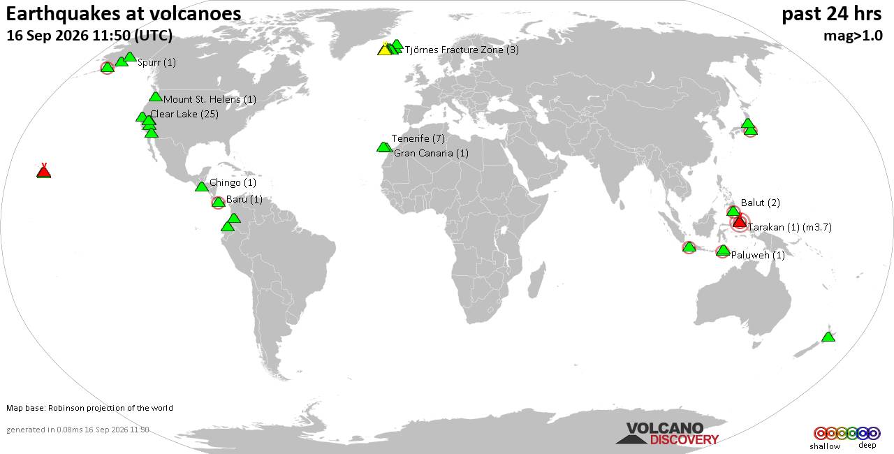
Volcano earthquake report for Wednesday, 16 September 2026
• Strong mag. 5.1 earthquake - New Britain Region, Papua New Guinea, on Wedne...
• World Earthquake Report for Wednesday, 16 September 2026
• Strong mag. 5.0 earthquake - Departamento del Choco, 86 km west of La Union...
• Strong mag. 5.1 earthquake - Hawke's Bay, New Zealand, on Thursday, Sep 17,...
• M 1.6 - 17 km SW of Petersville, Alaska
|
|
|
Joined: Feb 2001
Posts: 678,977
Launch Director
|
|
Launch Director
Joined: Feb 2001
Posts: 678,977 |
SPC Sep 16, 2026 Day 4-8 Severe Weather OutlookDay 4-8 Outlook 
Day 4-8 Convective Outlook
NWS Storm Prediction Center Norman OK
0356 AM CDT Wed Sep 16 2026

Valid 191200Z - 241200Z

...DISCUSSION...
Latest medium-range model output suggests that modest pre-frontal
surface troughing across the Texas/Oklahoma Panhandle vicinity
through south central/eastern Kansas, and perhaps the slow moving
frontal zone across northeastern Kansas through northern
Missouri/southeastern Iowa, may provide focus for scattered strong
thunderstorm development late Saturday afternoon into evening.  This
may be supported by forcing for ascent downstream of weak
larger-scale mid-level troughing slowly progressing across the
Rockies into Great Plains, with deep boundary-layer mixing along the
surface trough and higher boundary-layer moisture content along the
frontal zone contributing to thermodynamic profiles potentially
conducive to severe weather.  However, with the belt of stronger
lower/mid-tropospheric flow associated with a preceding impulse
tending to weaken and/or shift eastward near or to the south of the
Great Lakes region, it still appears that this potential will remain
relatively isolated in coverage and/or marginal in nature.

Thereafter, late this weekend through early next week, the spread
among model output concerning the mid/upper flow evolution
increases.  However, even among the differing solutions, there is
little readily apparent that indicates an increase in organized
severe thunderstorm potential.
Read morehttps://www.spc.noaa.gov/products/exper/day4-8/
|
|



CMS The Best Conveyancing solicitors conveyancing quotes throughout the UK
For any webhosting enquiries please email webmaster@aus-city.com
|
|
Entire Thread
|

 SPC Sep 16, 2026 Day 4-8 Severe Weather Outlook
|
Webmaster
|
Yesterday at 08:59 AM
|
|
Forums60
Topics829,271
Posts864,065
Members2,960
| |
Most Online102,106
Jul 10th, 2026
|
|
|
|
|

|





































