|
|
|
0 members (),
4,509
guests, and
23
robots. |
|
Key:
Admin,
Global Mod,
Mod
|
|
S |
M |
T |
W |
T |
F |
S |
|
|
|
1
|
2
|
3
|
4
|
5
|
|
6
|
7
|
8
|
9
|
10
|
11
|
12
|
|
13
|
14
|
15
|
16
|
17
|
18
|
19
|
|
20
|
21
|
22
|
23
|
24
|
25
|
26
|
|
27
|
28
|
29
|
30
|
|
|
|
|
There are no members with birthdays on this day. |
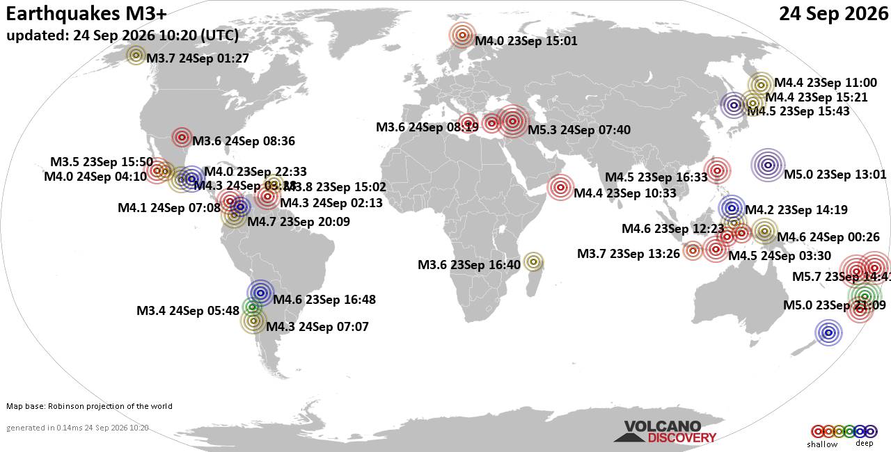
World Earthquake Report for Thursday, 24 September 2026
• Moderate mag. 4.3 earthquake - Madagascar: Mozambique Channel on Thursday, ...
• Small magnitude 3.9 earthquake hits near Hastings, Hastings District, Hawke...
• Volcano earthquake report for Thursday, 24 September 2026
• Light mag. 3.9 earthquake - South Pacific Ocean, 10.2 km south of Hastings,...
• Moderate magnitude 4.1 quake hits 31 miles southeast of Midland, Texas, Uni...
|
|
|
Joined: Feb 2001
Posts: 678,977
Launch Director
|
|
Launch Director
Joined: Feb 2001
Posts: 678,977 |
SPC Sep 24, 2026 1730 UTC Day 2 Convective OutlookSPC 1730Z Day 2 Outlook 
Day 2 Convective Outlook
NWS Storm Prediction Center Norman OK
1228 PM CDT Thu Sep 24 2026

Valid 251200Z - 261200Z

...NO SEVERE THUNDERSTORM AREAS FORECAST...

...SUMMARY...
Severe thunderstorms are not expected Friday.

...Synopsis...
A relatively benign mid-level flow pattern is forecast across much
of the central US as a stacked upper low deepens off the east coast
and a Pacific trough moves from WA/OR into the northern Rockies and
southern Canada. Weak mid-level ridging will persist over the
southern third of the CONUS as a broad and loosely organized
extension of the Pacific trough moves northeastward over the Rockies
and central High Plains. Mid-level flow aloft is forecast to remain
weak over much of the CONUS.

A surface low will quickly deepen over the western Atlantic under
the upper low supporting broad and cool low-level offshore flow for
much of the East. To the west, the limited upper-level forcing will
garner only modest ascent for surface lee troughing across the
central and southern High Plains where an unseasonably moist air
mass associated with remnant tropical/monsoon moisture will exist.
Given PWATS of 1.5-2", filtered diurnal heating should allow for
weak destabilization (MLCAPE 500-1000 J/kg) Friday afternoon.
Despite likely widespread shower and thunderstorm activity from the
central Plains to the Southwest, lingering cloud cover, poor
mid-level lapse rates, modest deep-layer vertical shear (20-30 kt)
suggest little potential for organized storms. Episodic hail or
damaging gusts cannot be ruled out from eastern NM into the TX
Panhandle and far western OK where heating is likely to be more
robust on the edge of the deeper tropospheric moisture. However,
forecast confidence in organized severe storms remains low, and 5%
probabilities will be withheld.

..Lyons.. 09/24/2026
Read morehttps://www.spc.noaa.gov/products/outlook/day2otlk_1730.html
|
|



CMS The Best Conveyancing solicitors conveyancing quotes throughout the UK
For any webhosting enquiries please email webmaster@aus-city.com
|
|
Entire Thread
|

 SPC Sep 24, 2026 1730 UTC Day 2 Convective Outlook
|
Webmaster
|
5 hours ago
|
|
Forums60
Topics840,452
Posts875,247
Members2,960
| |
Most Online102,106
Jul 10th, 2026
|
|
|
|
|

|





































