|
0 members (),
1,424
guests, and
25
robots. |
|
Key:
Admin,
Global Mod,
Mod
|
|
S |
M |
T |
W |
T |
F |
S |
|
|
|
|
|
1
|
2
|
3
|
|
4
|
5
|
6
|
7
|
8
|
9
|
10
|
|
11
|
12
|
13
|
14
|
15
|
16
|
17
|
|
18
|
19
|
20
|
21
|
22
|
23
|
24
|
|
25
|
26
|
27
|
28
|
29
|
30
|
31
|
|
There are no members with birthdays on this day. |
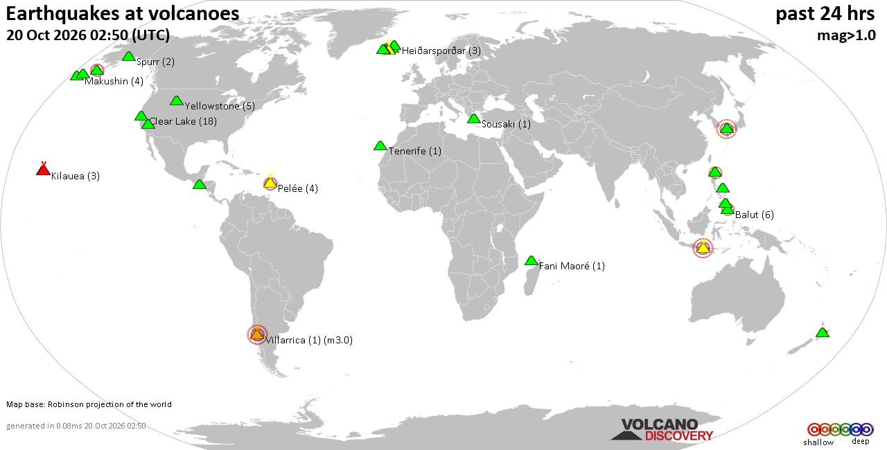
Volcano earthquake report for Tuesday, 20 October 2026
• M 1.9 - 41 km WNW of Nanwalek, Alaska
• M 1.9 - 41 km WNW of Nanwalek, Alaska
• M 1.5 - 19 km SW of Toms Place, CA
• M 1.5 - 19 km SW of Toms Place, CA
• Moderate mag. 4.0 earthquake - Tokyo, Japan, on Tuesday, Oct 20, 2026, at 1...
• M 2.1 - 17 km NW of Tehachapi, CA
|

#880711
Mon 28 Sep 2026 05:31:AM
|
Joined: Feb 2001
Posts: 678,977
Launch Director
|
|
Launch Director
Joined: Feb 2001
Posts: 678,977 |
Central Pacific Tropical Weather Outlook


000
ACPN50 PHFO 280531
TWOCP
Tropical Weather Outlook
NWS Central Pacific Hurricane Center Honolulu HI
Issued by NWS National Hurricane Center Miami FL
800 PM HST Sun Sep 27 2026
For the central North Pacific...between 140W and 180W:
Active Systems:
The National Hurricane Center is issuing advisories on Hurricane
Polo, located about 155 miles southwest of Cabo San Lazaro, Mexico,
on Hurricane Nolo, located a few hundred miles southwest of the
Hawaiian Islands, and on Tropical Storm Rachel, located a few
hundred miles southwest of southern Mexico.
Well East-Southeast of the Hawaiian Islands (EP91):
A broad area of low pressure located well east-southeast of the
Hawaiian Islands continues to become better organized. Environmental
conditions are expected to be conducive for further development, and
a tropical depression is likely to form during the next day or so.
The system should move generally northeastward and remain well east
of the Hawaiian Islands.
* Formation chance through 48 hours...high...70 percent.
* Formation chance through 7 days...high...90 percent.
&&
Public Advisories on Tropical Storm Rachel are issued under
WMO header WTPZ33 KNHC and under AWIPS header MIATCPEP3.
Forecast/Advisories on Tropical Storm Rachel are issued
under WMO header WTPZ23 KNHC and under AWIPS header MIATCMEP3.
$$
Forecaster Evans/Hagen
NNNN
|
|



CMS The Best Conveyancing solicitors conveyancing quotes throughout the UK
For any webhosting enquiries please email webmaster@aus-city.com
|
|
Entire Thread
|
 Central Pacific Tropical Weather Outlook
|
Webmaster
|
Mon 28 Sep 2026 05:31:AM
|
|
Forums60
Topics884,144
Posts918,941
Members2,960
| |
Most Online102,106
Jul 10th, 2026
|
|
|









































