|
1 members (Alisa),
2,021
guests, and
23
robots. |
|
Key:
Admin,
Global Mod,
Mod
|
|
S |
M |
T |
W |
T |
F |
S |
|
|
|
1
|
2
|
3
|
4
|
5
|
|
6
|
7
|
8
|
9
|
10
|
11
|
12
|
|
13
|
14
|
15
|
16
|
17
|
18
|
19
|
|
20
|
21
|
22
|
23
|
24
|
25
|
26
|
|
27
|
28
|
29
|
30
|
|
|
|
|
There are no members with birthdays on this day. |
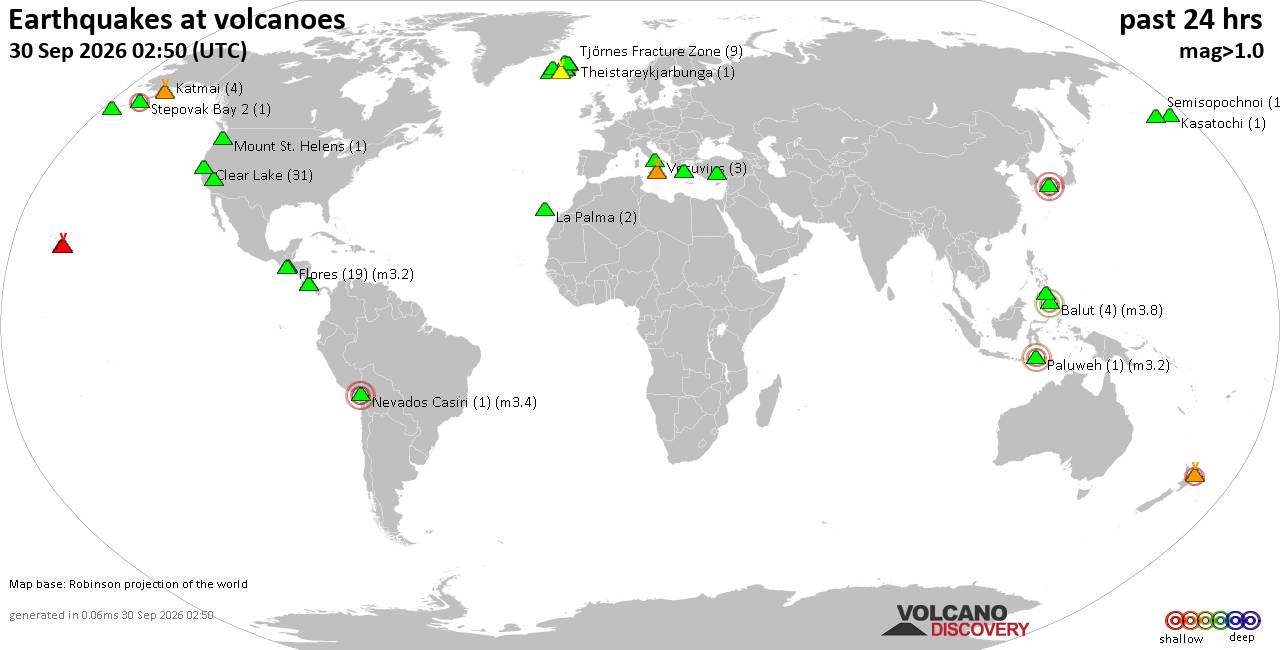
Volcano earthquake report for Wednesday, 30 September 2026
• M 0.9 - 4 km W of Devore, CA
• M 4.6 - 131 km SE of Itoman, Japan
• M -1.1 - 66 km ENE of Pedro Bay, Alaska
• M 1.6 - 8 km ESE of Cloverdale, CA
• M 3.0 - 8 km ESE of Cloverdale, CA
• M 4.4 - 136 km SW of Merizo Village, Guam
|
|
|
Joined: Feb 2001
Posts: 678,977
Launch Director
|
|
Launch Director
Joined: Feb 2001
Posts: 678,977 |
SPC MD 2338MD 2338 CONCERNING SEVERE POTENTIAL...WATCH POSSIBLE FOR PORTIONS OF WESTERN TEXAS 
Mesoscale Discussion 2338
NWS Storm Prediction Center Norman OK
0256 PM CDT Wed Sep 30 2026

Areas affected...portions of western Texas

Concerning...Severe potential...Watch possible

Valid 301956Z - 302200Z

Probability of Watch Issuance...40 percent

SUMMARY...At least a few severe gusts and a couple instances of hail
are possible with the stronger storms that can develop over the next
several hours. Assuming storms can appreciably increase in both
coverage and intensity, a Severe Thunderstorm Watch may be needed,

DISCUSSION...A surface low continues to track northeast along the
KS/OK Panhandle border area, with a weak surface trough extending
through western TX and a cold front trailing the surface low into
eastern NM. Ahead of the surface cold front and lee trough, surface
temperatures have warmed into the upper 80s to 90 F amid upper 50s
to upper 60s F dewpoints. RAP forecast soundings suggest a dry
boundary layer is in place, potentially extending to over 700 mb in
altitude. Visible satellite and MRMS mosaic radar data depict
developing storms, and as these storm mature, they should become
multicellular initially (given 20-30 kts of effective bulk shear).
Given nearly unidirectional tropospheric flow aligned roughly
parallel to the lee trough, convection should quickly become linear
in nature. As these linear segments overspread the dry boundary
layer, a few severe gusts may occur, along with an instance or two
of hail.

..Squitieri/Mosier.. 09/30/2026

...Please see www.spc.noaa.gov for graphic product...

ATTN...WFO...EWX...SJT...LUB...MAF...

LAT...LON   29190411 31190349 32630244 33140178 33580092 33800021
            33540000 32800003 31900047 30810113 29780195 29520251
            29160282 28920299 28820325 28870361 29190411

MOST PROBABLE PEAK TORNADO INTENSITY...UP TO 90 MPH
MOST PROBABLE PEAK WIND GUST...55-70 MPH
MOST PROBABLE PEAK HAIL SIZE...UP TO 1.25 IN
Read morehttps://www.spc.noaa.gov/products/md/md2338.html
|
|



CMS The Best Conveyancing solicitors conveyancing quotes throughout the UK
For any webhosting enquiries please email webmaster@aus-city.com
|
|
Entire Thread
|

 SPC MD 2338
|
Webmaster
|
2 hours ago
|
|
Forums60
Topics849,980
Posts884,775
Members2,960
| |
Most Online102,106
Jul 10th, 2026
|
|
|









































