|
0 members (),
2,629
guests, and
24
robots. |
|
Key:
Admin,
Global Mod,
Mod
|
|
S |
M |
T |
W |
T |
F |
S |
|
|
|
|
|
1
|
2
|
3
|
|
4
|
5
|
6
|
7
|
8
|
9
|
10
|
|
11
|
12
|
13
|
14
|
15
|
16
|
17
|
|
18
|
19
|
20
|
21
|
22
|
23
|
24
|
|
25
|
26
|
27
|
28
|
29
|
30
|
31
|
|
There are no members with birthdays on this day. |
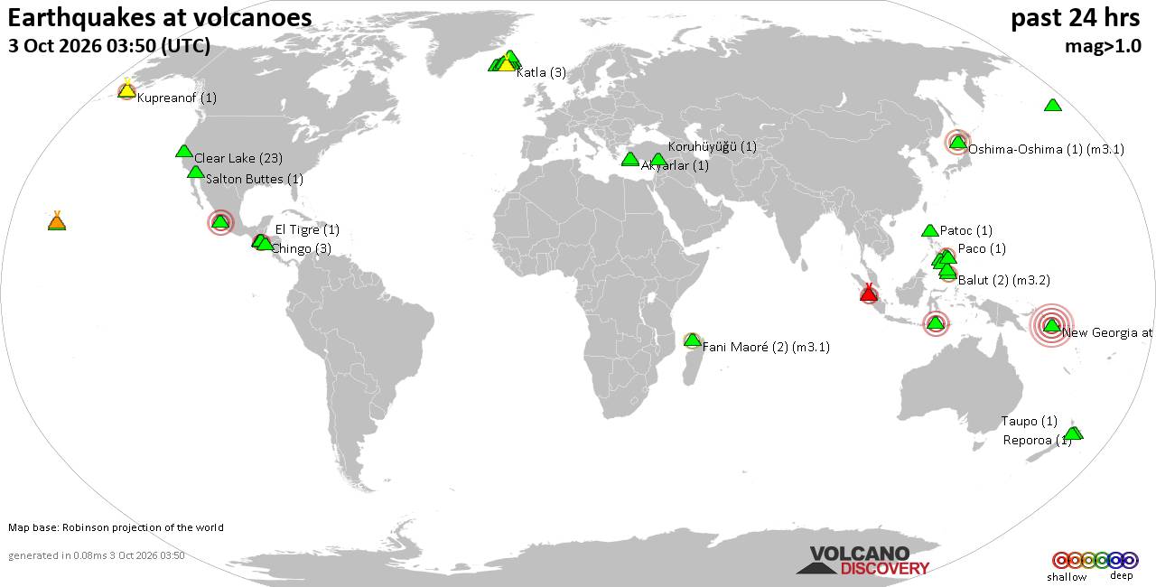
Volcano earthquake report for Saturday, 3 October 2026
• M 2.4 - 9 km E of Alum Rock, CA
• M 1.6 - 3 km NE of Sabana Grande, Puerto Rico
• M 4.2 - 6 km WNW of Wauna, Washington
• M 2.1 - 4 km WSW of Guánica, Puerto Rico
• M 5.1 - 182 km SSE of Vilyuchinsk, Russia
|
|
|
Joined: Feb 2001
Posts: 678,977
Launch Director
|
|
Launch Director
Joined: Feb 2001
Posts: 678,977 |
SPC Day 3-8 Fire Weather OutlookSPC Day 3-8 Fire Weather Outlook 
Day 3-8 Fire Weather Outlook
NWS Storm Prediction Center Norman OK
0350 PM CDT Sat Oct 03 2026

Valid 051200Z - 111200Z

The upper-level high over the Intermountain West will be suppressed
as a shortwave trough moves onshore along the West Coast on Day
3/Monday. As this occurs, the right exit region of a jet streak
moving along the Canadian border will dip into northern MT, leading
to dry and even warmer conditions. The upper-level ridge will
undergo further suppression on Day 4/Tuesday and Day 5/Wednesday as
the aforementioned jet continues to dive southward along its
northeastern periphery. This pattern looks to fully break down the
high as yet another higher-amplitude trough approaches the West
Coast late next week. Forecast guidance currently indicates that
this system will introduce increased winds, but also usher in cooler
temperatures and precipitation chances. Regardless, after several
days of dry conditions and above-normal temperatures, the potential
for increased winds preceding moderated conditions late next week
will be monitored closely.

Over north-central MT on Day 3/Monday, westerly flow associated with
the aforementioned upper-level jet will increase surface winds on
the lee side of the Rocky Mountains and across much of central and
eastern MT. Well-above-normal to near-record temperatures on Day
3/Monday, amid widespread low afternoon minimum RHs (near 15-20%)
and breezy westerly winds (15-20 mph), will meet/exceed elevated
fire weather criteria. Meanwhile, given the warm and dry antecedent
conditions, fuels remain driest across portions of central MT, where
ERCs have risen to near the 80th percentile. Thus, a 40% probability
of Critical Fire Weather has been introduced over this region on Day
3/Monday.

..Stearns.. 10/03/2026

...Please see www.spc.noaa.gov/fire for graphic product...
Read morehttps://www.spc.noaa.gov/products/exper/fire_wx/
|
|



CMS The Best Conveyancing solicitors conveyancing quotes throughout the UK
For any webhosting enquiries please email webmaster@aus-city.com
|
|
Entire Thread
|

 SPC Day 3-8 Fire Weather Outlook
|
Webmaster
|
2 hours ago
|
|
Forums60
Topics855,383
Posts890,178
Members2,960
| |
Most Online102,106
Jul 10th, 2026
|
|
|









































