|
|
|
0 members (),
2,562
guests, and
17
robots. |
|
Key:
Admin,
Global Mod,
Mod
|
|
S |
M |
T |
W |
T |
F |
S |
|
1
|
2
|
3
|
4
|
5
|
6
|
7
|
|
8
|
9
|
10
|
11
|
12
|
13
|
14
|
|
15
|
16
|
17
|
18
|
19
|
20
|
21
|
|
22
|
23
|
24
|
25
|
26
|
27
|
28
|
|
29
|
30
|
|
|
|
|
|
|
There are no members with birthdays on this day. |
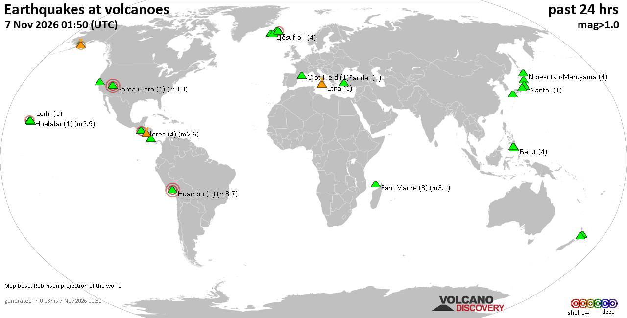
Volcano earthquake report for Saturday, 7 November 2026
• M 4.6 - 208 km WSW of Pistol River, Oregon
• M 1.4 - 0 km ENE of American Canyon, CA
• M 2.0 - 14 km WNW of Bayview, CA
• M 6.8 - 203 km NW of Port-Olry, Vanuatu
• M 1.6 - 23 km W of Volcano, Hawaii
|

#896185
Tue 06 Oct 2026 08:33:AM
|
Joined: Feb 2001
Posts: 800,656
Launch Director
|
|
Launch Director
Joined: Feb 2001
Posts: 800,656 |
SPC Oct 6, 2026 Day 4-8 Severe Weather OutlookDay 4-8 Outlook 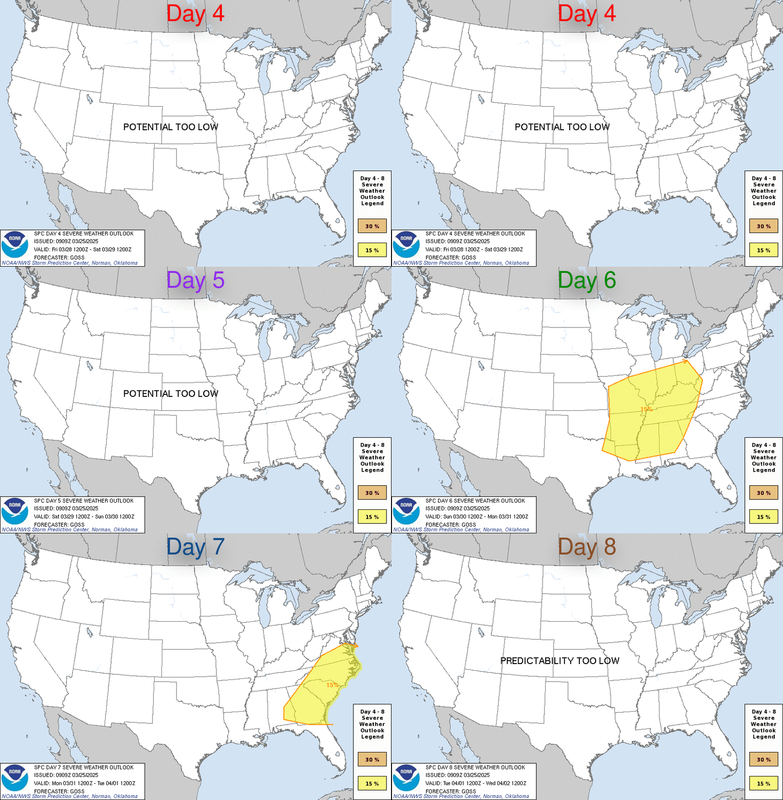
Day 4-8 Convective Outlook RESENT 1
NWS Storm Prediction Center Norman OK
0329 AM CDT Tue Oct 06 2026

Valid 091200Z - 141200Z

...DISCUSSION...
A surface high will move from the OH Valley into the Northeast on
Fri/D4 as an upper trough lifts out of the region and temporary
upper ridging occurs. A stationary boundary is still forecast to be
along the northern Gulf Coast at this time, and a weak midlevel wave
will begin to form over TX. Meanwhile, a potential tropical cyclone
may develop toward the central Gulf of America.

Low-level winds will begin to veer to a southeasterly direction
along the Gulf Coast late Fri/D4 into Sat/D5, as the potential
tropical cyclone evolves. NHC currently gives a high probability of
this occurring. As such, an influx of rich moisture will develop out
of the south, with a substantial rain shield and embedded
thunderstorms likely along the northern Gulf Coast beginning Fri/D4
night. Initially, surface temperatures over land will remain cool
due to precipitation and initial modification of the surface ridge
air mass.

At this time, it appears Sat/D5 is the most likely time for the more
substantial low-level warming to occur, with tropical yet
sufficiently unstable profiles. Of particular note is how the
developing shortwave trough over TX interacts with the tropical low.
Some models indicate 40-45 kt midlevel winds, which would complement
the strong low-level shear and favor low-topped supercells with
tornado potential. The greatest threat area should be along the
coastal counties given expected poor low-level lapse rates farther
inland. Initial elevated convection may give way to an east-west
zone of supercells as the coastal baroclinic zone moves inland. Some
additional threat into Sun/D6 may exist as well.

For the period Mon/D7 into Tue/D8, models are now developing an
amplified upper trough over the western CONUS. Low-level moistening
will be most prominent later in the period, and could eventually
result in a zone of strong to severe storm potential, however,
predictability is quite low at this time.
Read morehttps://www.spc.noaa.gov/products/exper/day4-8/
|
|



CMS The Best Conveyancing solicitors conveyancing quotes throughout the UK
For any webhosting enquiries please email webmaster@aus-city.com
|
|
Entire Thread
|
 SPC Oct 6, 2026 Day 4-8 Severe Weather Outlook |
Webmaster
|
Tue 06 Oct 2026 08:33:AM
|
|
Forums60
Topics915,206
Posts950,003
Members2,960
| |
Most Online102,106
Jul 10th, 2026
|
|
|
|
|

|









































