|
|
|
0 members (),
2,956
guests, and
26
robots. |
|
Key:
Admin,
Global Mod,
Mod
|
|
S |
M |
T |
W |
T |
F |
S |
|
|
|
|
|
1
|
2
|
3
|
|
4
|
5
|
6
|
7
|
8
|
9
|
10
|
|
11
|
12
|
13
|
14
|
15
|
16
|
17
|
|
18
|
19
|
20
|
21
|
22
|
23
|
24
|
|
25
|
26
|
27
|
28
|
29
|
30
|
31
|
|
There are no members with birthdays on this day. |
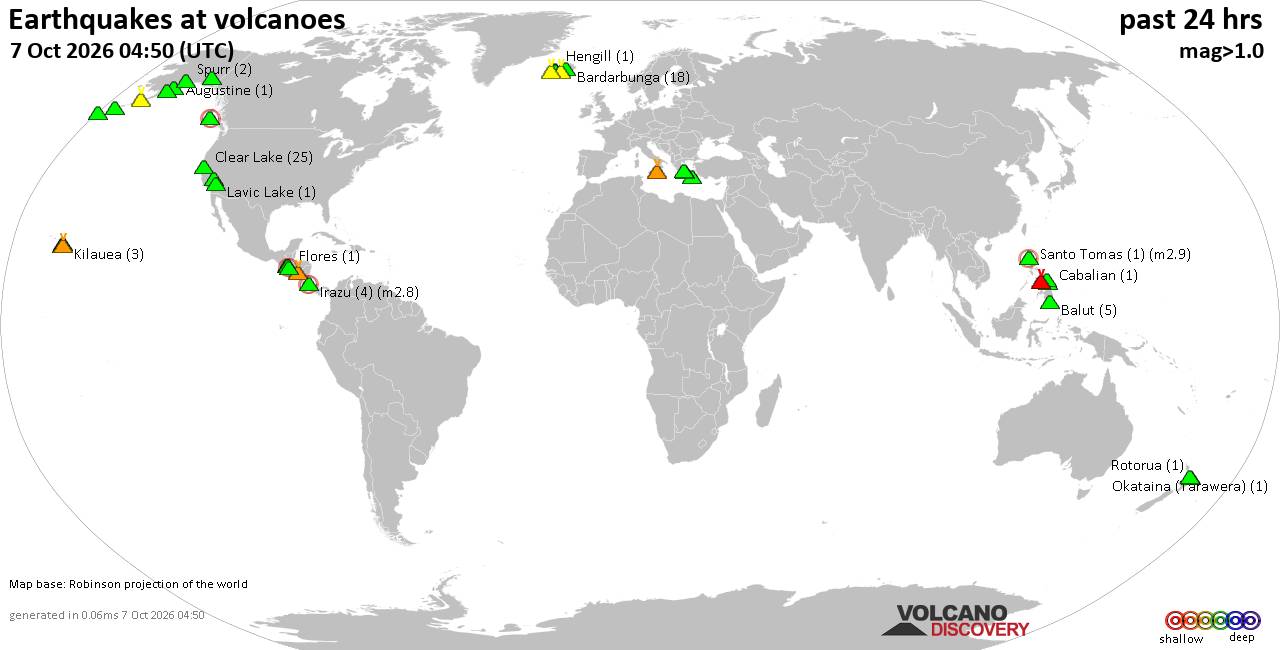
Volcano earthquake report for Wednesday, 7 October 2026
• M 1.7 - 65 km WNW of Ninilchik, Alaska
• M 5.5 - 92 km NNW of Aleneva, Alaska
• Moderate mag. 4.0 earthquake - South Pacific Ocean, 10.2 km east of Manokwa...
• M 2.2 - 11 km SE of Mammoth Lakes, CA
• M 2.8 - 11 km SE of Leilani Estates, Hawaii
|
|
|
Joined: Feb 2001
Posts: 678,977
Launch Director
|
|
Launch Director
Joined: Feb 2001
Posts: 678,977 |
SPC Oct 7, 2026 0600 UTC Day 1 Convective OutlookSPC 1200Z Day 1 Outlook 
Day 1 Convective Outlook
NWS Storm Prediction Center Norman OK
1145 PM CDT Tue Oct 06 2026

Valid 071200Z - 081200Z

...NO SEVERE THUNDERSTORM AREAS FORECAST...

...SUMMARY...
Severe storms are not expected across the U.S. today.

...Synopsis...
A mid-level trough will amplify over the Northeast while broad upper
ridging overspreads much of the western and central CONUS today.
This upper-air pattern will support surface troughing over the
Northeast, and encourage surface high pressure to overspread the
remainder of the U.S. With the upper trough over the northern Great
Lakes/Northeast, and with a subtle impulse over the Four Corners to
the central Plains, a few thunderstorms are possible given colder
temperatures aloft with these aforementioned features. The best
chance for thunderstorms will be along a moistened baroclinic zone
ahead of a weak surface low over central FL.

...Western FL Peninsula Coastline...
Similar to yesterday, a weak surface low will remain in place over
the eastern Gulf, amid a moist low-level airmass, characterized by
70s F surface dewpoints and minimal MLCINH. With afternoon heating,
thunderstorm development should occur. As in previous days, lapse
rates will be poor, with buoyancy driven by the rich low-level
moisture, contributing to thin (500-1000 J/kg) MLCAPE profiles.
Vertical wind shear will also be modest, though low-level veering
may yield some low-level hodograph curvature and associated
transient supercell potential. While waterspout potential will exist
offshore, it is unclear if tornadic waterspout-producing storms will
reach the western FL Peninsula coast, so severe probabilities will
be withheld for now. However, severe probabilities may need to be
added in later outlooks when meso-beta scale details regarding
onshore severe potential become clearer.

..Squitieri/Wendt.. 10/07/2026
Read morehttps://www.spc.noaa.gov/products/outlook/day1otlk_1200.html
|
|



CMS The Best Conveyancing solicitors conveyancing quotes throughout the UK
For any webhosting enquiries please email webmaster@aus-city.com
|
|
Entire Thread
|

 SPC Oct 7, 2026 0600 UTC Day 1 Convective Outlook
|
Webmaster
|
4 hours ago
|
|
Forums60
Topics861,215
Posts896,010
Members2,960
| |
Most Online102,106
Jul 10th, 2026
|
|
|
|
|

|









































