|
|
|
0 members (),
2,956
guests, and
26
robots. |
|
Key:
Admin,
Global Mod,
Mod
|
|
S |
M |
T |
W |
T |
F |
S |
|
|
|
|
|
1
|
2
|
3
|
|
4
|
5
|
6
|
7
|
8
|
9
|
10
|
|
11
|
12
|
13
|
14
|
15
|
16
|
17
|
|
18
|
19
|
20
|
21
|
22
|
23
|
24
|
|
25
|
26
|
27
|
28
|
29
|
30
|
31
|
|
There are no members with birthdays on this day. |
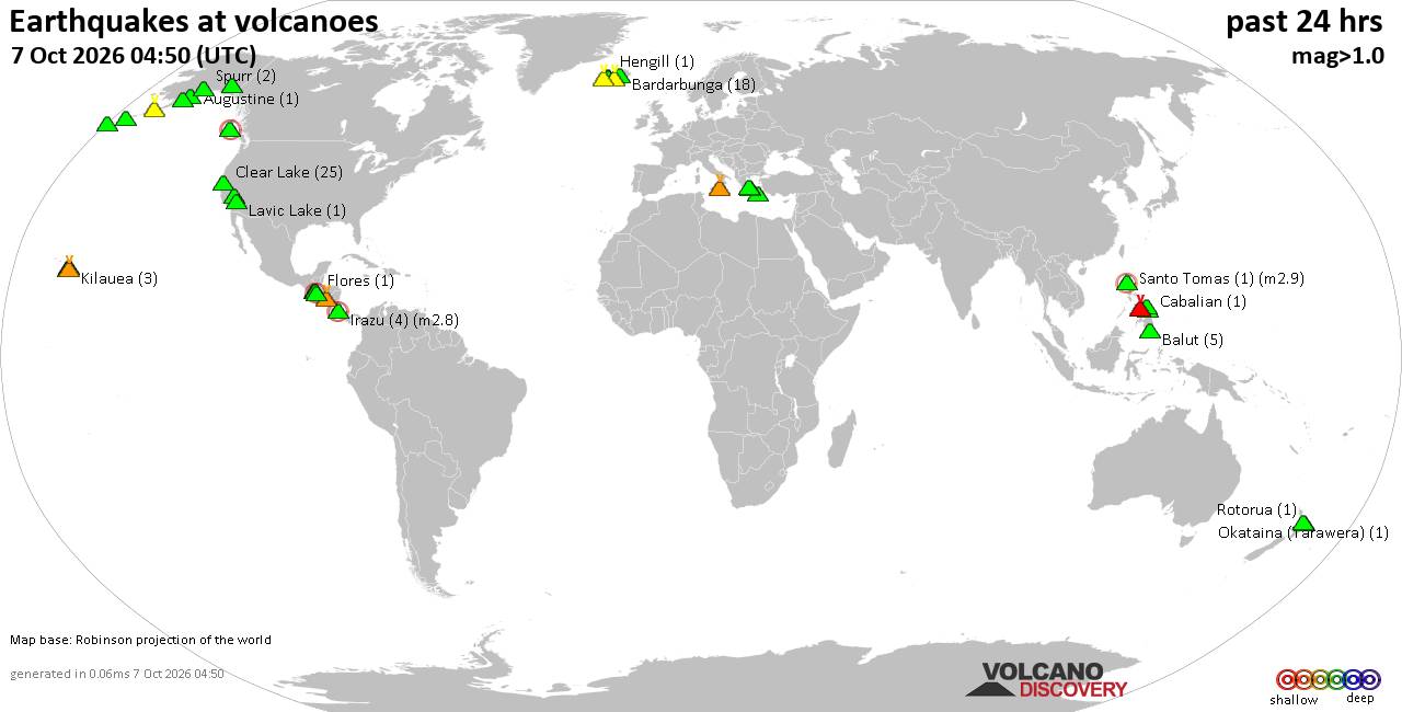
Volcano earthquake report for Wednesday, 7 October 2026
• M 1.7 - 65 km WNW of Ninilchik, Alaska
• M 5.5 - 92 km NNW of Aleneva, Alaska
• Moderate mag. 4.0 earthquake - South Pacific Ocean, 10.2 km east of Manokwa...
• M 2.2 - 11 km SE of Mammoth Lakes, CA
• M 2.8 - 11 km SE of Leilani Estates, Hawaii
|
|
|
Joined: Feb 2001
Posts: 678,977
Launch Director
|
|
Launch Director
Joined: Feb 2001
Posts: 678,977 |
SPC Oct 7, 2026 0600 UTC Day 2 Convective OutlookSPC 0600Z Day 2 Outlook 
Day 2 Convective Outlook
NWS Storm Prediction Center Norman OK
1128 PM CDT Tue Oct 06 2026

Valid 081200Z - 091200Z

...NO SEVERE THUNDERSTORM AREAS FORECAST...

...SUMMARY...
Severe storms are not expected on Thursday.

...Synopsis...
An upper low will move east out of James Bay and into Quebec on
Thursday, with a broad upper trough from the Great Lakes into the
Northeast. A leading midlevel speed max is forecast to move across
southern New England during the day, with cold temperatures aloft to
the north. This may favor isolated low-topped thunderstorms from the
Upper Hudson Valley into Maine as surface heating occurs and a wind
shift/trough sweeps across the region. Very small hail cannot be
ruled out with 500 mb temperatures near -25 C.

To the south, strong low-level easterlies will develop over the
northern Gulf of America as the tropical cyclone strengthens over
the central Gulf, possibly into a hurricane by Thursday evening per
NHC. This flow regime will maintain 70s F dewpoints over FL, with
scattered afternoon thunderstorms possible. Severe storms are not
expected due to weak shear and poor lapse rates.

To the west, cool midlevel temperatures to -12 C will exist over the
Great Basin, with sparse weak thunderstorms over parts of the Four
Corners states during the afternoon.

Elsewhere, a few thunderstorms may occur from eastern NE into IA
late in the day and overnight as southwesterly 850 mb winds increase
to 30 kt, with sufficient elevated instability present in the warm
advection/height rise regime.

..Jewell.. 10/07/2026
Read morehttps://www.spc.noaa.gov/products/outlook/day2otlk_0600.html
|
|



CMS The Best Conveyancing solicitors conveyancing quotes throughout the UK
For any webhosting enquiries please email webmaster@aus-city.com
|
|
Entire Thread
|

 SPC Oct 7, 2026 0600 UTC Day 2 Convective Outlook
|
Webmaster
|
4 hours ago
|
|
Forums60
Topics861,215
Posts896,010
Members2,960
| |
Most Online102,106
Jul 10th, 2026
|
|
|
|
|

|









































