|
|
|
0 members (),
1,345
guests, and
25
robots. |
|
Key:
Admin,
Global Mod,
Mod
|
|
S |
M |
T |
W |
T |
F |
S |
|
|
|
|
|
1
|
2
|
3
|
|
4
|
5
|
6
|
7
|
8
|
9
|
10
|
|
11
|
12
|
13
|
14
|
15
|
16
|
17
|
|
18
|
19
|
20
|
21
|
22
|
23
|
24
|
|
25
|
26
|
27
|
28
|
29
|
30
|
31
|
|
There are no members with birthdays on this day. |
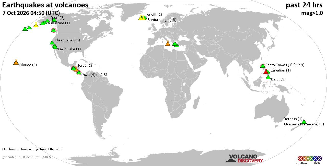
Volcano earthquake report for Wednesday, 7 October 2026
• M 1.2 - 10 km SSW of Idyllwild, CA
• M 1.7 - 10 km W of Boonville, CA
• M 2.4 - 6 km SE of Chickasha, Oklahoma
• M 1.5 - 1 km WNW of Loma Linda, CA
• M 1.5 - 49 km SSE of Tanana, Alaska
• M 1.7 - 8 km ESE of Prunedale, CA
|
|
|
Joined: Feb 2001
Posts: 678,977
Launch Director
|
|
Launch Director
Joined: Feb 2001
Posts: 678,977 |
SPC Oct 7, 2026 0730 UTC Day 3 Severe Thunderstorm OutlookSPC 0730Z Day 3 Outlook 
Day 3 Convective Outlook
NWS Storm Prediction Center Norman OK
0234 AM CDT Wed Oct 07 2026

Valid 091200Z - 101200Z

...THERE IS A MARGINAL RISK OF SEVERE THUNDERSTORMS ALONG THE
NORTH-CENTRAL GULF COAST...

...SUMMARY...
An increasing tornado risk may develop into early Saturday morning
along the north-central Gulf Coast in association with the
developing tropical cyclone.

...Discussion...
Severe storm chances will be low across most of the CONUS on Friday,
the exception being over the northern Gulf Coast late Friday night
into Saturday morning.

NHC currently forecasts Tropical Depression 9 to become a hurricane
late Thursday, strengthening further into Friday over the Gulf of
America. Some uncertainty exists as to the timing of an eventual
forward acceleration northward. In any case, the system is forecast
to affect the northern Gulf Coast late in the Day 3 period (which
ends at 12Z Saturday morning), and as such, low probabilities for
tornado risk have been added.

Low-level shear/SRH will be very strong east of the storm center.
The surface air mass may remain stable over the mainland until very
close to 12Z Saturday, with a greater chance of larger SBCAPE over
extreme southeast LA prior to 12Z. Once the coastal boundary moves
inland, a surge of mid 70s F dewpoints and southerly winds will lead
to overly enlarged hodographs, supporting rotation in the stronger
cells with tornado potential.

..Jewell.. 10/07/2026
Read morehttps://www.spc.noaa.gov/products/outlook/day3otlk_0730.html
|
|



CMS The Best Conveyancing solicitors conveyancing quotes throughout the UK
For any webhosting enquiries please email webmaster@aus-city.com
|
|
Entire Thread
|

 SPC Oct 7, 2026 0730 UTC Day 3 Severe Thunderstorm Outlook
|
Webmaster
|
15 hours ago
|
|
Forums60
Topics862,367
Posts897,162
Members2,960
| |
Most Online102,106
Jul 10th, 2026
|
|
|
|
|

|









































