|
|
|
0 members (),
1,392
guests, and
26
robots. |
|
Key:
Admin,
Global Mod,
Mod
|
|
S |
M |
T |
W |
T |
F |
S |
|
|
|
|
|
1
|
2
|
3
|
|
4
|
5
|
6
|
7
|
8
|
9
|
10
|
|
11
|
12
|
13
|
14
|
15
|
16
|
17
|
|
18
|
19
|
20
|
21
|
22
|
23
|
24
|
|
25
|
26
|
27
|
28
|
29
|
30
|
31
|
|
There are no members with birthdays on this day. |
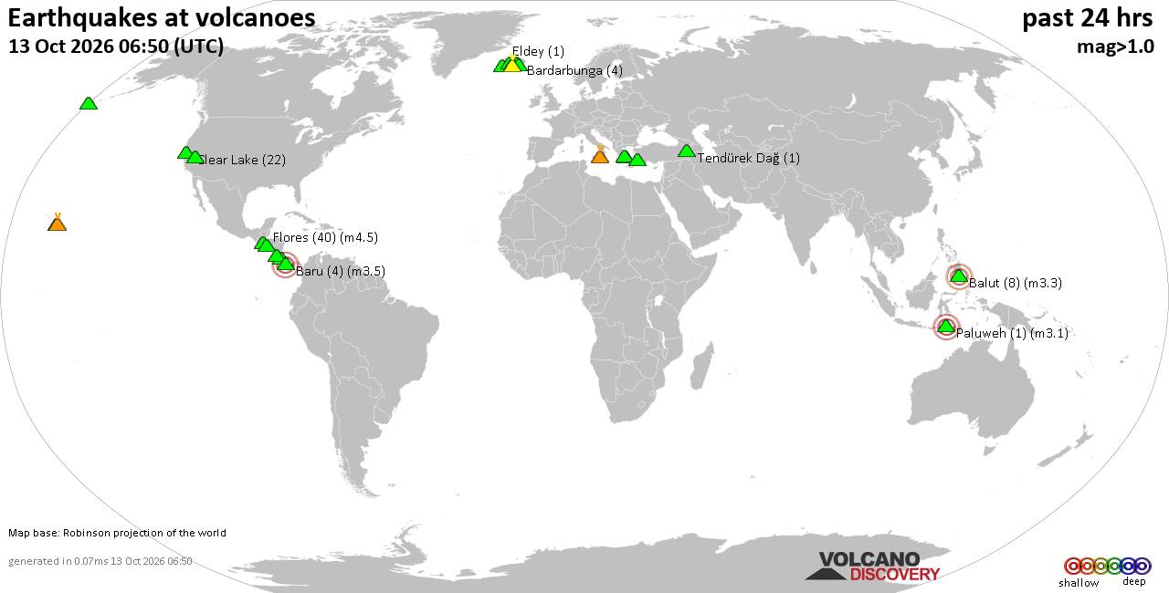
Volcano earthquake report for Tuesday, 13 October 2026
• M 2.7 - 19 km SSW of Leilani Estates, Hawaii
• M 2.5 - 5 km SSW of Pāhala, Hawaii
• M 1.9 - 15 km NE of Milford, Utah
• M 1.8 - 116 km E of Cordova, Alaska
• M 1.2 - 15 km NE of Little Lake, CA
• M 2.0 - 82 km ESE of Ugashik, Alaska
|

#899990
Thu 08 Oct 2026 08:24:AM
|
Joined: Feb 2001
Posts: 678,977
Launch Director
|
|
Launch Director
Joined: Feb 2001
Posts: 678,977 |
SPC Oct 8, 2026 Day 4-8 Severe Weather OutlookDay 4-8 Outlook 
Day 4-8 Convective Outlook
NWS Storm Prediction Center Norman OK
0321 AM CDT Thu Oct 08 2026

Valid 111200Z - 161200Z

...DISCUSSION...
On Sun/D4, a shortwave trough and surface low (previously associated
with the tropical cyclone) will move east across the TN/OH Valleys,
and toward the Mid Atlantic Sunday night. A warm front and northward
surge of moisture will occur from GA/Carolinas into VA/DelMarVa,
resulting in at least a few hundred J/kg MLCAPE. Substantial rain
and thunderstorms are likely to exist over the region, and therefore
boundary layer warming/destabilization is in question. Most models
show little if any daytime heating. As such, predictability is low
at this time, but at least low severe probabilities could be added
in later outlooks as the scenario evolves.

To the west, a shortwave trough with tropical remnants will affect
southern CA and AZ, with strong southwest winds aloft. Substantial
model differences exist regarding destabilization due to increasing
clouds and rain, though some severe wind and even hail potential
cannot be ruled out where instability is locally higher. This area
too may see at least low severe probabilities in later outlooks as
predictability increases.

For the remainder of the period through Thu/D8, a potential western
trough ejection may occur into the Plains, with the strongest
instability on or after Wed/D7 as moisture return becomes more
established with upper 60s F dewpoints possible from TX into OK and
KS. As such, this area will also be monitored as the event nears,
and as trough timing becomes more predictable.
Read morehttps://www.spc.noaa.gov/products/exper/day4-8/
|
|



CMS The Best Conveyancing solicitors conveyancing quotes throughout the UK
For any webhosting enquiries please email webmaster@aus-city.com
|
|
Entire Thread
|
 SPC Oct 8, 2026 Day 4-8 Severe Weather Outlook
|
Webmaster
|
Thu 08 Oct 2026 08:24:AM
|
|
Forums60
Topics873,200
Posts907,996
Members2,960
| |
Most Online102,106
Jul 10th, 2026
|
|
|
|
|

|









































