|
|
|
0 members (),
1,392
guests, and
26
robots. |
|
Key:
Admin,
Global Mod,
Mod
|
|
S |
M |
T |
W |
T |
F |
S |
|
|
|
|
|
1
|
2
|
3
|
|
4
|
5
|
6
|
7
|
8
|
9
|
10
|
|
11
|
12
|
13
|
14
|
15
|
16
|
17
|
|
18
|
19
|
20
|
21
|
22
|
23
|
24
|
|
25
|
26
|
27
|
28
|
29
|
30
|
31
|
|
There are no members with birthdays on this day. |
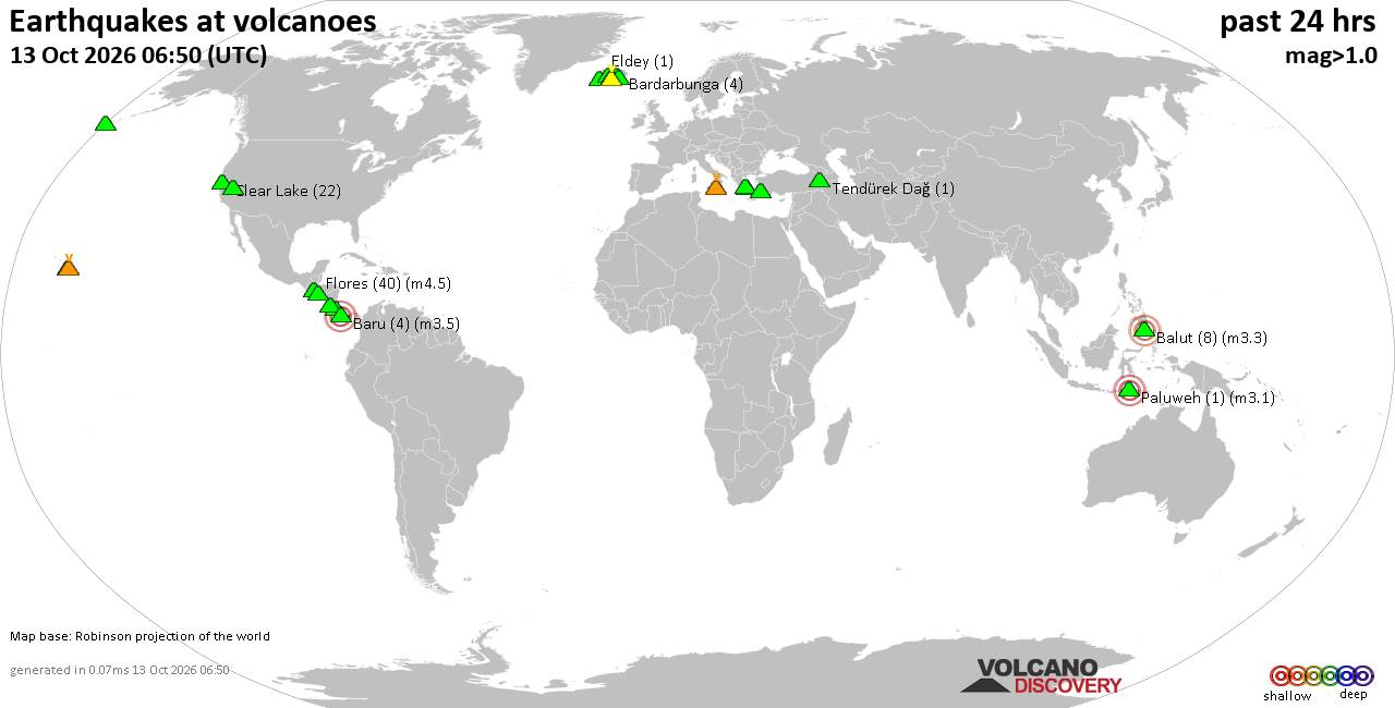
Volcano earthquake report for Tuesday, 13 October 2026
• M 2.7 - 19 km SSW of Leilani Estates, Hawaii
• M 2.5 - 5 km SSW of Pāhala, Hawaii
• M 1.9 - 15 km NE of Milford, Utah
• M 1.8 - 116 km E of Cordova, Alaska
• M 1.2 - 15 km NE of Little Lake, CA
• M 2.0 - 82 km ESE of Ugashik, Alaska
|

#906108
Sun 11 Oct 2026 05:06:PM
|
Joined: Feb 2001
Posts: 678,977
Launch Director
|
|
Launch Director
Joined: Feb 2001
Posts: 678,977 |
SPC Oct 11, 2026 1730 UTC Day 2 Convective OutlookSPC 1730Z Day 2 Outlook 
Day 2 Convective Outlook
NWS Storm Prediction Center Norman OK
1203 PM CDT Sun Oct 11 2026

Valid 121200Z - 131200Z

...NO SEVERE THUNDERSTORM AREAS FORECAST...

...SUMMARY...
No severe weather is expected Monday through Monday night.

...Upper Midwest/Great Lakes...

An upper shortwave trough will develop northeast from the central
High Plains to the Great Lakes on Monday. This will bring a belt of
mildly enhanced westerly mid/upper flow across the region, with an
increasing southwesterly low-level jet expected by Monday evening
from the Mid-MS Valley into MI. At the surface, low pressure will
shift east across MN/WI/MI, with a trailing cold front surging
east/southeast across the central Plains and Upper Midwest. A warm
front will be oriented west to east across northern WI to northern
Lower MI. Elevated thunderstorms may develop by 00z near and north
of this boundary on the edge of the increasing low-level jet and
stronger warm advection ahead of the surface low/cold front. Cooling
aloft will result in a plume of steep midlevel lapse rates
supporting modest elevated instability. Small hail may occur with
stronger updrafts within the modestly sheared environment across
northern WI/the U.P. of MI and portions of northern Lower MI during
the evening and overnight hours. Overall severe potential is
expected to remain limited by modest instability and capping across
the warm sector, precluding severe probabilities.

...Southwest/Great Basin...

Lingering moisture across the Southwest and Great Basin will support
scattered showers and thunderstorms within enhanced deep-layer
southwesterly flow ahead of an approaching upper low and attendant
trough. Meager destabilization will limit severe potential, though
some gusty winds are possible given stronger synoptic flow.

...Southern High Plains...

A few thunderstorms will be possible along a surface trough/dryline
across western TX/eastern NM as low-level moisture returns north and
west across the southern Plains. Modest vertical shear and weak
instability should limit severe potential, though some locally gusty
outflow winds are possible given steepened low-level lapse rates due
to daytime heating into the upper 80s/low 90s.

..Leitman.. 10/11/2026
Read morehttps://www.spc.noaa.gov/products/outlook/day2otlk_1730.html
|
|



CMS The Best Conveyancing solicitors conveyancing quotes throughout the UK
For any webhosting enquiries please email webmaster@aus-city.com
|
|
Entire Thread
|
 SPC Oct 11, 2026 1730 UTC Day 2 Convective Outlook
|
Webmaster
|
Sun 11 Oct 2026 05:06:PM
|
|
Forums60
Topics873,200
Posts907,996
Members2,960
| |
Most Online102,106
Jul 10th, 2026
|
|
|
|
|

|









































