|
0 members (),
1,346
guests, and
23
robots. |
|
Key:
Admin,
Global Mod,
Mod
|
|
S |
M |
T |
W |
T |
F |
S |
|
|
|
|
|
1
|
2
|
3
|
|
4
|
5
|
6
|
7
|
8
|
9
|
10
|
|
11
|
12
|
13
|
14
|
15
|
16
|
17
|
|
18
|
19
|
20
|
21
|
22
|
23
|
24
|
|
25
|
26
|
27
|
28
|
29
|
30
|
31
|
|
There are no members with birthdays on this day. |
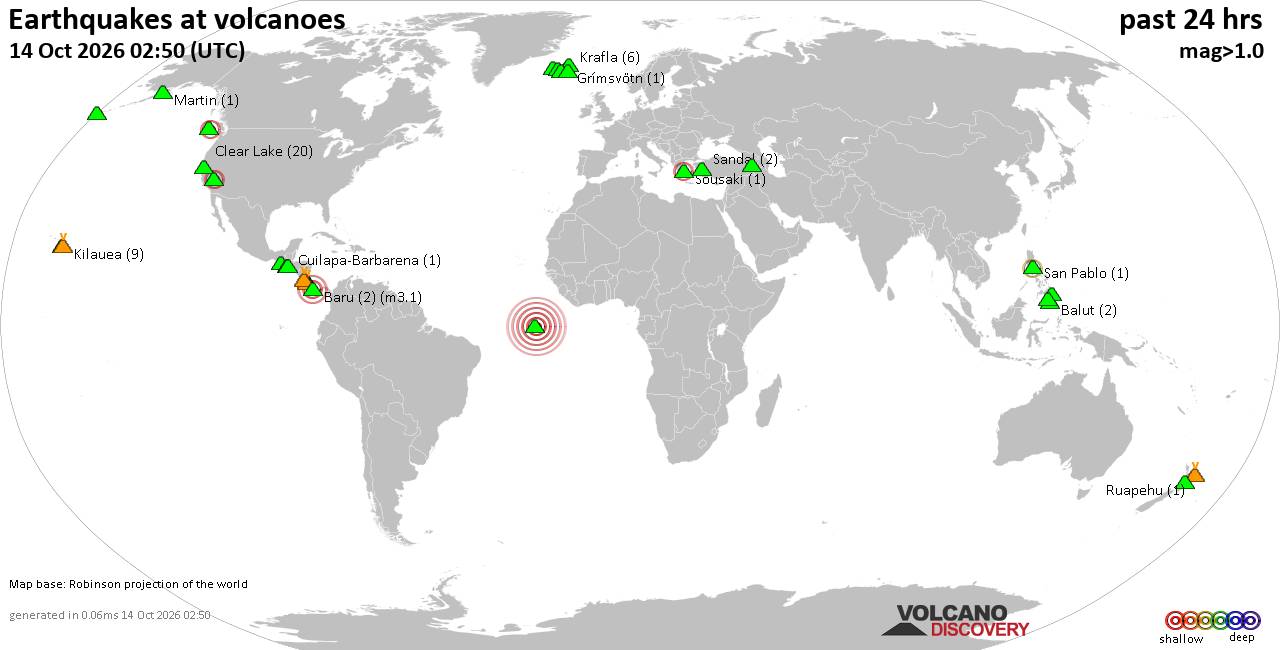
Volcano earthquake report for Wednesday, 14 October 2026
• M 4.2 - 112 km SW of Brisas Barra de Suchiate, Mexico
• M 1.7 - 1 km SSW of Redlands, CA
• M 1.5 - 3 km S of Encino, CA
• M 4.9 - 121 km S of Kokopo, Papua New Guinea
• M 3.2 - south of the Aleutian Islands
|
|
|
Joined: Feb 2001
Posts: 678,977
Launch Director
|
|
Launch Director
Joined: Feb 2001
Posts: 678,977 |
SPC Oct 14, 2026 0600 UTC Day 2 Convective OutlookSPC 0600Z Day 2 Outlook 
Day 2 Convective Outlook
NWS Storm Prediction Center Norman OK
1221 AM CDT Wed Oct 14 2026

Valid 151200Z - 161200Z

...THERE IS A MARGINAL RISK OF SEVERE THUNDERSTORMS OVER PORTIONS OF
THE MID-MISSISSIPPI AND OHIO VALLEYS...

...SUMMARY...
Isolated severe storms capable of damaging wind gusts and perhaps a
brief tornado or two are possible over portions of the
mid-Mississippi and Ohio Valleys Thursday afternoon and evening.

...Synopsis...

A short-wave trough over central Canada Thursday morning is forecast
to undergo considerable amplification while translating into the
Great Lakes late Thursday night/early Friday. Ahead of that feature,
an upper low will weaken into an increasingly sheared open wave
while accelerating from the central High Plains into the Midwest.
That pattern evolution will yield a steadily strengthening
deep-layer wind field over the mid-MS and OH Valleys through the
forecast period. At the surface, an area of low pressure is expected
to develop along a warm front from central or eastern KS through the
mid-MS and OH Valleys to the lower Great Lakes. Meanwhile, a
trailing cold front will surge south through much of the southern
Plains, Ozark Plateau, and mid-MS Valley.


...Mid-Mississippi and Ohio Valleys...

Scattered to numerous thunderstorms are expected to be ongoing
Thursday morning from the central Plains into the mid-MS Valley
ahead of the surface low and within a zone of low-level warm
advection and the possible influence of a lead disturbance moving
through the region. A subset of the morning storms is likely to
continue through the remainder of the day with convective outflow
and clouds limiting air mass destabilization in those areas.

A relatively narrow plume of upper 60s to low 70s F dewpoints will
be advected into the northern extension of the system warm sector,
contributing to MLCAPE up to 500-1000 J/kg by mid to late afternoon
in areas peripheral to active convection. A subsequent increase in
surface-based storm coverage and intensity is expected at that time
from east-central MO into central and southern IL. The presence of
40-50+ kt of deep-layer shear will be supportive of transient
supercell and bowing structures capable of isolated damaging wind
gusts and perhaps a brief tornado or two through the evening.

The duration and eastward extent of the damaging wind threat remain
in question Thursday night in the mid to upper-OH Valley. Model
soundings indicate a shallow, near-ground inversion developing
within the warm sector as the surface low outpaces better low-level
moisture return. However, widely spaced damaging wind gusts may
still remain possible given the presence of 40-50 kt winds within
the lowest km above ground.


...Southern Plains/Ozark Plateau...

A few strong storms capable of gusty winds and/or small hail appear
possible Thursday afternoon and evening along the cold front
progressing through the region. Poor midlevel lapse rates, weak
low-level winds, and deep-layer shear vectors oriented parallel to
the progressive/undercutting front are likely to lead to
outflow-dominant, disorganized convective modes, limiting severe
weather potential.

..Mead.. 10/14/2026
Read morehttps://www.spc.noaa.gov/products/outlook/day2otlk_0600.html
|
|



CMS The Best Conveyancing solicitors conveyancing quotes throughout the UK
For any webhosting enquiries please email webmaster@aus-city.com
|
|
Entire Thread
|

 SPC Oct 14, 2026 0600 UTC Day 2 Convective Outlook
|
Webmaster
|
3 hours ago
|
|
Forums60
Topics874,262
Posts909,058
Members2,960
| |
Most Online102,106
Jul 10th, 2026
|
|
|









































