|
|
|
0 members (),
1,554
guests, and
24
robots. |
|
Key:
Admin,
Global Mod,
Mod
|
|
S |
M |
T |
W |
T |
F |
S |
|
|
|
|
|
1
|
2
|
3
|
|
4
|
5
|
6
|
7
|
8
|
9
|
10
|
|
11
|
12
|
13
|
14
|
15
|
16
|
17
|
|
18
|
19
|
20
|
21
|
22
|
23
|
24
|
|
25
|
26
|
27
|
28
|
29
|
30
|
31
|
|
There are no members with birthdays on this day. |
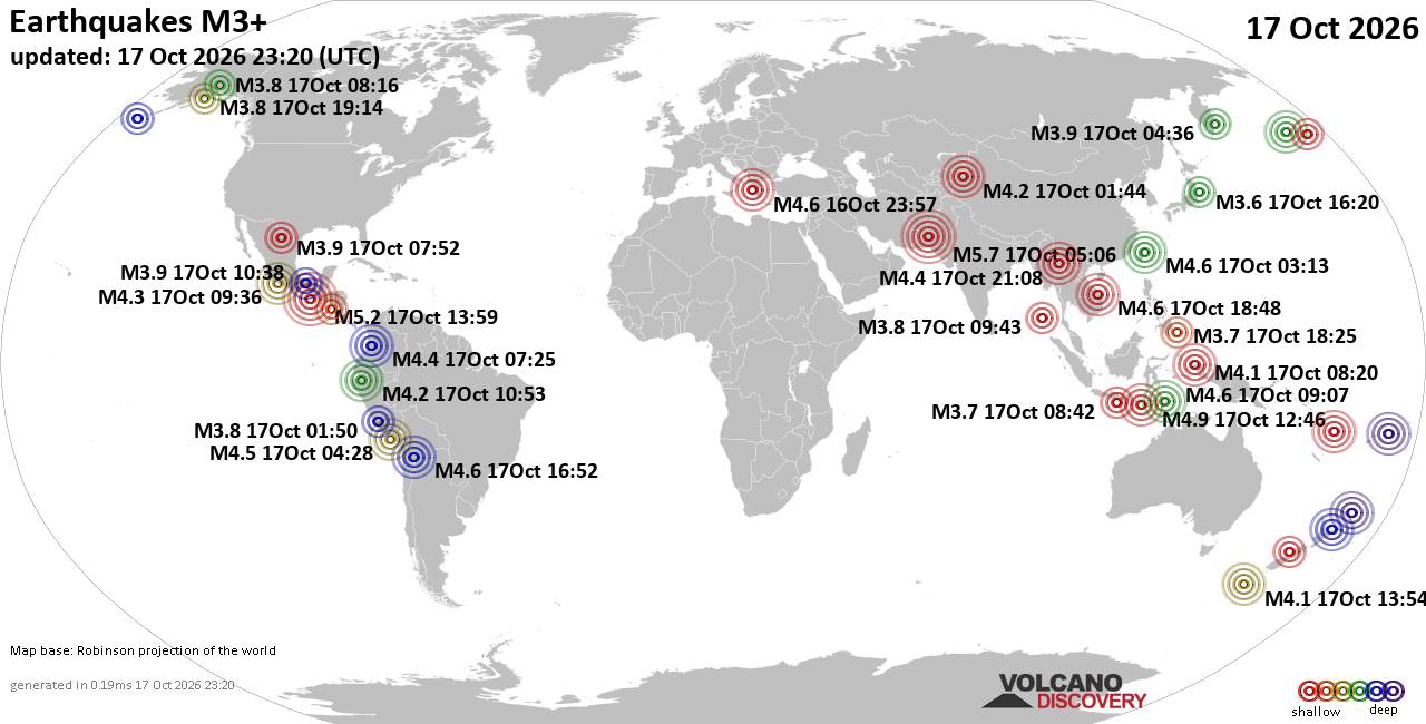
World Earthquake Report for Saturday, 17 October 2026
• Moderate mag. 4.5 earthquake - South Pacific Ocean, New Zealand, on Saturda...
• M 1.8 - 12 km NE of Pāhala, Hawaii
• M 3.0 - 25 km SSW of Mina, Nevada
• Volcano earthquake report for Saturday, 17 October 2026
• M 2.1 - 5 km NNE of Honaunau-Napoopoo, Hawaii
|
|
|
Joined: Feb 2001
Posts: 678,977
Launch Director
|
|
Launch Director
Joined: Feb 2001
Posts: 678,977 |
SPC Oct 17, 2026 2000 UTC Day 1 Convective OutlookSPC 2000Z Day 1 Outlook 
Day 1 Convective Outlook
NWS Storm Prediction Center Norman OK
0241 PM CDT Sat Oct 17 2026

Valid 172000Z - 181200Z

...NO SEVERE THUNDERSTORM AREAS FORECAST...

...SUMMARY...
Severe thunderstorms are not expected through tonight.

...Synopsis...
No substantial changes to the outlook.  The thunder area has been
trimmed southward in central FL to match movement of a cold front.
To the west, isolated lightning flashes will be possible through
tonight within the midlevel moisture plume to the east of the weak
closed low just off the northern Baja coast.  The northern extent of
any lightning threat is a bit uncertain given marginal buoyancy
depth/magnitude, but will maintain previous outlook area.

..Thompson.. 10/17/2026

.PREV DISCUSSION... /ISSUED 1114 AM CDT Sat Oct 17 2026/

...Synopsis...
Water-vapor imagery late this morning shows a positive-tilt upper
trough over the East and a closed low near the California/Baja
California border.  An extensive area of tranquil conditions
influenced by surface high pressure will prevail across much of the
contiguous U.S.  Widely scattered diurnal thunderstorms are possible
across the southern half of the FL Peninsula primarily through
sunset before much of the convective activity is relegated to the FL
Straits and offshore waters tonight.  Weak thunderstorms are
possible tonight in association with the upper low over southern AZ.
Read morehttps://www.spc.noaa.gov/products/outlook/day1otlk_2000.html
|
|



CMS The Best Conveyancing solicitors conveyancing quotes throughout the UK
For any webhosting enquiries please email webmaster@aus-city.com
|
|
Entire Thread
|

 SPC Oct 17, 2026 2000 UTC Day 1 Convective Outlook
|
Webmaster
|
4 hours ago
|
|
Forums60
Topics880,602
Posts915,399
Members2,960
| |
Most Online102,106
Jul 10th, 2026
|
|
|
|
|

|









































