|
|
|
0 members (),
1,731
guests, and
26
robots. |
|
Key:
Admin,
Global Mod,
Mod
|
|
S |
M |
T |
W |
T |
F |
S |
|
|
|
|
|
1
|
2
|
3
|
|
4
|
5
|
6
|
7
|
8
|
9
|
10
|
|
11
|
12
|
13
|
14
|
15
|
16
|
17
|
|
18
|
19
|
20
|
21
|
22
|
23
|
24
|
|
25
|
26
|
27
|
28
|
29
|
30
|
31
|
|
There are no members with birthdays on this day. |
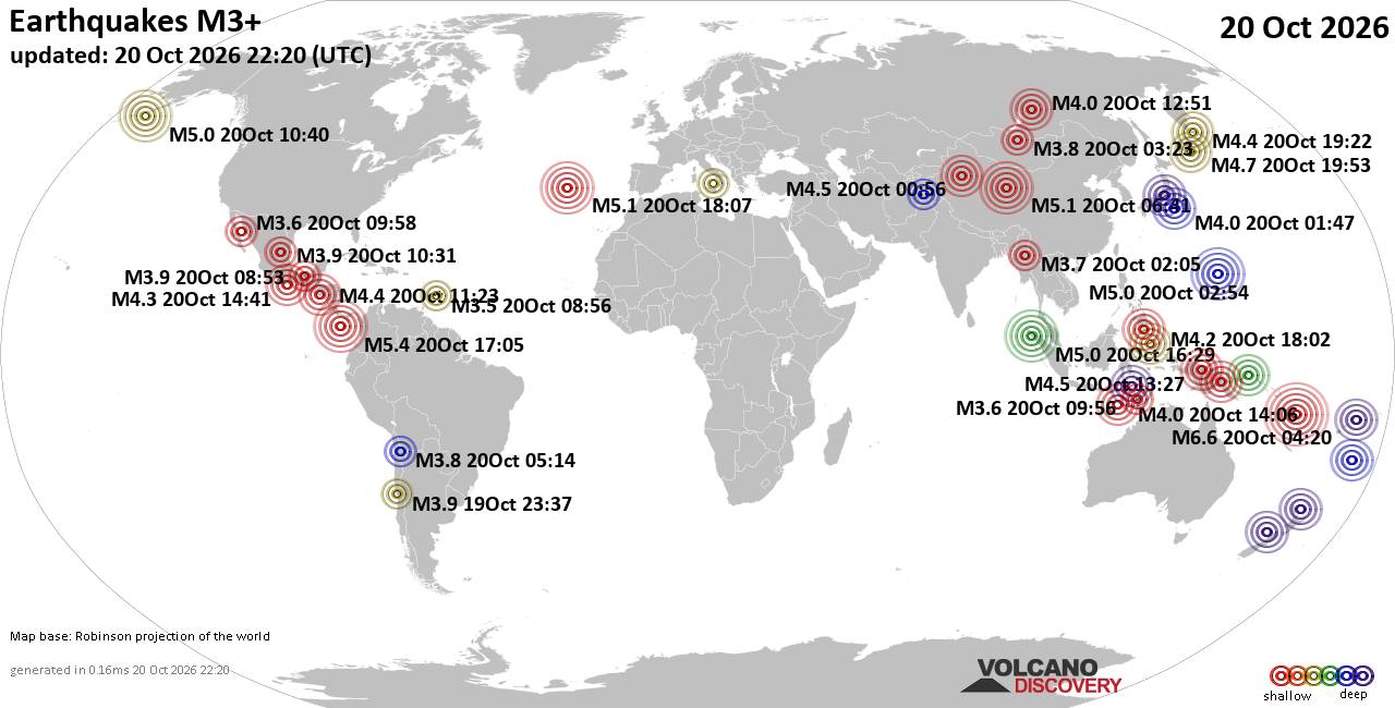
World Earthquake Report for Tuesday, 20 October 2026
• M 2.1 - 5 km SSW of Pāhala, Hawaii
• M 1.5 - 15 km NNE of Milford, Utah
• M 0.9 - 6 km WNW of Cobb, CA
• M 4.4 - 52 km S of Champerico, Guatemala
• M 1.9 - 8 km N of Redwood Valley, CA
|
|
|
Joined: Feb 2001
Posts: 678,977
Launch Director
|
|
Launch Director
Joined: Feb 2001
Posts: 678,977 |
SPC Oct 20, 2026 1930 UTC Day 3 Severe Thunderstorm OutlookSPC 1930Z Day 3 Outlook 
Day 3 Convective Outlook
NWS Storm Prediction Center Norman OK
0225 PM CDT Tue Oct 20 2026

Valid 221200Z - 231200Z

...THERE IS A SLIGHT RISK OF SEVERE THUNDERSTORMS ACROSS PARTS OF
ARIZONA...

...SUMMARY...
At least isolated severe thunderstorms are expected across the
Southwest and Four Corners area on Thursday, with the greatest risk
across parts of Arizona.

...Arizona and Desert Southwest/Great Basin...
A prominent/deep low-latitude upper trough off the coast of
California will become more northeastward-progressive on Thursday as
it moves inland toward the Lower Colorado River Valley. While some
weakening of the deep-layer wind field may occur over time, wind
profiles will nonetheless remain rather supportive of organized
storm modes, potentially including some supercells and sustained
multicells capable of hail and possibly some tornado risk, which may
primarily focus the first part of the day. These wind profiles with
long/semi-straight hodographs will support at least some severe
potential even if instability is a bit muted by early day cloud
cover and precipitation. It currently appears that parts of central
into eastern Arizona will have the most-favorable severe-weather
ingredients on Thursday, and the longest relative duration thereof,
hence a categorical Slight Risk upgrade.

..Guyer.. 10/20/2026
Read morehttps://www.spc.noaa.gov/products/outlook/day3otlk_1930.html
|
|



CMS The Best Conveyancing solicitors conveyancing quotes throughout the UK
For any webhosting enquiries please email webmaster@aus-city.com
|
|
Entire Thread
|

 SPC Oct 20, 2026 1930 UTC Day 3 Severe Thunderstorm Outlook |
Webmaster
|
4 hours ago
|
|
Forums60
Topics885,562
Posts920,359
Members2,960
| |
Most Online102,106
Jul 10th, 2026
|
|
|
|
|

|









































