|
|
|
0 members (),
1,731
guests, and
26
robots. |
|
Key:
Admin,
Global Mod,
Mod
|
|
S |
M |
T |
W |
T |
F |
S |
|
|
|
|
|
1
|
2
|
3
|
|
4
|
5
|
6
|
7
|
8
|
9
|
10
|
|
11
|
12
|
13
|
14
|
15
|
16
|
17
|
|
18
|
19
|
20
|
21
|
22
|
23
|
24
|
|
25
|
26
|
27
|
28
|
29
|
30
|
31
|
|
There are no members with birthdays on this day. |
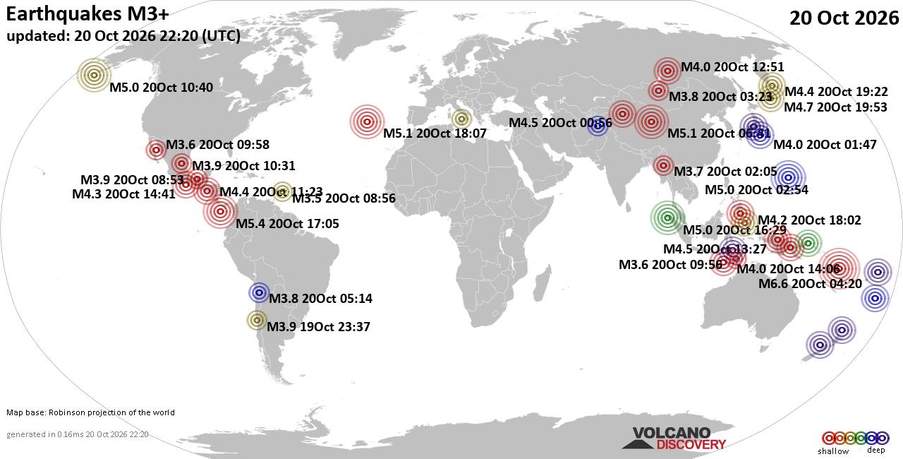
World Earthquake Report for Tuesday, 20 October 2026
• M 2.1 - 5 km SSW of Pāhala, Hawaii
• M 1.5 - 15 km NNE of Milford, Utah
• M 0.9 - 6 km WNW of Cobb, CA
• M 4.4 - 52 km S of Champerico, Guatemala
• M 1.9 - 8 km N of Redwood Valley, CA
|
|
|
Joined: Feb 2001
Posts: 678,977
Launch Director
|
|
Launch Director
Joined: Feb 2001
Posts: 678,977 |
SPC Day 2 Fire Weather OutlookSPC Day 2 Fire Weather Outlook 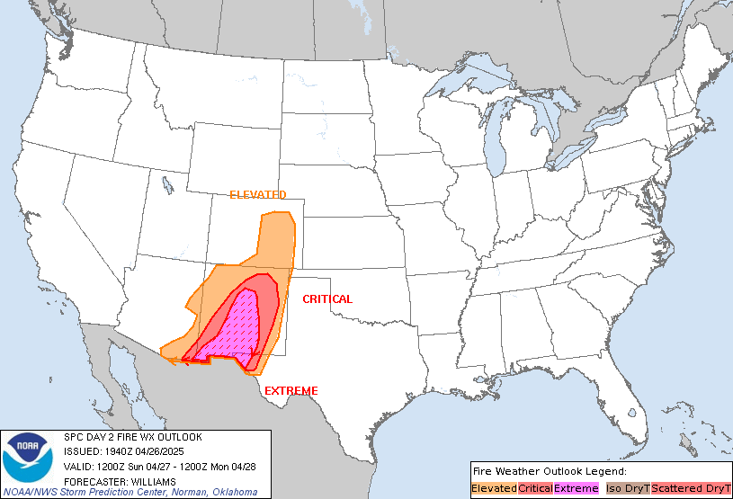
Day 2 Fire Weather Outlook
NWS Storm Prediction Center Norman OK
0133 PM CDT Tue Oct 20 2026

Valid 211200Z - 221200Z

...NO CRITICAL AREAS...

The forecast remains on track with no changes necessary.

..Stearns.. 10/20/2026

.PREV DISCUSSION... /ISSUED 1256 AM CDT Tue Oct 20 2026/

...Synopsis...
Fire weather concerns will remain low across CONUS D2/Wednesday.
An upper-level low will move onshore into the CA Central Coast
Wednesday and Wednesday night ushering in expanding cloud cover and
precipitation into CA, the Great Basin and the Four Corners region.
Stagnant surface high pressure across the eastern U.S. in addition
to an amplifying ridge aloft over the Great Plains will bring
continued dry conditions to the Deep South. Receptive fuels will
persist across the lower MS River Valley while further drying of the
fuelscape occurs portions of the Southeast. However, surface winds
are expected to be rather light at 10 mph or less which should
reduce the overall fire weather threat.

...Please see www.spc.noaa.gov/fire for graphic product...
Read morehttps://www.spc.noaa.gov/products/fire_wx/fwdy2.html
|
|



CMS The Best Conveyancing solicitors conveyancing quotes throughout the UK
For any webhosting enquiries please email webmaster@aus-city.com
|
|
Entire Thread
|

 SPC Day 2 Fire Weather Outlook |
Webmaster
|
5 hours ago
|
|
Forums60
Topics885,562
Posts920,359
Members2,960
| |
Most Online102,106
Jul 10th, 2026
|
|
|
|
|

|









































