|
|
|
0 members (),
1,152
guests, and
23
robots. |
|
Key:
Admin,
Global Mod,
Mod
|
|
S |
M |
T |
W |
T |
F |
S |
|
|
|
|
|
1
|
2
|
3
|
|
4
|
5
|
6
|
7
|
8
|
9
|
10
|
|
11
|
12
|
13
|
14
|
15
|
16
|
17
|
|
18
|
19
|
20
|
21
|
22
|
23
|
24
|
|
25
|
26
|
27
|
28
|
29
|
30
|
31
|
|
There are no members with birthdays on this day. |
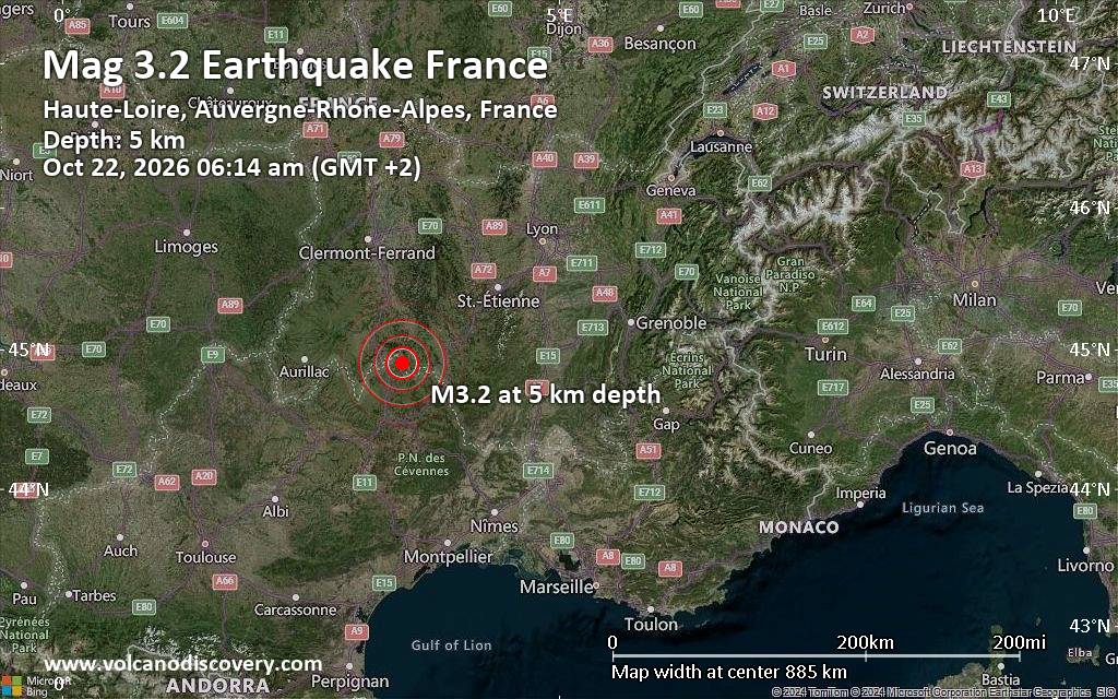
Small magnitude 3.2 earthquake hits near Le Puy-en-Velay, Haute-Loire, Auvergne-Rhone-Alpes, France
• M 4.2 - Fiji region
• M 3.2 - 23 km WSW of Gustine, CA
• M 4.9 - 68 km NNW of Khorixas, Namibia
• M 3.0 - 23 km NE of Hydesville, CA
• M 3.2 - 23 km WSW of Gustine, CA
• M 3.3 - 14 km SE of Petrolia, CA
|
|
|
Joined: Feb 2001
Posts: 678,977
Launch Director
|
|
Launch Director
Joined: Feb 2001
Posts: 678,977 |
SPC Oct 22, 2026 0600 UTC Day 2 Convective OutlookSPC 0600Z Day 2 Outlook 
Day 2 Convective Outlook
NWS Storm Prediction Center Norman OK
0100 AM CDT Thu Oct 22 2026

Valid 231200Z - 241200Z

...THERE IS A MARGINAL RISK OF SEVERE THUNDERSTORMS PORTIONS OF NEW
MEXICO...

...SUMMARY...
Isolated severe thunderstorms are possible across portions of New
Mexico on Friday.

...Synopsis...
A broad upper trough will slowly progress over the Rockies on
Friday, with a lead mid-level impulse poised to eject into the
northern Plains while a lagging 500 mb cut-off low drifts eastward
across the Desert Southwest. Given adequate low-level moisture
return and deep-layer ascent ahead of the longwave mid-level trough,
thunderstorms will be possible across much of the Rockies and the
central to northern Plains. Isolated severe thunderstorms are
possible across portions of NM, where locally greater moisture and
instability reside.

...Western into central New Mexico...
As the aforementioned leading mid-level impulse departs the Rockies
and the cut-off low approaches NM, 50+ kt southwesterly 500 mb flow
will overspread the Desert Southwest, where low to mid 50s F surface
dewpoints amid southeasterly surface flow will be in place. Given
7-7.5 C/km mid-level lapse rates, up to 1000 J/kg MLCAPE may
manifest amid appreciably curved and elongated hodographs, with
30-40 kts of effective bulk shear likely. By afternoon,
thunderstorms should develop and intensify with diurnal heating.
Given the aforementioned vertical shear/buoyancy, some supercell
structures should develop, accompanied by an isolated severe
wind/hail threat, and a tornado is also possible.

..Squitieri.. 10/22/2026
Read morehttps://www.spc.noaa.gov/products/outlook/day2otlk_0600.html
|
|



CMS The Best Conveyancing solicitors conveyancing quotes throughout the UK
For any webhosting enquiries please email webmaster@aus-city.com
|
|
Entire Thread
|

 SPC Oct 22, 2026 0600 UTC Day 2 Convective Outlook |
Webmaster
|
2 hours ago
|
|
Forums60
Topics887,974
Posts922,771
Members2,960
| |
Most Online102,106
Jul 10th, 2026
|
|
|
|
|

|









































