|
|
|
0 members (),
1,411
guests, and
25
robots. |
|
Key:
Admin,
Global Mod,
Mod
|
|
S |
M |
T |
W |
T |
F |
S |
|
|
|
|
|
1
|
2
|
3
|
|
4
|
5
|
6
|
7
|
8
|
9
|
10
|
|
11
|
12
|
13
|
14
|
15
|
16
|
17
|
|
18
|
19
|
20
|
21
|
22
|
23
|
24
|
|
25
|
26
|
27
|
28
|
29
|
30
|
31
|
|
There are no members with birthdays on this day. |
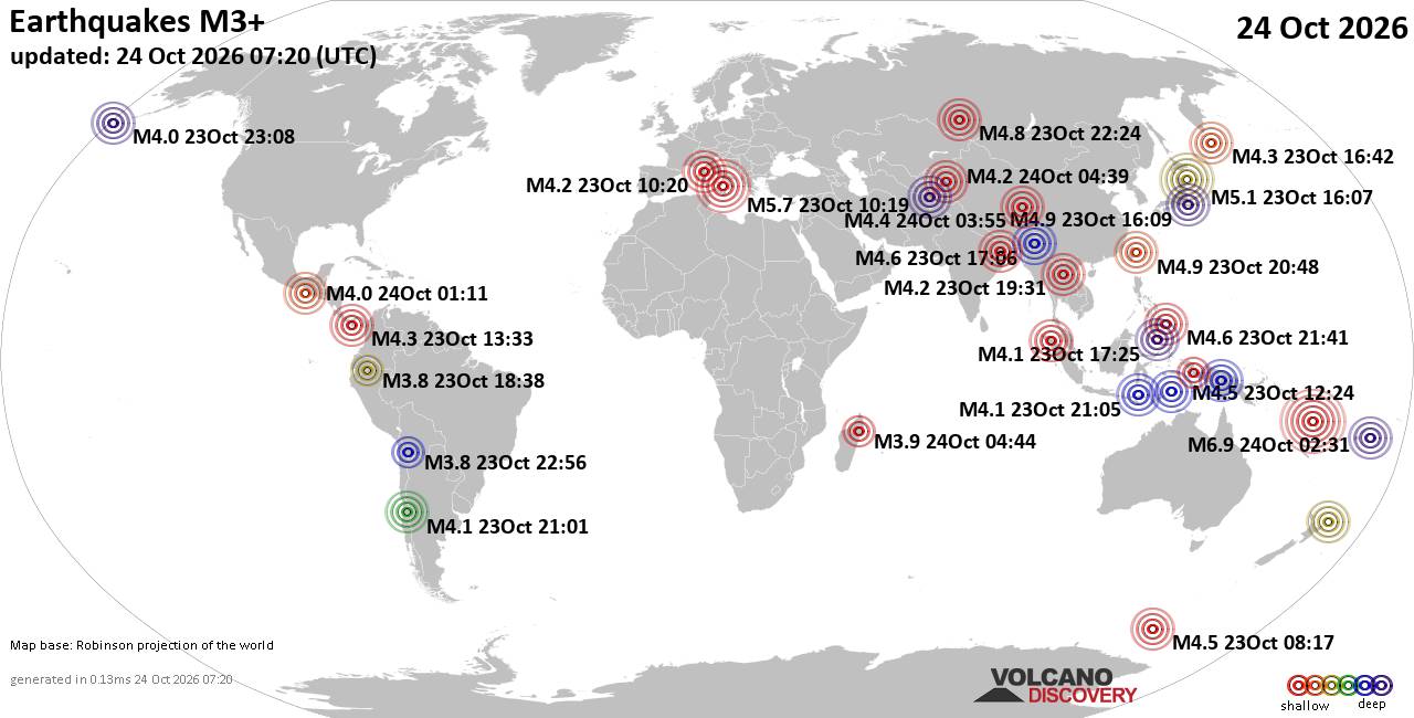
World Earthquake Report for Saturday, 24 October 2026
• M 5.9 - 196 km NW of Port-Olry, Vanuatu
• M 2.1 - 5 km SW of Anza, CA
• M 0.0 - 93 km N of Karluk, Alaska
• M 5.9 - 196 km NW of Port-Olry, Vanuatu
• M 5.9 - 196 km NW of Port-Olry, Vanuatu
• M 5.1 - 209 km NW of Port-Olry, Vanuatu
|
|
|
Joined: Feb 2001
Posts: 678,977
Launch Director
|
|
Launch Director
Joined: Feb 2001
Posts: 678,977 |
SPC Oct 24, 2026 0730 UTC Day 3 Severe Thunderstorm OutlookSPC 0730Z Day 3 Outlook 
Day 3 Convective Outlook
NWS Storm Prediction Center Norman OK
0156 AM CDT Sat Oct 24 2026

Valid 261200Z - 271200Z

...NO SEVERE THUNDERSTORM AREAS FORECAST...

...SUMMARY...
Severe thunderstorm potential is expected to be low on Monday.

...Synopsis...

An upper shortwave trough over the central Plains will continue
weakening as it lifts northeast to the Upper MS Valley on Monday.
Meanwhile, a weak upper shortwave impulse will move across the
southern High Plains vicinity and a stronger/deepening upper
cyclone/trough will dig over the Intermountain West. At the surface,
a cold front will develop southward across the central Plains and
Mid-MO Valley. Southerly low-level flow will maintain modest
boundary layer moisture across the southern High Plains into the
KS/NE ahead of the surface front. Instability is expected to remain
weak, and vertical shear will also be weaker than the previous few
days. As a result, severe thunderstorm potential appears limited.

..Leitman.. 10/24/2026
Read morehttps://www.spc.noaa.gov/products/outlook/day3otlk_0730.html
|
|



CMS The Best Conveyancing solicitors conveyancing quotes throughout the UK
For any webhosting enquiries please email webmaster@aus-city.com
|
|
Entire Thread
|

 SPC Oct 24, 2026 0730 UTC Day 3 Severe Thunderstorm Outlook |
Webmaster
|
2 hours ago
|
|
Forums60
Topics891,854
Posts926,651
Members2,960
| |
Most Online102,106
Jul 10th, 2026
|
|
|
|
|

|









































