|
|
|
0 members (),
1,356
guests, and
28
robots. |
|
Key:
Admin,
Global Mod,
Mod
|
|
S |
M |
T |
W |
T |
F |
S |
|
|
|
|
|
1
|
2
|
3
|
|
4
|
5
|
6
|
7
|
8
|
9
|
10
|
|
11
|
12
|
13
|
14
|
15
|
16
|
17
|
|
18
|
19
|
20
|
21
|
22
|
23
|
24
|
|
25
|
26
|
27
|
28
|
29
|
30
|
31
|
|
There are no members with birthdays on this day. |
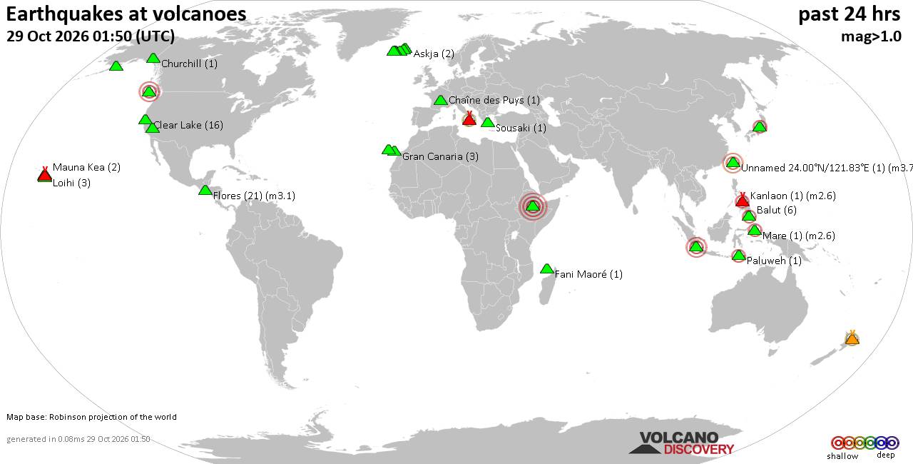
Volcano earthquake report for Thursday, 29 October 2026
• M 1.9 - 5 km WSW of Burning Man Earth, Nevada
• M 2.1 - 2 km E of Mountain Home, Arkansas
• M 2.5 - 95 km S of Sand Point, Alaska
• M 5.5 - 5 km ESE of Asahi, Japan
• M 5.0 - 43 km NNE of Semporna, Malaysia
|

#929194
Sat 24 Oct 2026 07:20:PM
|
Joined: Feb 2001
Posts: 678,977
Launch Director
|
|
Launch Director
Joined: Feb 2001
Posts: 678,977 |
SPC Oct 24, 2026 1930 UTC Day 3 Severe Thunderstorm OutlookSPC 1930Z Day 3 Outlook 
Day 3 Convective Outlook
NWS Storm Prediction Center Norman OK
0219 PM CDT Sat Oct 24 2026

Valid 261200Z - 271200Z

...NO SEVERE THUNDERSTORM AREAS FORECAST...

...SUMMARY...
Severe thunderstorm potential is expected to be low on Monday.

...Synopsis...
A midlevel low now over the lower CO River Valley will eject
east-northeastward Monday across KS/NE to IA/MN.  A few
thunderstorms will be possible along an associated baroclinic zone
from the central Plains into the southern High Plains.  Relatively
larger buoyancy/steeper lapse rates and marginal deep-layer vertical
shear are expected in the vicinity of far west TX, though confidence
is too low to add an outlook area for isolated large hail at this
time.  Otherwise, an upstream shortwave trough will progress inland
from OR to ID, where isolated lightning flashes will be possible
with low-topped convection closer to the OR coast.  Farther inland,
there is some potential for isolated flashes as far east as ID
during the afternoon/evening, but the magnitude of buoyancy is
questionable enough to preclude an outlook area.  Isolated
thunderstorms may also occur with returning moisture to the middle
and lower TX coast, and along the southeast FL coast on the western
periphery of a closed low over the Bahamas.

..Thompson.. 10/24/2026
Read morehttps://www.spc.noaa.gov/products/outlook/day3otlk_1930.html
|
|



CMS The Best Conveyancing solicitors conveyancing quotes throughout the UK
For any webhosting enquiries please email webmaster@aus-city.com
|
|
Entire Thread
|
 SPC Oct 24, 2026 1930 UTC Day 3 Severe Thunderstorm Outlook |
Webmaster
|
Sat 24 Oct 2026 07:20:PM
|
|
Forums60
Topics900,683
Posts935,480
Members2,960
| |
Most Online102,106
Jul 10th, 2026
|
|
|
|
|

|









































