|
|
|
0 members (),
2,562
guests, and
17
robots. |
|
Key:
Admin,
Global Mod,
Mod
|
|
S |
M |
T |
W |
T |
F |
S |
|
1
|
2
|
3
|
4
|
5
|
6
|
7
|
|
8
|
9
|
10
|
11
|
12
|
13
|
14
|
|
15
|
16
|
17
|
18
|
19
|
20
|
21
|
|
22
|
23
|
24
|
25
|
26
|
27
|
28
|
|
29
|
30
|
|
|
|
|
|
|
There are no members with birthdays on this day. |
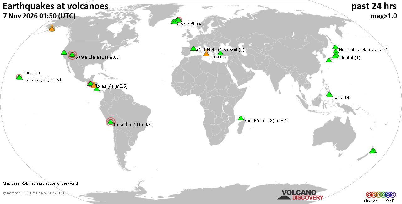
Volcano earthquake report for Saturday, 7 November 2026
• M 4.6 - 208 km WSW of Pistol River, Oregon
• M 1.4 - 0 km ENE of American Canyon, CA
• M 2.0 - 14 km WNW of Bayview, CA
• M 6.8 - 203 km NW of Port-Olry, Vanuatu
• M 1.6 - 23 km W of Volcano, Hawaii
|

#930362
Sun 25 Oct 2026 05:35:PM
|
Joined: Feb 2001
Posts: 800,656
Launch Director
|
|
Launch Director
Joined: Feb 2001
Posts: 800,656 |
SPC Oct 25, 2026 1730 UTC Day 2 Convective OutlookSPC 1730Z Day 2 Outlook 
Day 2 Convective Outlook
NWS Storm Prediction Center Norman OK
1232 PM CDT Sun Oct 25 2026

Valid 261200Z - 271200Z

...NO SEVERE THUNDERSTORM AREAS FORECAST...

...SUMMARY...
Severe thunderstorm are not expected Monday.

...Synopsis...
Broad troughing over the western half of the CONUS will continue
Monday as the primary shortwave trough, initially over the
southern/central High Plains lifts northeast to the Upper Midwest.
An intensifying upper-level cyclone and attendant shortwave trough
will deepen and spread southeast over the Great Basin and
Intermountain West as several weaker perturbations move through the
Southwest and southern Plains. A weak surface low will develop and
track northeastward into the Midwest with the primary shortwave. A
weak lee trough will support modest southerly low-level flow
maintaining boundary layer moisture ahead of a slow-moving cold
front across the central and southern Plains.

...Rio Grande Valley...
Modest destabilization is forecast ahead of the weak surface
trough/cold front from southwest TX and southern/eastern NM, into
portions of the OK/TX Panhandles, and far southwest KS. Surface
dewpoints in the mid 50s to near 60 F amid diurnal heating ahead of
the front should allow for modest destabilization Monday afternoon.
The front and lee trough should serve a focus for convective
development, with isolated thunderstorms forecast to toward late
afternoon into the evening, with additional warm advection storms
possible over the Midwest overnight. Buoyancy should be generally
weak (MLCAPE ~500 J/kg) amidst modest mid-level flow and bulk shear
(20-25 kt). Locally greater buoyancy and storm coverage across
Southwest TX and southern NM could support a stronger storm or two
during the afternoon with sporadic damaging gusts or isolated hail
not entirely impossible. However, the weak buoyancy along with poor
mid-level lapse rates should limit overall storm intensity.

...Northern Rockies...
The upper cyclone, initially over eastern WA/OR will move into the
northern Rockies accompanied by strong westerly flow aloft. Low and
mid-level lapse rates should steepen in response to the strong
ascent and cooling mid-level temperatures (-20 to -25 C). Despite
meager moisture, weak instability may develop across parts of ID in
the afternoon supporting isolated thunderstorms. While a stray
strong gust or small hail cannot be ruled out owing to the
increasingly strong upper-level wind fields, cool surface
temperatures and weak buoyancy should preclude any organized severe
risk.

..Lyons.. 10/25/2026
Read morehttps://www.spc.noaa.gov/products/outlook/day2otlk_1730.html
|
|



CMS The Best Conveyancing solicitors conveyancing quotes throughout the UK
For any webhosting enquiries please email webmaster@aus-city.com
|
|
Entire Thread
|
 SPC Oct 25, 2026 1730 UTC Day 2 Convective Outlook |
Webmaster
|
Sun 25 Oct 2026 05:35:PM
|
|
Forums60
Topics915,206
Posts950,003
Members2,960
| |
Most Online102,106
Jul 10th, 2026
|
|
|
|
|

|









































