|
|
|
0 members (),
2,467
guests, and
27
robots. |
|
Key:
Admin,
Global Mod,
Mod
|
|
S |
M |
T |
W |
T |
F |
S |
|
1
|
2
|
3
|
4
|
5
|
6
|
7
|
|
8
|
9
|
10
|
11
|
12
|
13
|
14
|
|
15
|
16
|
17
|
18
|
19
|
20
|
21
|
|
22
|
23
|
24
|
25
|
26
|
27
|
28
|
|
29
|
30
|
|
|
|
|
|
|
There are no members with birthdays on this day. |
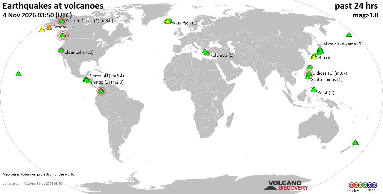
Volcano earthquake report for Wednesday, 4 November 2026
• M 3.0 - 55 km ENE of Pedro Bay, Alaska
• M 2.5 - 6 km NW of Pine Valley, CA
• M 0.9 - 5 km WNW of The Geysers, CA
• M 0.8 - 7 km SE of Lake Henshaw, CA
• M 2.2 - 19 km WNW of Ferndale, CA
|
|
|
Joined: Feb 2001
Posts: 678,977
Launch Director
|
|
Launch Director
Joined: Feb 2001
Posts: 678,977 |
SPC Nov 4, 2026 0600 UTC Day 1 Convective OutlookSPC 1200Z Day 1 Outlook 
Day 1 Convective Outlook
NWS Storm Prediction Center Norman OK
1134 PM CST Tue Nov 03 2026

Valid 041200Z - 051200Z

...THERE IS A MARGINAL RISK OF SEVERE THUNDERSTORMS ACROSS PARTS OF
THE SOUTHEAST AND SOUTHERN APPALACHIANS...

...SUMMARY...
Thunderstorms with isolated severe wind gusts and perhaps a brief
tornado will be possible across parts of the Southeast into the
southern Appalachians.

...Southeast/Southern Appalachians...
An upper-level trough will move eastward from the Ozarks into the
lower Ohio and Tennessee Valleys today. Ahead of the trough, a warm
front will move northward from the central Gulf Coast states into
the southern Appalachians. Near the front, a cluster of strong
storms is expected to develop in the morning from northeast Alabama
into northwest Georgia. As the front moves eastward, a persistent
confluence band is expected to setup from central Georgia northward
into the southern Appalachians. Although abundant cloud cover will
temper surface heating, RAP forecast soundings suggest that MLCAPE
will peak in the 1000 to 1500 J/kg near the confluence band during
the afternoon. This, combined with 0-6 km shear near 40 knots and
0-3 km storm-relative helicity around 200 m2/s2 could be enough for
isolated severe gusts and/or a brief tornado. The threat is expected
to decrease by early evening.

..Broyles/Weinman.. 11/04/2026
Read morehttps://www.spc.noaa.gov/products/outlook/day1otlk_1200.html
|
|



CMS The Best Conveyancing solicitors conveyancing quotes throughout the UK
For any webhosting enquiries please email webmaster@aus-city.com
|
|
Entire Thread
|

 SPC Nov 4, 2026 0600 UTC Day 1 Convective Outlook |
Webmaster
|
8 hours ago
|
|
Forums60
Topics910,568
Posts945,365
Members2,960
| |
Most Online102,106
Jul 10th, 2026
|
|
|
|
|

|









































