|
|
|
0 members (),
1,505
guests, and
26
robots. |
|
Key:
Admin,
Global Mod,
Mod
|
|
S |
M |
T |
W |
T |
F |
S |
|
1
|
2
|
3
|
4
|
5
|
6
|
7
|
|
8
|
9
|
10
|
11
|
12
|
13
|
14
|
|
15
|
16
|
17
|
18
|
19
|
20
|
21
|
|
22
|
23
|
24
|
25
|
26
|
27
|
28
|
|
29
|
30
|
|
|
|
|
|
|
There are no members with birthdays on this day. |
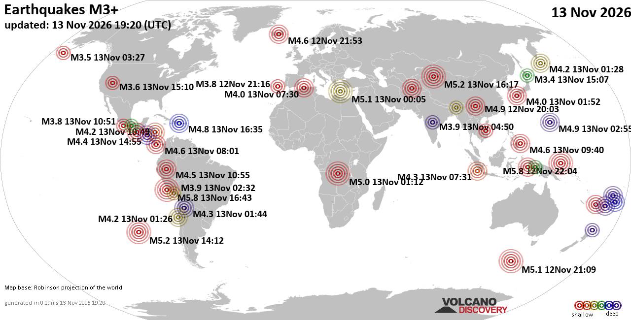
World Earthquake Report for Friday, 13 November 2026
• M 0.5 Other Event - 62 km ENE of Pedro Bay, Alaska
• M 0.5 Other Event - 64 km ENE of Pedro Bay, Alaska
• M 0.4 Other Event - 65 km ENE of Pedro Bay, Alaska
• M 4.5 - Mid-Indian Ridge
• M 0.4 Other Event - 63 km ENE of Pedro Bay, Alaska
• M 1.6 - 89 km NNW of Rachel, Nevada
|

#951399
Fri 06 Nov 2026 05:34:PM
|
Joined: Feb 2001
Posts: 800,656
Launch Director
|
|
Launch Director
Joined: Feb 2001
Posts: 800,656 |
Central Pacific Tropical Weather Outlook


000
ACPN50 PHFO 061734
TWOCP
Tropical Weather Outlook
NWS Central Pacific Hurricane Center Honolulu HI
Issued by NWS National Hurricane Center Miami FL
800 AM HST Fri Nov 06 2026
For the central North Pacific...between 140W and 180W:
Eastern Central Pacific (CP95):
Showers and thunderstorms associated with a trough of low pressure
located several hundred miles to the southeast of the Big Island of
Hawaii continue to become better organized. However, recent
satellite wind data indicate the system still lacks a well-defined
center. Environmental conditions are conducive for additional
development, and a tropical depression is expected to develop either
later today or on Saturday. The system is forecast to move
west-northwestward to westward at 10 to 15 mph, passing well south
of the Hawaiian Islands.
* Formation chance through 48 hours...high...90 percent.
* Formation chance through 7 days...high...90 percent.
$$
Forecaster Evans/Adams
NNNN
|
|



CMS The Best Conveyancing solicitors conveyancing quotes throughout the UK
For any webhosting enquiries please email webmaster@aus-city.com
|
|
Entire Thread
|
 Central Pacific Tropical Weather Outlook |
Webmaster
|
Fri 06 Nov 2026 05:34:PM
|
|
Forums60
Topics926,339
Posts961,136
Members2,960
| |
Most Online102,106
Jul 10th, 2026
|
|
|
|
|

|









































