|
0 members (),
1,930
guests, and
23
robots. |
|
Key:
Admin,
Global Mod,
Mod
|
|
S |
M |
T |
W |
T |
F |
S |
|
1
|
2
|
3
|
4
|
5
|
6
|
7
|
|
8
|
9
|
10
|
11
|
12
|
13
|
14
|
|
15
|
16
|
17
|
18
|
19
|
20
|
21
|
|
22
|
23
|
24
|
25
|
26
|
27
|
28
|
|
29
|
30
|
|
|
|
|
|
|
There are no members with birthdays on this day. |
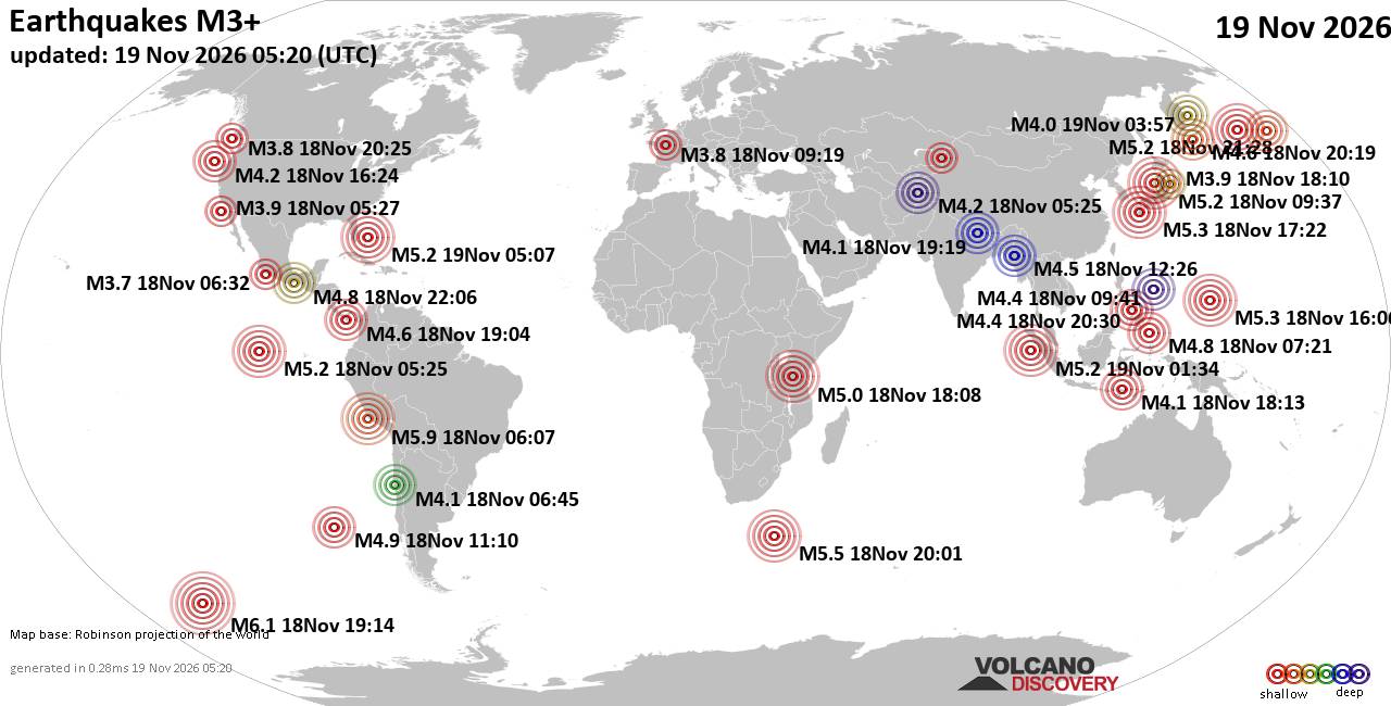
World Earthquake Report for Thursday, 19 November 2026
• Significant magnitude 5.2 quake hits 96 km east of Freeport, Bahamas, after...
• M 1.6 - 68 km WNW of Karluk, Alaska
• M 5.2 - 130 km W of Teluk Dalam, Indonesia
• Strong mag. 5.2 earthquake - Bahamas: Bahama Islands on Thursday, Nov 19, 2...
• M 5.0 - 111 km W of Petrolia, CA
|

#952789
Sat 07 Nov 2026 05:25:PM
|
Joined: Feb 2001
Posts: 800,656
Launch Director
|
|
Launch Director
Joined: Feb 2001
Posts: 800,656 |
Atlantic Tropical Weather Outlook


000
ABNT20 KNHC 071725
TWOAT
Tropical Weather Outlook
NWS National Hurricane Center Miami FL
100 PM EST Sat Nov 7 2026
For the North Atlantic...Caribbean Sea and the Gulf of America:
Western and Central Atlantic (AL94):
A non-tropical low pressure area located several hundred miles
south-southeast of Bermuda is producing disorganized showers and
thunderstorms. Recent satellite-derived wind data indicates a
sharpening frontal structure is associated with this system. The low
could still briefly acquire some subtropical characteristics through
tonight, though this scenario appears to be trending less likely.
The low is forecast to move generally eastward over the western and
central subtropical Atlantic during the next couple of days and
become absorbed by a new non-tropical low pressure system to its
east early next week. Regardless, gale-force winds are likely over
parts of the central subtropical Atlantic through the weekend. For
more information, including Gale Warnings, see High Seas Forecasts
issued by the National Weather Service.
* Formation chance through 48 hours...low...10 percent.
* Formation chance through 7 days...low...10 percent.
&&
High Seas Forecasts issued by the National Weather Service can be
found under AWIPS header NFDHSFAT1, WMO header FZNT01 KWBC, and
online at ocean.weather.gov/shtml/NFDHSFAT1.php
$$
Forecaster Mahoney
|
|



CMS The Best Conveyancing solicitors conveyancing quotes throughout the UK
For any webhosting enquiries please email webmaster@aus-city.com
|
|
Entire Thread
|
 Atlantic Tropical Weather Outlook |
Webmaster
|
Sat 07 Nov 2026 05:25:PM
|
|
Forums60
Topics935,002
Posts969,799
Members2,960
| |
Most Online102,106
Jul 10th, 2026
|
|
|









































