|
|
|
0 members (),
3,669
guests, and
19
robots. |
|
Key:
Admin,
Global Mod,
Mod
|
|
S |
M |
T |
W |
T |
F |
S |
|
1
|
2
|
3
|
4
|
5
|
6
|
7
|
|
8
|
9
|
10
|
11
|
12
|
13
|
14
|
|
15
|
16
|
17
|
18
|
19
|
20
|
21
|
|
22
|
23
|
24
|
25
|
26
|
27
|
28
|
|
29
|
30
|
|
|
|
|
|
|
There are no members with birthdays on this day. |
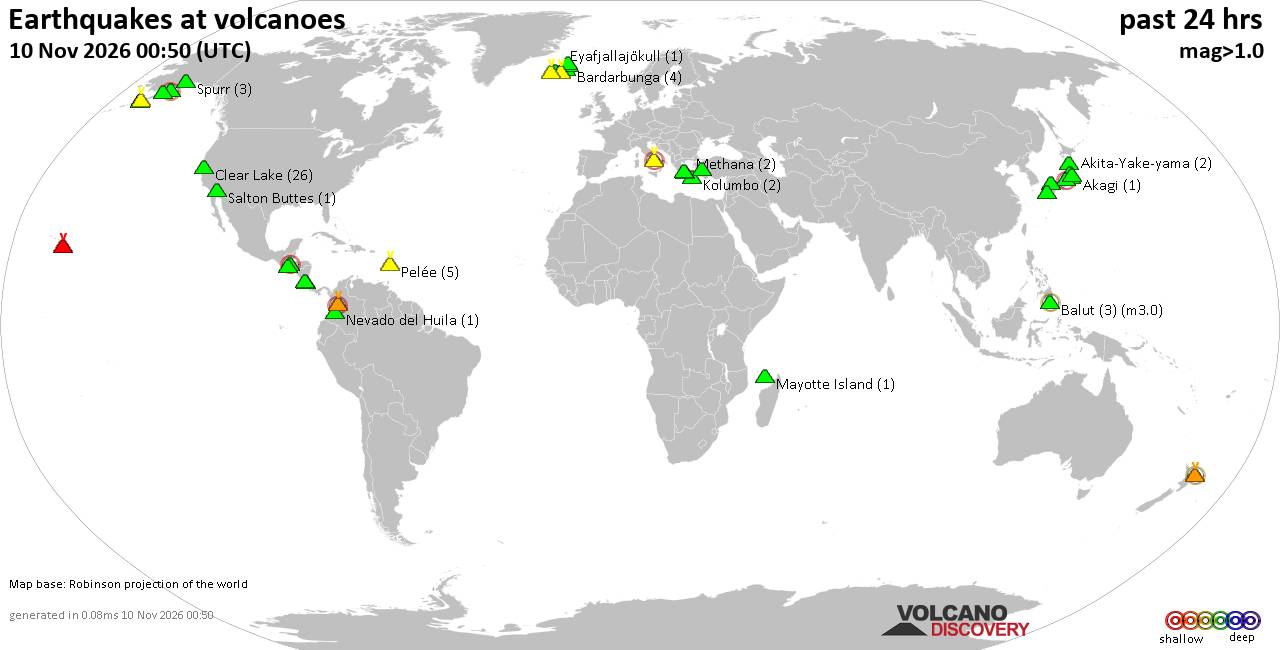
Volcano earthquake report for Tuesday, 10 November 2026
• M -0.6 - 63 km ENE of Pedro Bay, Alaska
• M 0.6 - 47 km ENE of Adak, Alaska
• M 2.3 - 54 km ENE of Susitna North, Alaska
• M 1.4 - 60 km WNW of Nikiski, Alaska
• M 1.1 - 109 km S of McCarthy, Alaska
|

#954234
Sun 08 Nov 2026 07:34:PM
|
Joined: Feb 2001
Posts: 800,656
Launch Director
|
|
Launch Director
Joined: Feb 2001
Posts: 800,656 |
SPC Nov 8, 2026 2000 UTC Day 1 Convective OutlookSPC 2000Z Day 1 Outlook 
Day 1 Convective Outlook
NWS Storm Prediction Center Norman OK
0131 PM CST Sun Nov 08 2026

Valid 082000Z - 091200Z

...NO SEVERE THUNDERSTORM AREAS FORECAST...

...SUMMARY...
Severe thunderstorms are not expected this afternoon and evening. A
few stronger storms may persist near the middle to lower Texas
coast.

...20z Update...
The Marginal Risk along the lower Texas coast was removed with this
update. Temperatures have been gradually cooling with the air mass
inland becoming overworked by ongoing rain/thunderstorm activity.
While shear profiles remain favorable, the more favorable air mass
with remain mainly offshore limiting the severe potential inland. A
few stronger occasionally rotating storms may persist over water.

..Halbert-E.. 11/08/2026

.PREV DISCUSSION... /ISSUED 1014 AM CST Sun Nov 08 2026/

...Middle-lower TX coast today...
A midlevel low over northern Mexico will drift slowly eastward and
weaken through the period.  At the surface, a baroclinic zone along
the middle-lower TX coast will provide a focus for thunderstorms
rooted at the surface, where boundary-layer dewpoints will remain
near 70 F.  Per the 12z observed soundings/VWPs/model forecasts,
deep-layer vertical shear will remain sufficient for some embedded
rotating storms, with the relatively stronger low-level
shear/hodograph curvature expected along the north edge of the
surface-based buoyancy with a small MCV just south of CRP.  Poor
midlevel lapse rates will temper the overall severe threat, though
an isolated, weak tornado and/or localized wind damage will be
possible with embedded circulations today.

Otherwise, elevated thunderstorms will remain possible from the
Edwards Plateau into interior south TX in a moist environment with
ascent and weak buoyancy atop the cooler near-surface air mass.

...Pacific Northwest and the lower Great Lakes...
The potential for isolated lightning flashes with low-topped
convection will diminish across northwest WA by about midday as a
midlevel trough moves inland and height rises ensue.  A separate
midlevel trough will continue southeastward over the lower Great
Lakes by this evening into early tonight.  Cooling midlevel
temperatures and weak buoyancy aided by the relatively warm lakes
will support convection that could become sufficiently deep to
support charge separation and isolated lightning flashes.
Read morehttps://www.spc.noaa.gov/products/outlook/day1otlk_2000.html
|
|



CMS The Best Conveyancing solicitors conveyancing quotes throughout the UK
For any webhosting enquiries please email webmaster@aus-city.com
|
|
Entire Thread
|
 SPC Nov 8, 2026 2000 UTC Day 1 Convective Outlook |
Webmaster
|
Sun 08 Nov 2026 07:34:PM
|
|
Forums60
Topics919,598
Posts954,395
Members2,960
| |
Most Online102,106
Jul 10th, 2026
|
|
|
|
|

|









































