|
0 members (),
3,668
guests, and
24
robots. |
|
Key:
Admin,
Global Mod,
Mod
|
|
S |
M |
T |
W |
T |
F |
S |
|
1
|
2
|
3
|
4
|
5
|
6
|
7
|
|
8
|
9
|
10
|
11
|
12
|
13
|
14
|
|
15
|
16
|
17
|
18
|
19
|
20
|
21
|
|
22
|
23
|
24
|
25
|
26
|
27
|
28
|
|
29
|
30
|
|
|
|
|
|
|
There are no members with birthdays on this day. |
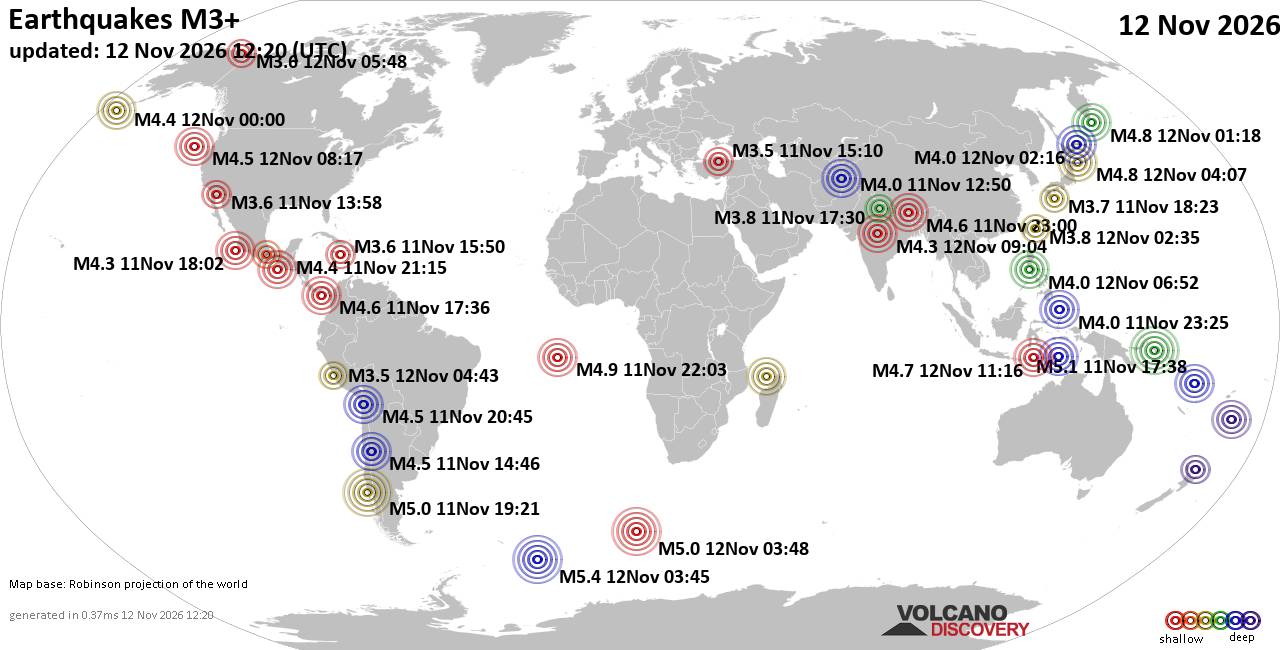
World Earthquake Report for Thursday, 12 November 2026
• M 4.5 - off the coast of Oregon
• M 1.2 - 12 km SE of Livermore, CA
• M 3.0 - 90 km S of Sand Point, Alaska
• M 4.2 - 193 km SE of Akutan, Alaska
• M 4.4 - 17 km SSE of Ikungi, Tanzania
|
|
|
Joined: Feb 2001
Posts: 800,656
Launch Director
|
|
Launch Director
Joined: Feb 2001
Posts: 800,656 |
SPC Nov 12, 2026 0600 UTC Day 1 Convective OutlookSPC 1200Z Day 1 Outlook 
Day 1 Convective Outlook
NWS Storm Prediction Center Norman OK
1121 PM CST Wed Nov 11 2026

Valid 121200Z - 131200Z

...THERE IS A MARGINAL RISK OF SEVERE THUNDERSTORMS TODAY ACROSS
PARTS OF SOUTHEASTERN PENNSYLVANIA...MUCH OF DELAWARE...ADJACENT
EASTERN MARYLAND AND SOUTHERN THROUGH CENTRAL NEW JERSEY...

...SUMMARY...
A couple of strong thunderstorms, accompanied by at least some risk
for severe weather, may impact parts of the northern Mid Atlantic
this afternoon.

...Discussion...
Downstream of amplified mid-level ridging, which may have reached
peak amplitude across the U.S. Intermountain West and Rockies
through much of the Canadian Prairies, a number of digging short
wave perturbations are forecast to contribute to the evolution of a
more prominent, positively tilted mid-level trough.  This may
encompass most areas near and east of the Mississippi River through
the Atlantic Seaboard by 12Z Friday.

One leading short wave trough is generally forecast to turn east and
northeast of the Allegheny/Cumberland Plateau through the northern
Mid Atlantic by late this afternoon, before undergoing considerable
deformation as it progresses farther to the northeast.  It appears
that this may be accompanied by an initially modest surface cyclone,
which may undergo notable deepening during the day while
redeveloping to the east-northeast of the Blue Ridge, before
occluding across the northern Mid Atlantic this evening.

...Northern Mid Atlantic...
Low-level moisture return inland of the coast appears likely to be
rather limited.  However, boundary-layer dew points increasing
through the lower/mid 50s F, within a corridor along a warm frontal
zone to the east of the surface low, may be sufficient to yield
mixed-layer CAPE in excess of 500 J/kg when coupled with mid-level
cooling (including 500 mb temperatures of -20 to -22 C).  Based on
forecast soundings, this may include buoyancy rooted near and just
off the surface, as low-level lapse rates steepen beneath the cold
air and boundary-layer humidity remains relatively high along the
frontal zone.  Although low-level hodographs might not become more
than modestly large, in the presence of moderate deep-layer shear,
it appears at least possible that the environment could become
conducive to the evolution of one or two supercell structures posing
some risk for a tornado.  Otherwise, stronger cells this afternoon
may be accompanied by small to perhaps marginally severe hail and
locally strong surface gusts, before weakening by evening.

..Kerr/Chalmers.. 11/12/2026
Read morehttps://www.spc.noaa.gov/products/outlook/day1otlk_1200.html
|
|



CMS The Best Conveyancing solicitors conveyancing quotes throughout the UK
For any webhosting enquiries please email webmaster@aus-city.com
|
|
Entire Thread
|

 SPC Nov 12, 2026 0600 UTC Day 1 Convective Outlook |
Webmaster
|
7 hours ago
|
|
Forums60
Topics923,761
Posts958,558
Members2,960
| |
Most Online102,106
Jul 10th, 2026
|
|
|









































