|
|
|
0 members (),
1,605
guests, and
22
robots. |
|
Key:
Admin,
Global Mod,
Mod
|
|
S |
M |
T |
W |
T |
F |
S |
|
1
|
2
|
3
|
4
|
5
|
6
|
7
|
|
8
|
9
|
10
|
11
|
12
|
13
|
14
|
|
15
|
16
|
17
|
18
|
19
|
20
|
21
|
|
22
|
23
|
24
|
25
|
26
|
27
|
28
|
|
29
|
30
|
|
|
|
|
|
|
There are no members with birthdays on this day. |
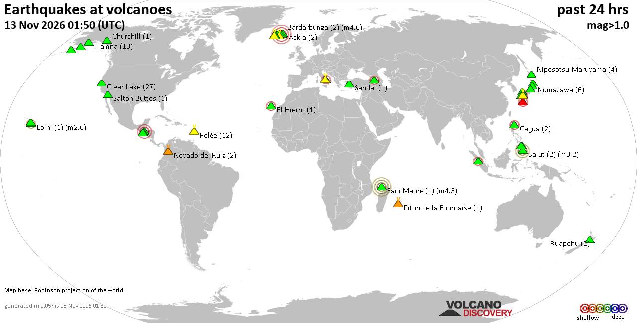
Volcano earthquake report for Friday, 13 November 2026
• M 2.9 - 152 km S of False Pass, Alaska
• M 4.4 - 172 km WNW of Sola, Vanuatu
• M 1.4 - 64 km WNW of Karluk, Alaska
• M 3.0 - 14 km SE of Petrolia, CA
• M -0.5 - 78 km NW of Ninilchik, Alaska
|
|
|
Joined: Feb 2001
Posts: 800,656
Launch Director
|
|
Launch Director
Joined: Feb 2001
Posts: 800,656 |
Magnitude 4.7 earthquake strikes near Selong, Kabupaten Lombok Timur, West Nusa Tenggara, Indonesia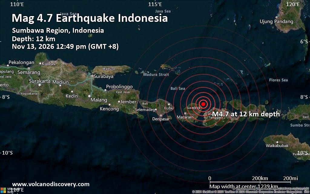 A magnitude 4.7 earthquake near Selong, Kabupaten Lombok Timur, West Nusa Tenggara, Indonesia, was reported just 7 minutes ago by Indonesia's Meteorology, Climatology, and Geophysical Agency, considered the country's main agency monitoring seismic activity. The earthquake occurred at a shallow depth of 12. km beneath the epicenter around noon on Friday, November 13th, 2026, at 12:49 pm local time. The exact magnitude, epicenter, and depth of the quake might be revised within the next few hours or minutes as seismologists review the data and refine their calculations, or as other agencies issue their reports.
A second report was later issued by the citizen-seismograph network RaspberryShake, which also listed it as a magnitude 4.7 earthquake.
Based on the preliminary seismic data, the quake should not have caused any significant damage but was probably felt by many people as light vibrations in the area of the epicenter.
Weak shaking might have been felt in Bangsal (pop. 100), located 26 km from the epicenter; Labuan Lombok (pop. 10,000), 28 km away; Labuan Lombok (pop. 10,000), 28 km away; Labuan Lombok (pop. 10,000), 28 km away; Selong (pop. 92,500), 50 km away; Taliwang (pop. 55,300), 55 km away; Praya (pop. 35,200), 72 km away; Sumbawa Besar (pop. 62,800), 78 km away; and Mataram (pop. 429,700), 78 km away.
VolcanoDiscovery will automatically update the magnitude and depth if they change and follow up if other significant news about the quake becomes available. If you’re in the area, please send us your experience through our reporting mechanism, either online or via our mobile app. This will help us provide more firsthand updates to anyone around the globe who wants to know more about this quake.
Earthquake data: Date & time: Nov 13, 2026 12:49 pm (GMT +8) local time (13 Nov 2026 04:49 GMT)Magnitude: 4.7 Hypocenter depth: 12.00 km Epicenter coordinates: 8.26°S / 116.75°E  ( Kabupaten Lombok Timur, West Nusa Tenggara, Indonesia) Primary data source: BMKGhttps://www.volcanodiscovery.com/earthquakes/news/410795/Magnitude-47-earthquake-strikes-near-Selong-Kabupaten-Lombok-Timur-West-Nusa-Tenggara-Indonesia.html
|
|



CMS The Best Conveyancing solicitors conveyancing quotes throughout the UK
For any webhosting enquiries please email webmaster@aus-city.com
|
|
Entire Thread
|

 Magnitude 4.7 earthquake strikes near Selong, Kabupaten Lombok Timur, West Nusa Tenggara, Indonesia |
Webmaster
|
2 hours ago
|
|
Forums60
Topics925,456
Posts960,253
Members2,960
| |
Most Online102,106
Jul 10th, 2026
|
|
|
|
|

|









































