|
0 members (),
1,776
guests, and
23
robots. |
|
Key:
Admin,
Global Mod,
Mod
|
|
S |
M |
T |
W |
T |
F |
S |
|
1
|
2
|
3
|
4
|
5
|
6
|
7
|
|
8
|
9
|
10
|
11
|
12
|
13
|
14
|
|
15
|
16
|
17
|
18
|
19
|
20
|
21
|
|
22
|
23
|
24
|
25
|
26
|
27
|
28
|
|
29
|
30
|
|
|
|
|
|
|
There are no members with birthdays on this day. |
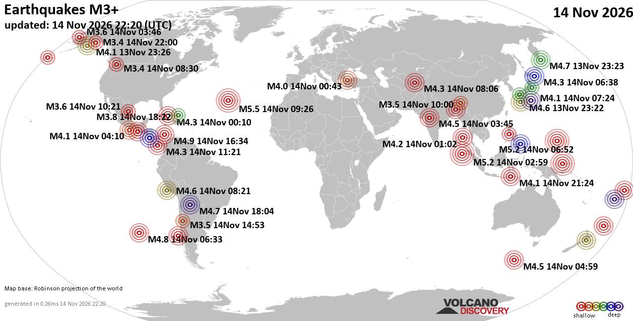
World Earthquake Report for Saturday, 14 November 2026
• M 1.7 - 17 km E of Little Lake, CA
• M 1.3 - 8 km ESE of Cloverdale, CA
• M 3.4 - 37 km ESE of Chenega, Alaska
• M 3.4 - 37 km ESE of Chenega, Alaska
• M 3.1 - 49 km WNW of Nanwalek, Alaska
|
|
|
Joined: Feb 2001
Posts: 800,656
Launch Director
|
|
Launch Director
Joined: Feb 2001
Posts: 800,656 |
SPC MD 2455MD 2455 CONCERNING SEVERE POTENTIAL...WATCH UNLIKELY FOR PORTIONS OF EASTERN NEW MEXICO INTO THE TEXAS PANHANDLE 
Mesoscale Discussion 2455
NWS Storm Prediction Center Norman OK
0342 PM CST Sat Nov 14 2026

Areas affected...portions of eastern New Mexico into the Texas
Panhandle

Concerning...Severe potential...Watch unlikely

Valid 142142Z - 142315Z

Probability of Watch Issuance...5 percent

SUMMARY...A couple of stronger storms may produce marginally severe
hail. A WW issuance is not expected.

DISCUSSION...MRMS mosaic radar imagery depicts deepening
thunderstorm updrafts, with NLDN data showing an increase in
lightning along a surface differential heating zone across eastern
NM into the TX Panhandle. A 500 mb jet max over central NM is now
approaching the NM/TX border area from the northwest, resulting in
both increased deep-layer ascent and the eastward advection of
cooler temperatures aloft. As a plume of 7 C/km mid-level lapse
rates continues to overspread a marginally heated/moistened boundary
layer, buoyancy should increase further, with up to 500 J/kg MLCAPE
potentially realized in spots. Despite the meager buoyancy, the
approach of the aforementioned mid-level jet max should increase
speed shear, with over 50 kts of effective bulk shear/elongated
hodographs expected.

Some supercell structures will be possible, capable of producing
isolated bouts of marginally severe hail. The best chance for severe
hail will be with any supercells that can traverse the baroclinic
boundary. Given the expected isolated nature of the severe threat, a
WW issuance is not currently anticipated.

..Squitieri/Hart.. 11/14/2026

...Please see www.spc.noaa.gov for graphic product...

ATTN...WFO...LUB...AMA...MAF...ABQ...

LAT...LON   35590466 35130328 33570083 33020069 32550090 32350124
            32460197 32750247 34000449 34390477 34730486 35590466

MOST PROBABLE PEAK HAIL SIZE...UP TO 1.25 IN
Read morehttps://www.spc.noaa.gov/products/md/md2455.html
|
|



CMS The Best Conveyancing solicitors conveyancing quotes throughout the UK
For any webhosting enquiries please email webmaster@aus-city.com
|
|
Entire Thread
|

 SPC MD 2455 |
Webmaster
|
Yesterday at 09:44 PM
|
|
Forums60
Topics927,996
Posts962,793
Members2,960
| |
Most Online102,106
Jul 10th, 2026
|
|
|









































